These islands, part of the chain of 6,000 islands that shelter the British Columbia coastline between Washington and Alaska, lie beyond the quick-access range of Vancouver and Victoria. The area covered by what some refer to as the Northern Gulf Islands extends from Lasqueti Island near Parkville, north to Quadra and Cortes Islands near Campbell River, and from Texada Island near Powell River north to Savary and the Copeland Islands near Lund, including Jedediah Island Provincial Park.
The Northern Gulf Islands are essentially the Discovery Islands (includes Quadra Island and Cortes Island) and the islands located in the Strait of Georgia (Denman Island, Hornby Island, Texada Island, Lasqueti Island, Jedediah Island, and Savary Island).
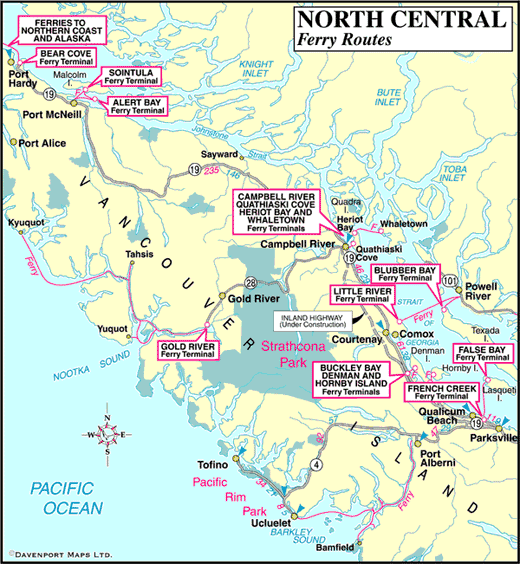
The fleet of BC Ferries that services some of them is not as large nor are the sailings as frequent as sailings to the Southern Gulf Islands. Others can only be reached by private transportation such as water taxis, kayaks, canoes, or powerboats, and occasionally airplanes.
Visitors will find that the farther north in the Strait of Georgia they explore, the fewer fellow travellers they’ll encounter. The wonderful silence that envelops these islands is characteristic of the ambience in remote central coast locales.
It wasn’t always this way. In the heyday of fishing and logging camps, the population on the more isolated islands was surprisingly higher than it is today. Evidence of this can be seen in abandoned cabins, ancient villages, and overgrown logging roads. Explore by car, kayak, mountain bike, or on foot. Find a location that appeals to you, and within this microcosm experience the wonder and magic that pervades life here.
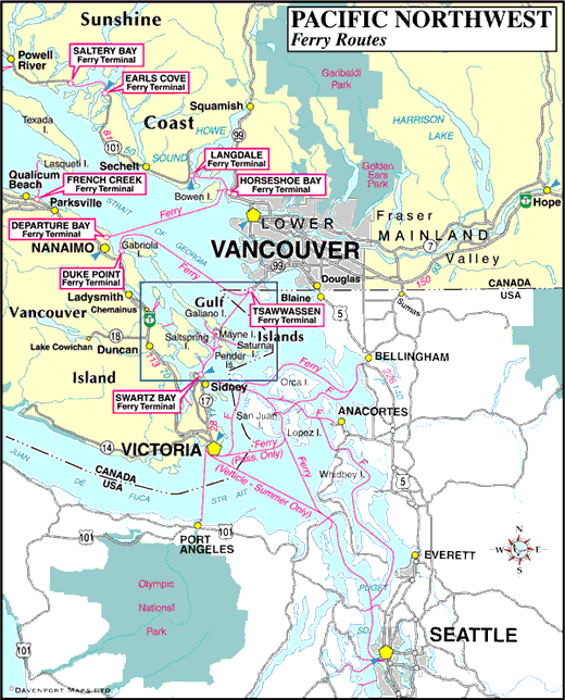
Location: The Northern Gulf Islands and Discovery Islands are located between Vancouver Island and the mainland of British Columbia. Visit our Transportation section for detailed information on ferry routes and schedules. Air Transportation is available to all islands, with the exception of Jedediah, Sandy, and the Copeland Islands. Scheduled flights are available, and charter services are also available from Nanaimo, Comox, and Campbell River on Vancouver Island, and Powell River on the Sunshine Coast, among other areas.
Discovery Islands
Quadra Island (Quathiaski Cove)
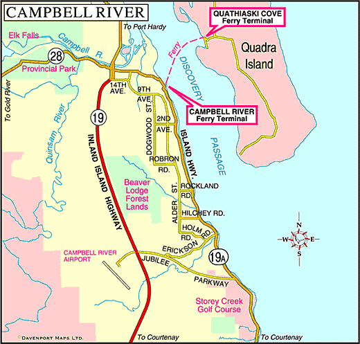
Quadra Island is a 10-minute ferry ride from Campbell River. Resident artists and craftspeople make the island a fine place to sleuth around for pottery and other wares. The Nuyumbalees Cultural Center (formerly Kwagiulth Museum and Cultural Center) contains an outstanding collection of authentic artifacts.
Cortes Island
After going to the effort to reach Cortes Island, with its placid lakes, beaches rich in shellfish, and rugged gorges – your reward is finding a campsite on the southwestern corner at Smelt Bay Provincial Park, a heavenly setting on this picturesque island.
Rendezvous Islands
The Rendezvous Islands are located in Calm Channel off the northeast end of Read Island in the Discovery Island chain of islands. The Rendezvous Island group comprises North Rendezvous Island, Middle Rendezvous Island, and Rendezvous Island South.
Islands in the Strait of Georgia
Denman Island
Tranquil and bucolic, Denman and Hornby Island sits just off the east coast of Vancouver Island. Denman, the larger of the two is known for its pastoral farmlands and its population of talented artisans.
Hornby Island
Lying off the south end of Denman Island, Hornby Island offers a rugged, seductive mix of northwest rainforest and magnificent warm-water swimming beaches.
Texada Island
Originally home to a whaling station, Texada Island is now the site of a working limestone quarry. Texada offers biking, hiking, fishing, swimming, scuba diving, birdwatching and rock hounding.
Lasqueti Island
Hop aboard the foot passenger ferry from French Creek and cruise across the Strait of Georgia to Lasqueti Island. Largely undeveloped, Lasqueti is a worthwhile destination for a day trip or longer – not only for its natural beauty, but it is so distant from the mainstream.
Jedediah Island
Jedediah Island is a Marine Provincial park located between Lasqueti Island and Texada Island, in the Sabine Channel of the Strait of Georgia. It is the largest and most diverse island of a chain of over thirty islands and rocky islets located north and west of Lasqueti Island. Jedediah’s isolation and tranquility make it an excellent destination for kayaking and wilderness camping.
Savary Island
Savary Island and the Copeland Islands Marine Provincial Park are only accessible by private boat or water taxi from Lund on the Sunshine Coast. The best beaches in the entire chain of Gulf Islands are to be found on Savary Island. It’s debatable which side of the snout-shaped island has the best beaches, but when you’re in heaven, it doesn’t matter which side of the street you walk on!
Neighbouring Coastal Inlets and Desolation Sound
Jervis Inlet
Jervis Inlet separates Sechelt Peninsula and Malaspina Peninsula on the Sunshine Coast of British Columbia. The beautiful coastline is deeply indented at Jervis Inlet, slicing deep into the Coast Mountain Range. Jervis Inlet becomes Princess Royal Reach and Queens Reach, with a branch to Princess Louisa Inlet and the famed Chatterbox Falls.
Desolation Sound
Desolation Sound is located at the northern end of the Sunshine Coast, offering spectacular fjords, mountains, islands, and marine wildlife. Desolation Sound is an extremely attractive place to explore for kayakers and sailboats thanks to the sheltered waters and many islands, islets, inlets, coves and bays provided by Desolation Sound Marine Park the other parks surrounding Desolation Sound.
Toba Inlet
Toba Inlet is a deep fjord north of Desolation Sound that carves its way many miles inland, cutting deep into the magnificent Coast Mountains that rise as an imposing backdrop. Surrounded by majestic snow-capped mountain peaks, Toba Inlet is fed by glacial waters, with the glacial silt colouring the inlet’s waters a fabulous shade of jade green.
Bute Inlet
Considered one of the grandest and most scenic waterways in the world, Bute Inlet is a deep fjord surrounded by the rugged coastal mountains that heave out of the emerald waters and rise to heights of nearly 10,000 feet. One of the deepest fjords in British Columbia, the wilderness and mist-shrouded Bute Inlet boasts magnificent coastal scenery and abundant wildlife.
Loughborough Inlet
Loughborough Inlet sits midway between Knight Inlet to the west and Bute Inlet to the east. Due to the alignment of the Coast Mountain ranges separating the inlets, the upper end of Loughborough Inlet is only about 10 kilometres (6.2 miles) from the nearest waters of Knight Inlet.


