Hiking in the Okanagan
The Okanagan’s open terrain makes for ideal hiking, with little or no bushwhacking required. The parks mentioned below offer remoteness, breathtaking landscapes, and challenging outdoor adventure. Unless otherwise noted, these parks are open year-round.
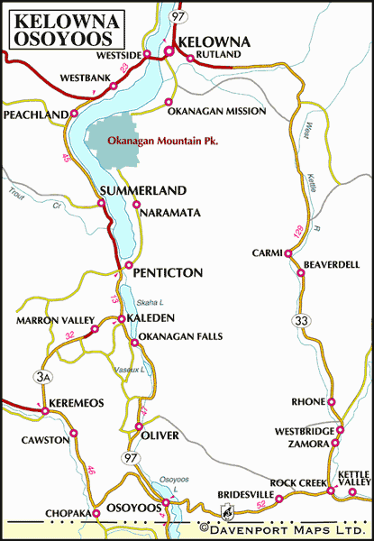
Okanagan Mountain Provincial Park offers wilderness walk-in sites, located on the east side of Okanagan Lake just opposite Peachland. There’s no road access to the park, but secondary roads from Kelowna offer access to parking lots on the park’s northeastern boundary. An alternative approach is from Penticton via Naramata on Chute Lake Road, a rough 15.5-mile (25-km) route to the south parking lot.
Okanagan Mountain Park is well suited to backwoods camping. Wilderness campsites are located at Divide, Victor, and Baker Lakes and at Buchan Bay. From the north parking lot, follow Golden Mile-Boulder Trail (moderate; 2 miles/3.5 km) to the Wildhorse Canyon Trail (moderate; 3 miles/5 km) and finally the Buchan Bay Trail (easy; 1 mile/1.6 km) to reach the wilderness campsites at Buchan Bay. Wilderness campsites are located near the south parking lot. More sites are located at Divide Lake on Okanagan Mountain, reached via the Divide Lake North Trail (10 miles/16 km return) from the Rimrock Road parking lot, or via the Mountain Goat Trail (6 miles/10 km return) from the south parking lot. The campsites at Baker and Victor Lakes are reached by following the Baker Lake Trail (moderate; 2.5 miles/4 km return) from Divide Lake.
Hiking trails provide an excellent opportunity to ramble around and see unique plants and animal life in this semidesert wilderness region. The lake and mountain views are good from the top of Okanagan Mountain, but wear sturdy footwear (this park is in rattlesnake country) and carry water between camping areas if you’re hiking in summer. In addition to the backcountry campsites, facilities also include horse-loading ramps in the north and south parking lots, as well as marine campsites and mooring buoys on Okanagan Lake. Hike to the top of Okanagan Mountain on the Divide Lake North Trail (moderate; 10 miles/16 km return) from the Rimrock Rd parking lot for beautiful views of the lake to the west and the Monashees to the east, and check out the four archaeological sites in the park.
Nickel Plate Provincial Park is another undeveloped wilderness area that hikers and cross-country skiers will find rewarding. Nearby Lookout Mountain rises above the Nickel Plate Lake region, studded with huge erratics (boulders deposited by receding glacial ice). There’s soft camping on the lake’s sandy beaches. Blueberries and other edible berries grow in the forested surroundings, as does Labrador tea, with its white blossoms and fuzz-backed leaves, used by Native Canadians and early settlers to make a relaxing drink. Nickel Plate is 18 miles (29 km) northeast of Hedley, near Apex Resort, and is accessed by a gravel road off Hwy 3A.
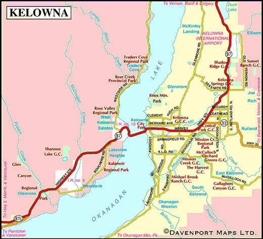
Bear Creek Provincial Park features a moderate 14-mile (24-km) hiking trail as well as a 6-mile (10-km) easygoing hiking trail. Trails begin from a common trailhead at the entrance to the park. Wear sturdy footwear because the prickly pear cacti on the more exposed rocky slopes of the upland region of the park can puncture skin even through clothing and running shoes. Rattlesnakes abound here. Visitors are asked to stay on the trails in Bear Creek Provincial Park. This area is a feast for the senses, with its expansive views of the lake and canyon; its scent of cottonwood, pine, and fir forests; and its splashes of colourful wildflowers. Bear Creek Provincial Park is located 5 miles (9 km) west of Kelowna on the west side of Okanagan Lake off Hwy 97.
Silver Star Provincial Park, 14 miles 22 (km) north of Vernon, is superb for winter activities, and is also a great place to visit in summer for hiking and nature rambling. In summer, Silver Star Mountain Resort operates a chairlift for visitors to ascend to hiking trails in the subalpine zone with fabulous views of the Monashees in the north and east, the Shuswap Highlands in the north and west, and the Okanagan Plateau in the south.
Walking tours in the Okanagan include Okanagan Valley International Peace Park in Oliver and Historic Vernon and Okanagan Landing in Vernon. Maps are available from the Oliver Visitor Centre on Hwy 97, and Vernon Tourism on Hwy 97.
Hardy Falls Park in Peachland is a cool oasis in what can sometimes be a hot landscape. A pleasant walking trail (easy; 2 miles/3 km return), complete with seven footbridges, leads to a splendid little waterfall hidden away at the head of a narrow canyon. The shade and the cool water attract a wide variety of wildlife as well as human visitors. In the spring, wildflowers brighten the canyon walls and the underbrush along the trail. Carp spawn in the creek and dippers nest in the cracks of the waterfall. In October, crimson kokanee dart among the riffles in the creek. Harry Hardy was one of the first orchardists in the Westbank area, and Hardy Falls Park is named in his honour. The park is adjacent to Antlers Beach Park, where you can head for a dip after your walk.
The Kettle Valley Railway (Kettle River Recreation Area) when it was completed in 1906, connected numerous small communities in southern BC, and featured many marvels of railroad construction as it wound through mountain passes, river gorges, valleys, rural communities, over numerous trestles and through tunnels. Today, the Kettle Valley Railway no longer operates, and many sections of the old rail bed are now being converted to hiking and cycling recreational uses. You can walk or hike as much or as little of the Kettle Valley Railway Trail, south of Kelowna, as you feel inclined to tackle. Stamina, more than conditioning, will determine if you complete the 15-mile (24-km) round trip between the trailheads on the Little White and Myra Forest Service Roads. As the trail follows an abandoned railbed, the grade is moderate. This was one of the more challenging sections of the route to engineer, and required 18 trestles and two tunnels. Washrooms are available at the trailheads as well as near the middle of Myra Canyon. Pack along water and wear sturdy shoes.
To reach the Little White trailhead, go south of Hwy 97 (also called Harvey St) in downtown Kelowna on Pandosy Street, east on K.L.O. road, then south on Spiers, June Springs, and Little White Forest Service Roads, all of which interconnect and lead to the railbed. To reach the Myra trailhead, travel east of Pandosy Street on K.L.O road to McCulloch Road, which joins the Myra Forest Service Road and leads to the railbed.
Hiking in the Shuswap
Head to Herald Provincial Park for some interesting hiking: two distinct topographical units (upland and flat delta) have created a great terrain; there are also Native Canadian pithouse depressions, or kekuli, in the area west of the creek, as well as some old Native cache pits.
Roderick Haig-Brown Provincial Park has several beautiful walks and low-key hikes; the Lower Trail System provides access to viewing the salmon run along the Adams River. You shouldn’t miss the Reinecker Creek self-guided nature walk here, which leads to Margaret Falls.
Eagle River Nature Park, about 7 miles (12 km) east of Sicamous, has 10 miles (16 km) of hiking and cross-country trails.
Hiking in the Similkameen/Crowsnest Highway
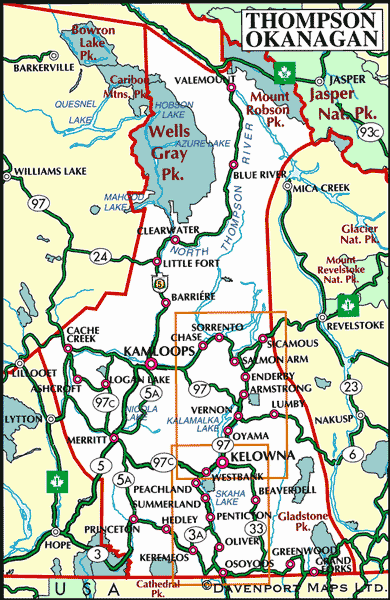
E.C. Manning Provincial Park boasts numerous trails to suit both novice and experienced hikers. North of Hwy 3, the Blackwall Peak and Three Brothers Mountain area offers Canada’s finest and most extensive example of subalpine meadows accessible by vehicle. A partly paved, partly gravel road winds up the mountain to the parking area just below the 6,768-foot (2063-m) Blackwall Peak. At this level, the snow stays until late June and returns in September; as a result, all kinds of plants rush into flower. The magnificent floral displays peak from late July to mid-August, when the meadows provide a kaleidoscope of colours.
The short Paintbrush Trail (easy; less than 1 mile/1.6 km) beginning at the naturalist hut introduces visitors to the fascinating world of the subalpine zone. To experience more extensive floral displays and better views of the mountain peaks, hike along part or all of the Heather Trail (moderate; 26 miles/42 km return) to Nicomen Ridge. In places, the carpets of flowers spread 3 miles wide; in others, they condense into massive mats of arctic lupines speckled with Indian paintbrushes and subalpine daisies. A park booklet helps with flower identification en route. Plants, of course, should never be damaged or removed, and hikers must not venture off the trail. Wilderness camping areas are located along the Kicking Horse Trail at Kicking Horse, at about 8 miles (13.5 km), and Nicomen Lake, at just over 14 miles (23 km). This area has a permanent ban on open fires, so backpacking stoves should be used for all cooking. Overnighters can return the same way or, with the use of two vehicles, along Grainger Creek Trail and Hope Pass Trail (moderate; 7.5 miles/12 km), coming out on Hwy 3 at Cayuse Flats, about 15 miles (24 km) west of E.C. Manning Provincial Park headquarters.
Shorter trails in the park include one to the top of Windy Joe Mountain (moderate to difficult; 9.3 miles/15 km return), where an old fire lookout with interpretive panels identifies the surrounding mountains. Frosty Mountain Loop (difficult; 17 or 18 miles/28 or 29 km return, depending on route) is most colourful in the fall, when its beautiful larch forest is on fire with autumnal shades. The highest peak in the park at 7,900 feet (2408 m), Frosty offers fabulous views of the North Cascades.
Awe-inspiring peaks and wildflower meadows can be experienced along the Skyline I Trail (difficult; 12.7-mile/20-km loop) and Skyline II Trail (difficult; 7.8 miles/12.5 km to Mowich Camp), which heads west towards the Skagit Valley Provincial Park. E.C. Manning Provincial Park also contains a section of the Canada-wide Trans-Canada Trail, which enters the park in its southeast corner as Monument 83 Trail from Cathedral Provincial Park. For real long-distance hiking buffs, Manning is the start of the Pacific Crest Trail, which runs for 2,480 miles (4000 km) to Mexico. Detailed descriptions of all park trails are available at the visitors centre.
Trails are so plentiful and wonderfully diverse in this section of the Cascade Mountains that only a few can be mentioned here. The Skagit River Trail (easy; 9 miles/15 km one way) can be accessed from Hwy 3 at Sumallo Grove, about 6.5 miles (10.5 km) from E.C. Manning Provincial Park’s western entrance. From the junction of the Sumallo and Skagit Rivers, the trail follows the latter’s beautiful valley bottom along the original Whatcom Trail into the Skagit Valley Recreation Area.
The Cascade Provincial Recreation Area is located on the north side of Hwy 3, adjacent to E.C. Manning Provincial Park. Situated in the magnificent Cascade Mountains, largely within the Hozameen Range, it contains such spectacular landscapes that an early Hudson’s Bay Brigade Trail explorer named its Paradise Valley area the ‘Garden of Eden.’ Unlike E.C. Manning Provincial Park, it contains no road network. Access is chiefly via trail from two parking lots along Hwy 3 in E.C. Manning Provincial Park, at Snass Creek (just east of Rhododendron Flats) and Cayuse Flats.
In the late 1850s, gold was discovered on the Columbia, Fraser, Thompson, and Similkameen Rivers. The Cascade Provincial Recreation Area contains three important historic trails dating from this period – the Dewdney, Whatcom, and Hope Pass Trails – any one of which constitutes an all-day hike.
Originally designed to be a mule trail to the Similkameen, the Dewdney Trail became a wagon road between Fort Hope and Snass Creek. A moderate 10-mile (16-km) section leading from Hwy 3 follows Snass Creek to Dry Lake and Paradise Valley. The Whatcom Trail (difficult; 10.5 miles/17 km one way) was built by the citizens of Whatcom, Washington, who wanted a trail from the gold fields through their town. Also accessed from the Snass Creek parking lot, it veers northeast and climbs steeply through forest and meadows to Whatcom Pass and the Punchbowl, continuing on to Paradise Valley. Hiking up on the Dewdney Trail and returning on the Whatcom Trail makes an interesting two-day loop.
The Hope Pass Trail was an alternative to the Dewdney Trail built by the Royal Engineers. From the junction of the Sumallo and Skaist Rivers (at the Cayuse Flats parking lot), it follows the Skaist River to its source, then crosses the divide at Hope Pass and heads northeastward along Whipsaw Creek to the Similkameen. With proper transportation arrangements, one could complete this strenuous 16-mile (26-km) hike by coming back on Hwy 3 at 41-Mile Creek, 30 miles (48 km) east of the E.C. Manning Provincial Park visitors centre.
Cathedral Provincial Park, located 30 miles (48 km) southeast of Princeton off Hwy 3, is in the transition zone between the dense, wet forests of the Cascade Mountains and the arid, desertlike Okanagan Valley. This mountainous park presents a wealth of variety in its terrain, flora, and fauna, as well as hiking opportunities suitable for both the novice and the seasoned climber. The five major lakes in the heart of Cathedral are like azure gemstones, surrounded by jagged peaks mantled with alpine and subalpine wildflowers. There are more than 230 plant species in the park, including over 20 that are rare in British Columbia. Fascinating rock formations with names like Smokey the Bear, the Devil’s Woodpile, and Stone City make hiking in this park a thrilling adventure.
No water is available other than from lakes and streams as you cross the 20 miles (32 km) of hiking trails. You’ll find overnight parking at the trailheads and six info shelters, where detailed information on the park is displayed. Experienced, well-equipped hikers might want to tackle a section of the Centennial Trail, which runs about 250 miles (400 km) from Osoyoos all the way to Burnaby. Many other trails wind through the park, most starting in the core area around Quiniscoe Lake. All the trails are detailed in the park brochure available at the info shelters. Note: This road is closed to all but lodge and BC Parks vehicles. From Hwy 3 a rough gravel road skirts the north and most of the west boundary of the park. Access roads are not maintained.
Located just to the east of Hope, the Coquihalla Canyon Provincial Park allows visitors to explore an engineering marvel. The Othello Tunnels were built from 1911 to 1918 to complete the Kettle Valley Railway. They were cut through solid granite to allow the railway to span the 300-foot-deep (90-m) Coquihalla Canyon, at a whopping cost (for the time) of $300,000. Plagued by washouts and rock slides, the railway line was closed in 1959. The impressive chain of tunnels, linked by a suspension bridge and a wooden bridge, is a major attraction during summer months. A leisurely walk (2.5 miles/4 km return) on the abandoned railway grade will take you though the tunnels and the spectacular Coquihalla Canyon gorge. Flashlights are useful inside the tunnels. Traffic heading northeast should enter Hope and follow Kawkawa Lake Rd and Othello Rd east for about 5 miles (8 km) to reach the park. Southwest-bound traffic on Hwy 5 (the Coquihalla Hwy) should take exit 183. Pit toilets and picnic tables are available near the parking lot.
Hiking in Boundary Country
The trailhead at Midway Village (on the Myers Creek Road just southeast of Midway) has nearly 6 miles (10 km) of easy to difficult hiking and biking trails from Midway to a scenic viewpoint on the international border.
The route to Thimble Mount Viewpoint (moderate; 9 miles/14 km return) is well groomed and perfectly suited for hiking, biking, and horseback riding, with an abandoned turn-of-the-century mine site in the area. To reach the trailhead, turn north off Hwy 3 between Greenwood and Grand Forks on BC Mine Road. The trailhead is located about 1.5 miles (2.5 km) on the east side of the road.
Aside from the parks mentioned above, the most interesting trail in the Boundary area has to be the abandoned Kettle Valley Railway itself. Bikers, hikers, and horseback riders can pick up the trail at Grand Forks, Greenwood, or Midway (all along Hwy 3) or at Rock Creek, Westbridge, or Beaverdell (all along Hwy 33). The Kettle River Recreation Area makes a good staging area. This ‘rails-to-trails’ route is for those who like difficulty measured in distance travelled rather than miles per second or wipeouts per trip. The trail is not formally managed, and doesn’t have heart-stopping thrills or technically difficult riding, but your heart will beat a little faster crossing trestles nearly 200 feet (60 m) high (walk your bike).
The river’s eastern bank can be explored for the remains of gold and silver mines, but keep a sharp eye out for old mine shafts and adits (horizontal entrances or passages). Wondering about the name? A kettle is a peculiar geological formation left over from the most recent ice age. These steep-sided depressions (also known as potholes) mark the ground where ice boulders were once trapped between rock.


