In the middle of the Bella Coola Valley, on the Bella Coola River across from the 8,000-foot Mt. Nusatsum, is the small fishing and logging village of Bella Coola.
Bella Coola marks the western terminus of Alexander Mackenzie’s trek across Canada in 1793, the first crossing of the country by land. Long the home of the Coast Salish Nuxalk people, the Bella Coola Valley became a route to the Cariboo gold fields in 1858, the location of a Hudson’s Bay Company trading post in 1867, and a home for Norwegian colonists from Minnesota. Farming, lumber, and fishing industries began shortly after their settlement.
The Bella Coola Valley is of archaeological and historical significance in that it was a trade corridor between coastal and interior Native Groups. The river had several villages along its length. Furs and leather were exchanged for salmon and eulachon grease, and were transported along what were called the “grease” trails.
Remnants of precontact Native culture include the site of Friendly Village, visited by Alexander Mackenzie in 1793, pictographs near Big Rock, a burial ground and smokehouse near Stuie, and aboriginal trade trails. There are also obsidian quarries on Tsitsutl Peak.
For many years Bella Coola was linked to the world beyond only by horse trail and by sea. The only way to or from Bella Coola was via a steep packhorse trail that led to Anahim Lake, and the start of Highway 26. In August 1953, the residents of Bella Coola celebrated a newfound and well-deserved freedom. For two long years they had donated their time, energy, equipment and money to develop the last portion of Highway 20 – the stretch of road that would finally give them access to the economic centre of Williams Lake. This route, commonly known as The Hill has had a significant impact on the prosperity of Bella Coola.
Travellers by road from Williams Lake will follow scenic Highway 20 for 282 miles (451 km) west across the Chilcotin Plateau, through the Coast Mountains and down to a network of inlets leading out to the Pacific Ocean. Here, at the head of North Bentinck Arm, you will find the only port with inland access between Vancouver and Prince Rupert.
The scenic drive can be rather challenging though. The notorious stretch east of Bella Coola, known locally as The Hill is 43 kilometres of steep, narrow road with sharp hairpin turns and two major switchbacks, as the highway descends from the Chilcotin Plateau. Definitely not for drivers who suffer from a fear of heights, The Hill has a 9-km stretch of up to 18 percent grade. Westbound drivers towing heavy loads may wish to leave their trailers in the parking lot at the top of the hill.
BC Ferries’ Discovery Coast Passage route, from Port Hardy on the northeastern tip of Vancouver Island, deposits and picks up travellers at Bella Coola. The Queen of Chilliwack, carrying 115 vehicles and 375 passengers, sails from Bella Coola in the early morning, offering daylight views of the picturesque Dean Channel, and a stop at nearby Ocean Falls. If you are trying to decide whether you should get to Bella Coola by road or ferry, common wisdom has it that the north-south ferry route is preferable.
Population: 909
Location: Bella Coola is located on the coast of central British Columbia, at the western terminus of the Bella Coola Highway (Hwy 20), 282 miles (451 km) west of Williams Lake. For access by sea, Bella Coola is 160 miles (251 km) north of Port Hardy and 404 miles (647 km) south of Prince Rupert.
Rich in clean air, glacier-fed rivers, fresh mountain streams and magnificent wildlife, Bella Coola is a favourite destination of naturalists, artists and photographers.
The Thorsen Creek Petroglyphs are located 8 kilometres west of Bella Coola. Norwegian explorer and writer Thor Heyerdahl suggested that the Easter Islanders originated here because the incised rock symbols on the canyon face so greatly resemble the Polynesian stone carvings on Easter Island.
The Bella Coola Museum, located in a former schoolhouse, recounts the history of the Nuwalk Nation, as well as the area’s Norwegian history, and the building of the Freedom Highway by local residents.
The Big Cedar Tree Forest Recreation Site protects one of the province’s largest western red cedars. Measuring more than 5 metres across, this magnificent old cedar stands as a monument to British Columbia’s ancient forests. A short trail begins about 50 metres from the roadside, and a picnic table is nearby. Located along the South Bentinck Arm road, 47 kilometres south of Bella Coola.
In April, visitors can witness the traditional Eulachon Fishery, along the riverbank right in Bella Coola. The tiny, silvery smelt are highly prized by the Nuxalk people for their oil or “grease”, a traditional source of nutrition, and a valuable trade commodity.
Snootli Creek Fish Hatchery breeds and releases chum, chinook and coho salmon to the Bella Coola River. Other programs include monitoring the spawning success of wild salmon and monitoring wild fry migrations so that hatchery fry can be released to coincide with wild fry migrations. Snootli Creek Hatchery is located off Highway 20, 12 km east of Bella Coola, at the head of North Bentick Arm. Guided tours are provided. No self-guided tours allowed.
Only accessible by water, the Tallheo Cannery reflects the history of a thriving canning industry that began in the late 1890s.
A visit to Bella Coola should include Kopas Store, on the corner of Mackenzie and Dean Streets. Kopas Store offers a wonderful folksy ambience along with a wide selection of BC books, Native jewellery and art, fishing licences, marine charts and maps, and a selection of goods and giftware. Originally from Alberta, photographer and author Cliff Kopas opened the store in 1937 after discovering the Bella Coola Valley when he and his bride took a four-month horseback trek on the Alexander Mackenzie Heritage Trail/Nuxalk-Carrier Grease Trail. An excellent history of the region is related in his book Bella Coola, and Bella Coola Country by his son Leslie Kopas, which displays many of Cliff’s incredible photographs.
Take a guided multi-day trip to Hunlen Falls, one of the highlights of the region. This is the third-highest waterfall in Canada, so don’t forget your camera.
The Coast Mountains begin about 30 km west of Anahim Lake and stretch westwards to Bella Coola. Heavy glaciation on these peaks is evidence that parts of British Columbia are still in the grip of the most recent ice age. Viewpoints abound, and particularly notable are those at the summit of the Bella Coola Freedom Road (Hwy 20) at Heckman Pass, near the eastern entrance to Tweedsmuir Provincial Park, and farther west The Hill, which overlooks the Atnarko Valley.
In 1894, a group of Norwegian colonists arrived from Minnesota, and settled in Hagensborg in the Bella Coola Valley, a town that still reflects this Norwegian heritage today. They chose the area because the landscape reminded them of their homeland – fjords just like in Norway!
The low-lying Atnarko Valley and Bella Coola Valley have a more coastal climate and vegetation. Towering specimens of coastal hemlock, western red cedar, and some remnant Douglas-fir abound. Also present are black cottonwood on the valley floors, which thrive in forests carpeted with giant sword ferns and tangles of huckleberries, blueberries, raspberries, wild roses, thimbleberries, salmonberries, wild lilies, and orchids, to name but a few of the many plant species found here.
Bears: With all those berries around, it’s no wonder that there are so many bears in the area. Both grizzly and black bears occupy the Atnarko and Bella Coola Valleys, congregating along the riverbanks in autumn to feast during the annual salmon spawning migrations.
Snootli Creek Regional Park is a favourite walk for locals, offering an easy stroll through the ancient cedar grove. Located off Walker Park Road 6.5 miles (10.5 kms) east of Bella Coola townsite, Snootli Creek Park has four distinct pathways that range in length from 200 meters to 2 kilometres long. All are rated easy. The dense, interlocking branches of the massive ancient cedars create an almost impermeable forest canopy layer, allowing walkers to stay relatively dry even during periodic rains.
One of British Columbia’s largest parks, Tweedsmuir South Provincial Park, is accessed from Highway 20, which bisects the southern half of the 895,000-hectare park, east of Bella Coola. The park encompasses an astounding diversity of landscapes and conditions, with the Dean River acting as a natural boundary between the north and the south sections of the park.
Campgrounds are located on the Atnarko River, near park headquarters at the bottom of the hill, and farther west at Fisheries Pool, near Stuie.
Canoeing: The chain of lakes connected by Hunlen Creek provides the opportunity for an enjoyable canoeing trip of three to five days. Leading from Turner Lake to Sunshine Lake, a distance of about 27 km one way, this route enjoys calm water, beautiful scenery, good cutthroat trout fishing, sandy beaches, and wilderness camping.
Hiking: The Alexander Mackenzie Heritage Trail runs through the park, but it’s not the only trail of length in the park. Tweedsmuir is serious backcountry hiking and camping. West of the park headquarters is the start of the Tweedsmuir Trail, which leads north about 35 km to the Rainbow Cabin on the Alexander Mackenzie Trail, and also leads to the Rainbow Range. The Hunlen Falls/Turner Lakes Trail (58 km return) along the Atnarko River begins at the Young Creek picnic site east of park headquarters, and passes through prime grizzly bear habitat. Don’t hike alone, and exercise caution at all times! Other trails in the south region include the Ptarmigan Lake Trail (24 km return), which ascends to Panorama Ridge, Lonesome Lake Trail (31 km), the Junker Lake Trail (21 km), Rainbow Range Trail (16 km return), and a couple of others.
Horseback Riding: Horses are permitted on many of the trails leading from Rainbow Range trailhead, 30 km west of Anahim Lake. The Alexander Mackenzie Trail can also be travelled by horseback. You’ll also find good riding on the Puntzi Lake trails, 7 km north of Highway 20, about 60 km west of Alexis Creek.
Picnic Sites include, from east to west, Rainbow Range, just inside the park’s east entrance; Young Creek, a good place to take a break while driving the hill; Big Rock, Fisheries Pool, and Burnt Bridge, near the park’s western entrance.
Wildlife: Magnificent trumpeter swans winter at Lonesome Lake, south of Highway 20.
Although you’ll find cowboy boots and Stetson hats to be standard issue in many parts of the province, from Surrey in the Lower Mainland to Dawson Creek in the Northeast, the Chilcotin Plateau east of the Bella Coola Valley can rightfully claim to be the true bastion of the range rider in British Columbia. Very few of the roads here are paved, restricting access to only the most adventuresome and savvy map readers. Vast expanses of the Chilcotin are worked by large outfits such as the Gang Ranch, at one time the largest ranch in North America, with over 400,000 hectares. The ranch epitomizes the spirit of this isolated region. Wherever you stop along the Bella Coola Road, there’s always a pot of coffee brewing.
Outdoor enthusiasts with an historical bent can tackle one of Canada’s ultimate hikes, the ancient Grease Trail of the Carrier Indians, now known as the Alexander Mackenzie Trail. Hike into history, retracing all or part of the steps of the famous explorer on the trail that extends 420 kilometres from the mouth of the West Road (Blackwater) River, north of Quesnel, through Tweedsmuir Park to Dean Channel west of Bella Coola.
Hiking: Southwest of Bella Coola on Hwy 20, the short and easy MGurr Lake Trail offers access to local mountain hikes with spectacular views of the Coast Mountain Ranges and fjords. Nearby, the Gray Jay Lake Trail crosses some sensitive wetland habitat on its way to a scenic viewpoint of local fjords. The Snooka Creek Trail, developed by BC Forest Service, is an easy to moderately challenging trail between Bella Coola and Hagensborg that accommodates hikers, mountain bikers, and horseback riders. Five kilometres east of Hagensborg, and 20 kilometres south of Hwy 20, Odegaard Falls is a fine destination for picnics or hiking, and offers a fine view of the falls, which cascade about 200 metres down into the East Nusatsum Valley. The Odegaard Glacier that feeds the creek is visible well above the timberline, at the head of the east fork of the Nusatsum River. Many more trails exist than can be described here – see the Hiking section.
Camping: Forest Service campsites located close to Bella Coola include those at Odegaard Falls and Nusatsum River. Just southwest of Bella Coola, Blue Jay Lake has campsites, lakeside picnic areas, and is a popular spot for canoeing, angling and swimming. On the Bella Coola River, near the western boundary of Tweedsmuir Provincial Park, McFall Flats is a Forest Service recreation site with vehicle-only sites. No tenting is allowed because of the bear hazard. The main features of this site are its sandy riverside beach, sportfishing, and numerous roads and trails nearby for hiking, mountain biking, or horseback riding.
Paddling: Canoe the famous Blackwater River, through remote wilderness lakes, and virgin environment unspoilt by logging. Fish for the equally famous Blackwater strain of the Kamloops trout. Pick your drop-off point, and arrange vehicle drops and food caches.
Fishing: Bella Coola is known as a gateway to excellent coastal fishing. Cruise Burke and Dean Channels, or out to the open ocean for Chinook, halibut and cod. The Bella Coola River system is one of the most productive on the entire coast. East of the Bella Coola on the Atnarko River, steelhead and cutthroat trout; chinook, sockeye, coho, chum and pink salmon, and dolly varden are fished at various times of the year. Try the pristine Class ll Dean River, reached by air from Anahim Lake, which reaches the Pacific Ocean as one of the finest steelhead rivers in the world, a fact known and supported by local grizzly bears. Anglers must be familiar with the conservation regulations in effect throughout this system. Grizzlies are exempt from complying with the regulations.
Backcountry: Due to the wild nature of this region, visitors who wish to get off the beaten track, but lack backcountry experience, would do well to hire a guide.
Sign up for a river drift or eco-tour. It’s a magical combination of phenomenal scenery, a chance to view wildlife and learn about the Valley’s unique ecosystem. Drift peacefully on either the Bella Coola River or Atnarko River; enjoy spotting eagles, waterfowl, kingfishers, heron and songbirds that inhabit this lush temperate rainforest.
The Bella Coola River mouth forms a beautiful estuary that is a special intertidal area teeming with life. To explore this rich environment at the end of North Bentinck Arm, take a guided Zodiac trip. Or, for experienced paddlers, launch your own kayak or canoe to explore the area.
Winter: In winter, the mountains guarantee deep powder for heli-skiing, heli-boarding and snowmobiling as well as ample snow for cross-country skiing and snowshoeing.
The Bella Coola Rodeo, one of the largest amateur rodeos in Western Canada, takes place annually on the Canada Day weekend. A rodeo in this small community is a wild event, as cowhands show their skills kicking off with a gymkhana, and competing in bronco riding, barrel racing, calf tie-down, team roping, bull riding and the infamous cow patty bingo.
Every Sunday from June 1 to September locals and visitors head to the Bella Coola Farmers’ Market located at the Quonset Hut on Highway 20, 6Km east of Bella Coola, from 10 am to 2 pm. It’s a chance to mingle with the locals, buy fresh produce, local honey and homemade goodies and get a sampling of the fine arts and crafts available in the Valley
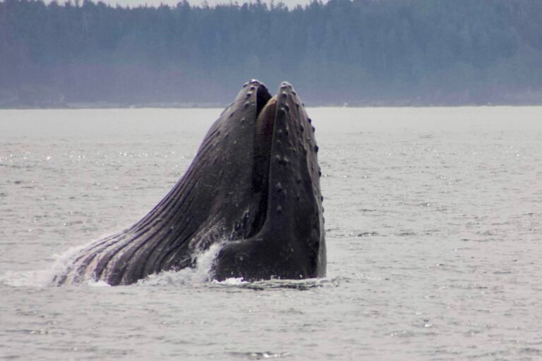
If travelling on the Queen of Chilliwack, the most stunning scenery is between Bella Bella and Bella Coola. With the setting sun behind you, the monolithic rock formations looming over the narrow Burke Channel give the cruise a European flavour. You’ll get an even better look at the scenic Dean Channel during daylight hours if you board the ferry in Bella Coola for the southbound sailing. Weather permitting, the ship’s two upper decks are an excellent vantage point from which to watch for the logging camps, barge houses, and abandoned settlements that indicate a human presence on this rugged coastline. Although Natives have inhabited the area for thousands of years, the inhospitable terrain has limited development and exploration by European settlers until comparatively recently. Wildlife viewing – the ferry slows for orcas – is another bonus of this trip. Don’t forget your binoculars. Facilities aboard the Queen of Chilliwack include reclining sleeper seats, a cafeteria, and small licenced lounge, a gift shop and – a boon for kayakers – pay showers.
Located in the Kitimat Ranges of the Coast Mountains, Fiordland Conservancy is an exceptionally scenic area, with rich estuaries at the base of sharply plunging glacier-topped mountains. Salmon spawn in the many coastal rivers and creeks. There are a number of excellent beaches and interesting upland features, including glaciers, waterfalls, lakes, and rivers, along with wonderful hiking and wildlife-viewing opportunities. Sitka deer, salmon, and grizzlies have shared this magnificent area with the Heiltsuk people for centuries. Trapping, hunting, fishing, and other traditional food-gathering activities have richly sustained these people over the years. There are a number of archaeological sites located here, particularly along the shorelines. Unfortunately for paddlers, campsites are few due to the steep topography of the area. The recreation area is an important habitat area for both black and grizzly bears, which can make travel on shore risky.
Those taking the Discovery Coast Passage should be aware that, depending on their departure time and length of trip, they may have to ‘camp’ one night aboard ship. A sleeping bag or warm blanket will enhance your comfort in one of the reclining seats. Alternatively, bring along a camping mattress and stretch out on the floor. A small number of cots and blankets are available onboard. Hardy types are also permitted to pitch their (self-supporting) tents on the deck.
Circle Tour: See the best of BC when you embark upon one of the many circle tours that take in Vancouver Island, the Discovery Coast, the Sunshine Coast, the interior winelands or the remote Northern British Columbia. The coastal tours involve exciting rail, road and ferry trips, which is half the fun of travelling in British Columbia. Scenic highways flank the coast, taking you through charming beachside communities, rolling farmlands and majestic mountain ranges. Start your journey here and now, by selecting from one of the Circle Tours, designed to assist you in planning your journey by road through beautiful British Columbia.