Located south of Mara Lake on the banks of the Shuswap River, the idyllic riverfront community of Enderby is nestled below the steep volcanic Enderby cliffs, which tower high above the city. When viewed from Enderby, local legend has it that the ridge resembles the head of the Neanderthal Man who guarded the northern gateway to the Okanagan Trench in the days of yore.
Enderby and the gentle waters of the Shuswap River have played a key role in the history and growth of the North Okanagan as a vital transportation route for the Shuswap Indians and the early European settlers. It was in the vicinity of this river that the Spallumcheen tribe of the Shuswap Indians lived for hundreds of years, hunting and fishing along its banks. And it was just south of the present townsite that overlander Alexander Leslie Fortune pre-empted land in 1866, thus becoming the first white settler in the North Okanagan. Fortune’s place on the bend in the Shuswap River made an ideal stopping spot for steamboats and paddlewheelers from Kamloops shipping supplies to settlers in the Okanagan.
Enderby was named in 1887 after a Jean Ingelow poem, in which the villagers were saved from a rising tide of water by the chiming of church bells playing the tune The Bridges of Enderby. With the completion of the Shuswap and Okanagan Railroad in 1892, the small town began to grow and prosper, with the construction of a flour mill, sawmill and brickyard by 1895. The business district expanded accordingly, and the decision was made to incorporate the city in 1905.
The Shuswap River has retained its importance as a navigable river, but canoeists and kayakers have taken the place of steamboats. The river now links the small developed communities in the rural district, from Kingfisher in the east to Mara in the north, and the city of Enderby remains the centre of services for the rural area.
Population: 3,134
Location: Enderby is located on Highway 97A on the eastern bank of the Shuswap River, 10 miles (16 km) north of Armstrong and 16 miles (26 km) southeast of Salmon Arm.
Farming: The Enderby area has several unusual farms, with fallow deer, ostriches, llamas, goats and Morgan horses, many of which welcome visitors.
Fish Hatchery: In the late seventies, Chinook salmon stocks were close to extinction on the Shuswap River. Concerned local residents started a salmon id enhancement program in the Kingfisher area. Since 1981, the Kingfisher Environmental Interpretive Centre has evolved from a community run hatchery to the current capacity to rear 500,000 fry annually, and offers walking trails and self-guided natural history trails.
Salmon Spawn: The Shuswap River is famous for its spawning grounds east of Enderby, where coho, spring and sockeye salmon return each year to spawn in the gravel beds.
The historical Walking Tour of Enderby takes in many of the fascinating heritage buildings still standing in the town. A superb booklet and map are available at the Visitor Centre.
The Enderby and District Museum features an imaginative look into the colourful history of the area. The changing displays feature the Shuswap Indians, entertainment, logging, farming and transportation, from 1880 to the present. Located in downtown Enderby, and open daily except Sunday during the summer.
Wildlife: See beavers swimming in the water, turtles sunbathing on logs and rocks, and enjoy the sound of birds along the Jim Watt Riverwalk, a scenic walk along the beautiful Shuswap River. Wood ducks, eagles, ravens, and common songbirds can be seen searching for food, building nests, or resting in the reeds and treetops above. During the salmon season come walk the riverwalk and watch the salmon swimming by.
Mara Provincial Park: A broad, sandy beach, roped swimming area, picnic tables and a boat launch are available at Mara Provincial Park, situated along the east side of Mara lake, north of Enderby on Highway 97A. This is a popular spot for parasailing and waterskiing, but no overnight camping is available.
Recreational parks in the Enderby area include Barnes Park at the south end of town, which features swimming pools and a skate board park, Belvedere Park next to the Enderby Bridge, Birchbark Park located on the east side of the Enderby Bridge, Quilakwa Park, and Riverside Park on the Shuswap River.
Golf: Mabel Lake Golf and Country Club is located 35 km east of Enderby, just off highway 97A. The par-36, 9-hole golf course is surrounded by majestic mountain ranges and natural forests, with picturesque rock walls and challenging ponds. Each hole consists of 4 sets of tees with fairways winding through mature forests, offering a challenge for golfers of all skill levels. Golfers can also play at the Birchdale Golf Course in neighbouring Grindrod. Golf Vacations in British Columbia.
Larch Hills Cross-country Ski Area, just 20 minutes west of Enderby, has groomed cross-country skiing trails for the advanced and beginning ski enthusiast.
Snowmobiling rules in Enderby, home to the Hunters Range Snowmobile Association, which sponsors a number of annual snowmobiling events, including the popular Snowrama in February. This group operates a day chalet and shelter, and has marked groomed and non-groomed trails in the 200 square kilometres of great snowmobiling amongst the alpine meadows and bowls in the Hunters Range east of Enderby.
Hiking & Horseback Riding: Stretching from Enderby Cliffs to Mabel Lake, these same rolling hills of beautiful alpine meadows make the Hunters Range ideal for hiking and horseback riding during the summer months.
A challenging hike to the Enderby Cliffs promises a terrific view of the valley and the meandering Shuswap River, as well as a close look at the volcanic rock and fossil sites. Permission is required to cross private property to hike up the cliffs, and trail maps and notes are available from the Visitor Centre.
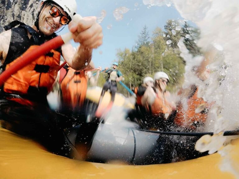
The Shuswap River offers canoeists and kayakers miles of waterways to explore, from rolling rapids to calmer waters near the city. Jet-boat river tours are available for guided trips to the river channels.
The small farming village of Gindrod is located on the west bank of the Shuswap River, 8 miles (13 km) north of Enderby on Highway 97A. Set in peaceful and rural surroundings, Grindrod is full of country charm with a storybook setting; a popular destination with visitors. Golfers can tee off at the Birchdale Golf Course.
South of Enderby is the small community and commercial centre of Armstrong, presiding over the fertile dairy and ranch land of the Spallumcheen Valley. Agriculture and ranching are the traditional economic ventures of Armstrong, named after E.C. Heaton Armstrong, a London banker who helped finance the Shuswap and Okanagan Railway in 1892.
Circle Tours: See the best of the area on Okanagan and Kootenay Rockies Circle Tour. Travel the sunny interior of British Columbia, north through the Okanagan to Sicamous, following Highway 1 into the mountains of the BC Rockies. From Golden, head south through the Columbia Valley to Creston, and west through the Southern Okanagan, starting and ending your sun-drenched voyage in Osoyoos, the place where two lakes come together. Circle Tours in British Columbia.


