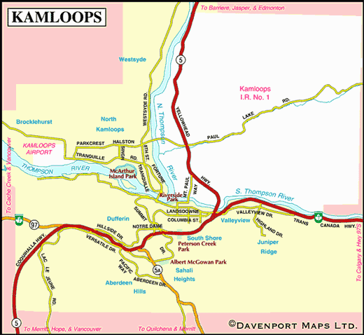
Map of Kamloops
 |
Situated at the confluence of the North and South Thompson Rivers in the Thompson Valley, the sprawling city of Kamloops takes its name from the First Nations word Kahm-o-loops, meaning meeting of the waters. Water isn’t the only thing that meets here; the Trans-Canada, the Yellowhead and Highway 97 all meet in Kamloops, as do the two national rail lines, CP and CN.
The Secwepemc nation has inhabited the Kamloops region for thousands of years, basing their society on hunting and gathering and a dynamic trading economy. It was the native fur trade that first attracted white interest to the area, and dramatically changed the lives of the Shuswap Indians. The Secwepemc called the location of the present city Cumcloups. During the fur trade era the name Kamloops denoted the Indian settlement, but after 1867, the aboriginal name was gradually adopted for the village as a whole, with Kamloops being incorporated as a town in 1893.


