A large scalloped bay protected from the open sea by South Thormanby Island, Halfmoon Bay encompasses a small village of permanent homes, summer cottages and five regional parks on the Sunshine Coast of British Columbia.
The community of Halfmoon Bay can be reached by the uniquely named Redrooffs Road, so-called because a popular local resort once featured a cluster of tourist cabins, all with red roofs.
This area of the Sunshine Coast was originally inhabited by the shishalh tribe of the Coast Salish First Nations. The area was chosen for its mild climate and abundance of fresh water and natural food (fish, shellfish, berries and roots). The shishalh tribe became known as the Sechelts, a derivation of she’shalt, meaning the people. Roberts Creek formed the boundary between the Sechelt people to the north and the Squamish people to the south.
The Sunshine Coast is split into two portions on either side of Jervis Inlet. Roughly speaking, the southern half between the ferry slips at Langdale and Earls Cove occupies the Sechelt Peninsula, while the northern half between the ferry slip at Saltery Bay and Lund sits on the Malaspina Peninsula.
Location: Halfmoon Bay is located on Highway 101 on the Sunshine Coast of BC. The Sunshine Coast is accessible from the rest of the Lower Mainland only by boat or airplane. Travellers aboard BC Ferries leave Horseshoe Bay in West Vancouver for the 45-minute ride to Langdale on the Sechelt Peninsula on the Horseshoe Bay to Langdale Ferry Route. Highway 101 links Langdale with Halfmoon Bay, 16 miles (25 km) to the north.
Stop at the Halfmoon Bay Lookout for a splendid panoramic view of Welcome Pass, the Thormanby Islands, and Malaspina Strait.
Priestland Cove in Halfmoon Bay is named after the indomitable Clara Priestland, who regularly rowed out into the bay to intercept Union Steamships, collecting and dispatching local mail.
Fishing: March is one of the few months on the fishing calendar when anglers get to stay home and tidy their tackle boxes, or tie on a fly and try for surface-feeding trout at Trout Lake on the north side of Hwy 101, 1.2 miles (2 km) south of Halfmoon Bay.
Diving: The popular spot for diving in the waters of Halfmoon Bay is at Coopers Green Regional Park on Redrooffs Road. The relatively shallow water on the east side of the bay provides good beginner and intermediate diving as well as snorkelling. A note of caution: Divers must be mindful of boaters in the water around Coopers Green Regional Park and Halfmoon Bay in general.
Cycling: Hwy 101 rises and falls as it parallels the coastline for much of its length. One of the steepest hills is on the north side of Sechelt. Redrooffs Road is a delightful 6-mile (10-km) side road that loop-dee-loops along the coast off Hwy 101. The southern entrance to Redrooffs is located about 4 miles (7 km) north of Sechelt. The northern entrance is just north of Trout Lake. Note: In recognition of cyclists, Porpoise Bay Provincial Park in Sechelt has 6 ride-in campsites.
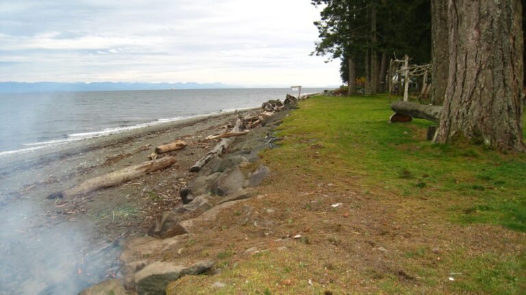
On Redrooffs Road between Sechelt and Halfmoon Bay is the waterfront Coopers Green Regional Park, where you’ll find a beach with a mix of rock and sand, and offshore islets. Enjoy a picnic supper while watching the summer sun sink offshore as it lights up the picturesque cove. Coopers Green is a popular location for divers, and has a large grassy, treed area with a volleyball court, horseshoe pit, BBQ pit, washroom facilities, swimming beach and a public boat ramp.
Short trails in Connor Park connect to extensive hiking and mountain biking trails that wind through the Halfmoon Bay area. The park is reached via Redrooffs Road from Hwy 101, between Sechelt and Halfmoon Bay – approximately 10 minutes driving north of Sechelt. From Redrooffs Road turn east on Southwood, left on Westwood and left at the deadend.
Sargeant Bay Provincial Park, 4.5 miles (7 km) east of Halfmoon Bay, features a sandy beach that’s ideal for swimming and picnicking. You’re most likely to find yourself sharing it with local bird-watchers who come down to explore the nearby marsh. As you walk south along the bay, the cobblestone beach changes to more hospitable sand, which is where you’ll want to spread out and listen to the lapping of the waves and the laughing of the gulls.
There is camping at Smuggler Cove Marine Provincial Park, located about 2.5 miles (4 km) southwest of Halfmoon Bay, one of the most popular anchorages on the Sunshine Coast, well-protected from wind and sea. This small, sheltered marine park with walk-in campsites serves as a jumping-off point for paddlers wishing to explore several offshore islands in what is arguably the most scenic location on the Sunshine Coast. Watch for the well-marked approach to the park on the south side of Hwy 101, between Halfmoon Bay and Secret Cove. Follow Brooks Road 3 miles (5 km) to the parking lot, from where you can walk the 1-mile (1.6-km) trail to the wilderness campsites, or paddle in from Brooks Cove through Welcome Passage. The sheltered coastline of Smugglers Cove provides great protection for paddling.
Paddlers can head offshore to Simson Provincial Park, which enjoys a particularly pretty location on South Thormanby Island, occupying much of the island, with a blend of sandy beaches, forested slopes, and tranquil coves. Spyglass Hill at the north end of the island is a prominent landmark to watch for after launching from Halfmoon Bay north of Sechelt. It’s only a 2-mile (3-km) paddle from the public boat ramp in Halfmoon Bay across Welcome Passage to the east side of South Thormanby, the larger of two similarly named islands.
The tiny 1-hectare Buccaneer Bay Provincial Park features a broad sandy beach located at the southern tip of North Thormanby Island. The large sheltered Buccaneer Bay provides safe anchorage in most summer conditions, and the nearby Gill Beach on South Thormanby Island is considered to be one of the most beautiful beaches on the Sunshine Coast. The area features tide pools, driftwood, warm water for swimming and is popular with families and kayakers. Wilderness camping is allowed, and hiking and picnicking are also offered. Access is by boat only from Halfmoon Bay and Secret Cove.
Mount Richardson Provincial Park on the east side of Sechelt Inlet protects ocean shoreline and Mount Richardson. The summit of Mount Richardson (986 metres/3,205 feet) offers great views of Sechelt Inlet, the Sechelt Peninsula, and the town of Sechelt. Access is by 4-wheel drive to the mountaintop hiking area and Richardson Lake with its rustic campsites. The park shoreline includes three of the boat-accessible camping sites on Sechelt Inlet, at Oyster Beach, Nine Mile Point and Tuwanek.
Marine Parks: Several Marine Provincial parks are located in this area, most with undeveloped facilities. Boaters may find freshwater at the occasional one but should always bring their own. Much of the coastline is sheltered, which provides good protection for those in small paddlecraft or motorboats. Kayakers can explore the many bays and headlands around Smuggler Cove Marine Provincial Park, just north of Halfmoon Bay, or paddle across Welcome Passage to the golden sand beaches of Buccaneer Bay Provincial Park on the west side of North Thormanby Island. Like several local landmarks, Buccaneer Bay was named after a race horse in England’s 1880 Epsom Derby.
Golf: Sechelt Golf & Country Club is an 18-hole, Par 72 golf course (6,553 yards) located in the heart of the Sunshine Coast and open to the public every day for a memorable round of golf. Golfers will enjoy the generous fairways and large gently sloping greens. Golf Vacations in British Columbia.
Mountain Biking: One of the most ambitious mountain-bike trail projects, the 20-mile (33-km) Suncoaster Trail, opened in the mid-1990s. At present, it extends between Homesite Creek, near Halfmoon Bay, through the foothills of the Caren Range to Klein Lake near Earls Cove. Along the way, it passes abandoned rail lines, BC Hydro service roads, old-growth forests, and rocky promontories, and near its northern terminus has incredible views of Ruby and Sakinaw Lakes. Although mostly gravelled singletrack, the trail follows Hwy 101 for short distances where necessary. The shoulders on the highway have been broadened to comfortably accommodate cyclists in these places. Eventually, the trail will extend to Langdale. One of the most scenic spots is beside a waterfall where a 68-foot (21-m) bridge spans Sakinaw Creek.
Other lengthy loop trails reached from the Trout Lake and Halfmoon Bay Forest Roads include the Carlson Lake Loop (moderate/difficult; 13 miles/21 km), which is marked by orange paint, and the Lyon Lake Loop (difficult; 10.5 miles/17 km), marked by yellow paint. North of Trout Lake, the Homesite Creek Bike Loop (moderate/difficult; 5 miles/8 km) follows the Homesite Creek Forest Road. The entrance to the road is obscure, so watch carefully for an orange ‘Trucks Turning’ sign about 3.5 miles (5.6 km) north of Trout Lake on the north side of Hwy 101, just past Homesite Creek. The 5-mile (8-km) intermediate/expert trail is marked by biking symbols and blue paint. The biggest reward on this loop is an extended downhill after a taxing opening ascent.
Wildlife: The marshland around Sargeant Bay Provincial Park is an important stopover for waterfowl such as harlequin ducks, Canada geese, and trumpeter swans, as is the upland area for a host of migratory songbirds. Local volunteers have undertaken an ambitious project to restore wildlife habitat around the bay.
A bittersweet victory was gained in the Caren Range when the last of the great Caren forest was recently protected as Caren Range Provincial Park, but not before some of the oldest trees in Canada – in excess of 2,000 years old – were cut by B.C. logging companies, then left to waste! You’ll have to drive a long way through open hillsides before you reach the shade of the park, but the tranquillity you’ll experience there will be a grand reward.
Marbled Murrelet: Some of the oldest yellow cedar and western hemlock in western Canada grow in the Caren Range, northeast of Halfmoon. Home to the marbled murrelet, a drab, starling-size seabird whose numbers are in as precipitous a decline as the old-growth western hemlock on which it depends, these mountains form the backbone of the Sechelt Peninsula. Although most murrelets nest in cliffs and rock walls, the marbled murrelet, having evolved beside the majestic, ramrod-straight, temperate old-growth forest, lay their eggs on the hemlocks’ broad, moss-draped limbs.
Located 6 miles (10 km) southeast of Halfmoon Bay on Highway 101, the small community of Sechelt sits on the narrow Sechelt isthmus separating Sechelt Inlet from the Strait of Georgia. A magnificent sweep of beautifully cobbled beach combines wave-polished granite ramparts with driftwood & many-coloured pebbles. Treed mountains, cascading creeks and waterfalls create the spectacular coastline of Sechelt, making the community a year-round delight for photographers.
About 2.5 miles (4 km) north of Halfmoon Bay is Secret Cove, a popular summer resort retreat in a sheltered harbour near the entrance to Smuggler Cove Marine Provincial Park, which boasts some of the best fishing charters of the Lower Mainland and Sunshine Coast of BC.
Circle Tours: See the best of the area on a driving Circle Tour. Head north out of Vancouver for the scenic Sunshine Coast and Vancouver Island Circle Tour. Board a B.C. Ferries vessel at Powell River that will take you across the waters of the Strait of Georgia to Comox, on Vancouver Island’s east coast. Travel south to Victoria and return to Vancouver by ferry from Swartz Bay to Tsawwassen. Circle Tours in British Columbia.


