Carved from wilderness in the 1960s, the resource-based community of Gold River is located in central Vancouver Island in the heart of historic British Columbia, 90 km west of Campbell River.
This area is the traditional territory of the Mowachaht and Muchalaht people of the Nuu-chah-nulth First Nation. The name Gold River appears on maps dating back to 1871, after the Chinese were taking gold out of the area in the 1860s.
When Gold River was built in 1965, it was Canada’s first all-electric town, and the first in Canada to have underground wiring. The District of Gold River was incorporated on August 26, 1965 and reincorporated as the Village Municipality of Gold River on January 1, 1972.
It was near Estevan Point, in 1774, that Spanish sailors first traded with seagoing native peoples. Four years later, in Resolution Cove, Captain James Cook was greeted by proud local whalers called the Mowachahts.
Gold River was always dependant upon the Pulp Mill and the forest industry. Since the closure of the Pulp Mill in October 1998, Gold River has focused on rebuilding the community and attracting many new residents to the town, along with many new skills and interests.
Many visitors to the west side of Vancouver Island may never have had the chance to boat in the wind, the rain, and the ever-rolling seas that characterize the world of the ‘outside’ waters, as the open ocean here is often called. One of three freighters that ply the waters of Vancouver Island’s Barkley, Nootka, and Kyuquot Sound is based in Gold River, at the western terminus of Hwy 28, providing a service between Gold River, Nootka Sound, and Tahsis.
Exploring the outside waters aboard the Uchuck III as the former World War II minesweeper makes a weekly two-day round-trip voyage to the fishing hamlet of Kyuquot can be an adventure. For many passengers, particularly in storm season, the high (or low) point of the journey is the two-hour stretch each way spent tossing about on the open ocean waters between Port Eliza and Kyuquot. From the moment the 136-foot-long freighter leaves the dock in Gold River and begins its 10-hour journey the big question is whether your constitution can handle the rise-and-fall motion of the ship in high seas. (At such times it helps to remember that the word uchuck translates as healing waters.)
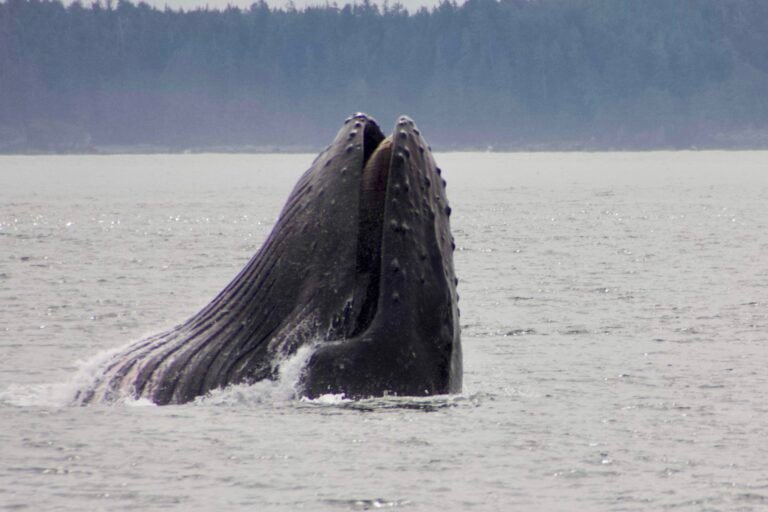
Gold River received tremendous media coverage worldwide in July 2001 when Luna the Killer Whale became a media sensation when he turned up in Nootka Sound after being separated from his pod in Puget Sound in Washington. Attempts to reunite Luna (L98) with his family were suspended, as the Mowachaht and Muchalaht First Nations believed Luna, or Tsuxit, embodied the spirit of Chief Ambrose Maquinna, who had died just days before the whale was first seen in the area. The orca loved to play around boats, and sadly this ultimately led to his death in March 2006, when Luna got too close to the propellers of a tug boat in Mooyah Bay, one of Luna’s favourite places in winter.
Population: 1,389
Location: Gold River is located on Highway 28 in central Vancouver Island, 90 km west of Campbell River. Highway 28 originates from Highway 19 just north of Campbell River and leads west for 57 miles (92 km) to Gold River.
The Gold River flows south of the town and empties into Muchalat Inlet, 9 miles (14 km) from Gold River. If you can handle the cold, take a refreshing swim in the clean, crystal-clear waters of the glacier river. You can also take a trip down the rapids in a tube. A popular swimming spot in town is the Heber River Canyon. The more adventurous can jump off the cliffs into the Gold River at Peppercorn Park, or try the lower cliffs at Deep Pool.
Upana Caves: Venture into the awe-inspiring Upana Caves, all 100 or so of them, located about 10 miles (about 17 km) west of Gold River on Head Bay Forest Road. They provide an awe-inspiring adventure for those who like to explore the interior of the earth. There are fifteen known entrances within the system. The combined length of cave passages is approximately 450 meters (1 475 feet). The individual caves vary in size from single rooms to branching passages of considerable length. The overall passage and room dimensions are comparable with those of other Vancouver Island caves. Dress warmly, as these caves, the deepest north of Mexico, extend more than 2,000 feet (610 m) into the honeycombed limestone rock. You can take a self-guided tour through a network of caves or join a guided tour. For an even deeper adventure, join a guided tour of the “White Ridge” caverns. Cavers named the system for the river that flows through one of the caves. The underground sequences of the television series, Huckleberry Finn and His Friends, were filmed at the cave – Gold River is home to the B.C. Speleological Association. There are about 1 050 known caves on Vancouver Island. Most of these caves are found in the Quatsino Formation limestone deposits of Northern Vancouver Island.
Caving on Vancouver Island.
Flightseeing: If you are short of time, you can see the best sights in the region from a floatplane, including Yuquot (Friendly Cove), Hot Springs Cove, and Rugged Point Marine Provincial Park. You can also join a mail run trip with Air Nootka and enjoy the amazing views of the remote west coast. They can also take you to the spectacular Cougar Annie’s Garden outside Muchalat Inlet, near Hot Springs Cove. Another awesome adventure is a helicopter trip up the Burman River, flying through part of Strathcona Park and into the Gold River Canyon.
Indian Falls on Highway 28 toward Muchalat Inlet provides good views of the river, forest and the beautiful falls that drop down the canyon.
Golf: Golfers can enjoy the wildlife, the mountainous terrain, and the sparkling Gold River when playing the 9-hole golf course at Golf River Golf & Country Club. The community-built golf course is very challenging to both the novice and experienced golfer. Vancouver Island Golf Vacations.
Fishing: Nootka Sound is a hot spot for tyee in July and August. Coho, red snapper, rock cod and halibut are also plentiful. The Nootka Sound area has 7 wild salmon rivers and three hatcheries, including a large federal salmon hatchery on the Conuma River. Halibut are plentiful, and generally range from 15 to 50 pounds, although some in the 175-pound range have been taken in the area.
For freshwater fishermen, the Gold River is considered to be one of the premier steelhead fishing rivers in the province. The Gold River features two runs of Steelhead per year, offering year-round catch-and-release steelhead fishing easily accessed from several places along its banks. The first run is from December to March and the second from June to August, although steelhead are present throughout the year. The Gold River region is surrounded by many freshwater lakes, most of which contain natural fish stocks, and many of the lakes in the area are stocked with cutthroat and Rainbow trout. Rainbow, Cutthroat, and Dolly Varden are all caught in the area. Trout sizes vary from lake to lake, and it is not uncommon to catch rainbow trout weighing 5 lbs. or cutthroat trout of over 6 lbs. Muchalat Lake, Star Lake, and Antler Lake all offer good trout fishing from a canoe, belly float, or simply from shore.
Strathcona Provincial Park was created in 1911 and is the original park in the BC provincial system. At the time, the 544,000 acres (200,000 hectares) seemed like a fabulous amount of land to set aside. It still does, especially to those who like to hike in the middle of the rugged, heavily glaciated Vancouver Island Mountains. The park was created for those who seek adventure in remote wilderness surroundings. It may be easier to reach the trailheads today, but the routes still remain as challenging as ever. To really experience the beauty of this park, come prepared to explore the backcountry. A day-trip to Strathcona gets you into an unparalleled natural wonderland of vast forests, great lakes, alpine meadows and challenging peaks.
The campgrounds of Strathcona Provincial Park are reached via Hwy 28, about 25 miles (40 km) east of Gold River. You’ll find vehicle/tent campsites in two locations, Ralph River and Buttle Lake. Ralph River Campground requires a 15.5-mile (25-km) drive south from Hwy 28 along the east shore of Buttle Lake; you’ll find the well-marked turnoff from Hwy 28 on the east side of the bridge that spans Buttle Narrows, where Buttle Lake merges with Upper Campbell Lake. An old-growth Douglas fir forest shelters the peaceful setting of the campsites at Ralph River. Buttle Lake Campground is farther west, and just a short distance south of Hwy 28 at the junction of Upper Campbell and Buttle Lakes in a pleasantly forested, riverside location. There’s good swimming, in season, at both campgrounds.
Camping on Vancouver Island.
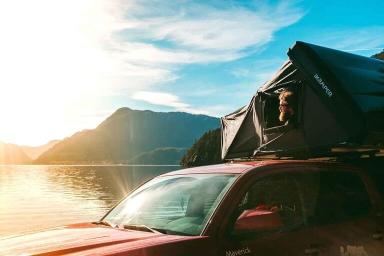
Camping is also available at unserviced campsites near Gold River. The Muchalat Lake Recreation Site on Muchalat Lake, about 8 miles (13 km) northwest of Gold River via the Gold River mainline, is a large open site at the east end of Muchalat Lake, with 40 campsites, a boat ramp, a dock, a beach and swimming area. Gold River Campground, located on the Gold River on Highway 28, between the town of Gold River and Muchalat Inlet, offers riverside camping for tents and vehicles. Between Gold River and Tahsis is the Cougar Creek Recreation Site on Tlupana Inlet (via the Nesook Mainline), a fabulous and well-maintained fishing campground offering 55 campsites and a boat launch. Cougar Creek is a popular destination for anglers and those wanting to explore Nootka Sound. On Head Bay Forest Road is the Conuma River Campsite, a rustic campground located beside the Conuma River.
Hiking: More than a dozen hikes and walks originate from the Buttle Lake area of Strathcona Park. Trailheads are found at both the north and south ends of the 9-mile (15-km) lake, as well as additional trails that lead off elsewhere around the lake. From the park entrance on Hwy 28, the Elk River Trail (moderate; 13.5 miles/22 km return) leads through the Elk River Valley to aptly named Landslide Lake. Careful of your footing here and on the Crest Mountain Trail (moderate; 6 miles/10 km return), which climbs to a variety of scenic viewpoints farther west. The Crest Mountain trailhead is located on the north side of Hwy 28, about 15 miles (24.5 km) west of Buttle Narrows Bridge. A fascinating look at weathering appears along the Karst Creek Trail (easy; 2.5 miles/4 km return), which begins beside the picnic area on the east side of Buttle Lake. The Wild Ginger and Shepard Creek walking trails originate in the Ralph River Campground.
Hiking Trails in Strathcona Provincial Park.
Hikes closer to Gold River include the Heber River Trail (40 minutes, round trip), which follows the spectacular Heber Canyon. The trailhead is at the bridge on Matchlee Drive. The Peppercorn Trail (40 minutes one way) starts from the Gold River bridge and ends at the Peppercorn Park, which features swimming and a diving cliff. The Antler Lake Nature Walk (60 minutes one way) starts at the end of Scout Lake Road, follows Scout Lake for a short distance, and then heads up the mountain. This trail is an easy walk through bush, winding and shaded most of the way. At the side of the mountain the trail starts a steep descent out into the open. At the dirt road you can see Antler Lake. Proceed down the road for ten minutes to the lake for a refreshing swim or picnic.
Mountain Biking: Take your mountain bike to the old-growth forests at Scout Lake and Antler Lake, between Gold River and Tsaxana (the Mowachaht-Muchalaht reserve), and explore the trails and jumps built by a local bike club.
Canoeing & Kayaking: Paddlers can head to Muchalat Lake, Star Lake, and Antler Lake. Kayakers can head down the Gold River – but be prepared for level 4 rapids – or venture farther afield to Tahsis Inlet, Tlupana Inlet, and Esperanza Inlet. Be aware of strong onshore winds in the afternoons. Most of the coastline is rugged, but there are many sloping sandy beaches in the area.
Paddlers heading to Nootka Sound can avoid the long stretch down Muchalat Inlet by launching at the Cougar Creek Rec Site on Tlupana Inlet (access via Head Bay Forest Road and Nesook Mainline).d Kayakers might be fortunate enough to see black bears foraging for food on the beaches.
Mountain Climbing: Nearby Strathcona Provincial Park is a mountain climber’s dream. Over 100 routes exist in the 18 Craggs at Crest Creek Craggs alone, drawing climbers from all over the world. Located just 15 minutes east of Gold River, most of the routes at Crest Creek are rated 5.8 to 5.10, with some as high as 5.13. Heights vary between 30 feet and 170 feet and offer great views of adjacent valleys. Use the Crest Mountain hiking trailhead to reach the routes, located on the north side of Hwy 28, about 15 miles (24 km) west of Buttle Narrows Bridge. Other favourite spots include Kings Peaks and Elkhorn Mountains.
Boat launches are situated at two locations on slender, steep-sided Buttle Lake in Strathcona Provincial Park. One is located beside the Auger Point picnic tables in the Buttle Lake Campground; the other is located about 15 miles (25 km) south of the campground near the Karst Creek picnic area. Buttle is a flooded lake, and along the shoreline submerged deadheads are an ever-present threat. Beware of the sudden winds and storm conditions that can quickly channel through this mountainous region. Boaters can head to four wilderness marine campsites on the western shore of Buttle Lake, as well as a site on Rainbow Island just offshore from the Buttle Lake campground at the north end of the lake. Buttle Lake also features a sandy beach and several hiking trails ranging from 30 minutes to 6 hours in length.
The Gold Muchalat Provincial Park is located on the Gold and Muchalat Rivers, northwest of Gold River. The park protects an important trans-valley corridor of old-growth Douglas-fir and western hemlock trees, and also protects important habitat for the Marbled Murrelet, deer and Roosevelt elk. Sockeye Salmon spawn in the Muchalat River and Summer Steelhead, Rainbow Trout and Coho are found in both rivers, attracting anglers to this pristine sport fishing area, accessed on the Gold River Main logging road off Hwy 28.
The White Ridge Provincial Park extends from its boundary with Strathcona Park northwest to the Gold River Highway. The park protects important deer and elk habitat and derives its name from the white limestone and sensitive karst topography for which the area is internationally known. The 1,343-hectare White Ridge Park includes a prominent forested ridge that forms the eastern viewscape of the community of Gold River.
Muchalat Inlet: Southwest of Gold River, the sheltered waters of Muchalat Inlet run like a long corridor through steep-sided fjords to Nootka Sound, and the Pacific Ocean. Landing places are few, and once in Nootka Sound, a much more weather-beaten landscape begins to reveal itself. Bligh Island Marine Provincial Park, part of the Spanish Pilot Group, sits at the mouth of Muchalat Inlet.
There’s much to explore in this group of six islands, scattered where Muchalat Inlet converges with two adjacent inlets and their channels. The waters in this region can get choppy, so small craft must cross with care. Large Bligh Island is named for a much-maligned British Navy captain who sailed here with the equally well-known Captain Cook in 1788. A cairn at Resolute Cove on the southeast coast of the island commemorates the landing.
The port at the head of Muchalat Inlet consists of a public wharf, two large floating docks for fishing boats, and docking facilities for float planes. Alongside the port is the log dump, where you can marvel at the superbly maneuverable little tugboats (called sidewinders) that push logs into log booms for ocean transport by barge.
Take part in June’s Great Walk, an incredible 42 miles from Gold River to Tahsis – easily North America’s toughest walkathon! The 63.5-km pledge trek along the Head Bay Service Road linking the two communities is sponsored by the Tahsis Lions Club, and attracts about 1,100 participants to this beautiful and remote part of Vancouver Island.
Tahsis is an unspoiled coastal village situated at the head of Tahsis Inlet, a deep fjord on the wild west coast of Vancouver Island that cuts northwards off Nootka Sound. Tahsis is accessible via a good gravel road from Gold River, and offers a variety of outdoor adventures, including sportfishing, hiking and kayaking.
Nootka Sound Steeped in history and surrounded by the natural beauty of the west coast of Vancouver Island, Nootka Sound is a paradise for sport anglers and outdoor adventurers seeking to explore and enjoy the magnificent wilderness surroundings. Nootka Sound was the site of the first agriculture, shipbuilding, logging and brewing (spruce beer!) by Europeans on the B.C. coast. Nootka Sound is accessed from Muchalat Inlet, 9 miles (14 km) south of Gold River on Highway 28.
Campbell River is the nearest town to the east of Gold River (56 miles/90 km).The young and vibrant community is known for its fabulous salmon fishing and serves as the gateway to Gold River, the remote North Vancouver Island, and the BC Discovery Islands to the east.
he M.V. Uchuck III sails from Gold River to Kyuquot on Thursdays. The round-trip ticket includes accommodation in Kyuquot. Shorter day trips aboard the Uchuck include the Tahsis Day Trip, which departs on Tuesdays year-round and travels through Nootka Sound to Tahsis (5 hours one way), with stops to deliver passengers and cargo at logging camps and settlements. A one-hour stop allows for a walking tour of Tahsis village.
The Nootka Sound Day Trip includes a brief stop at Resolution Cove and a 90-minute stop at Yuquot (Friendly Cove). The landing fee at Friendly Cove goes to the Mowachaht Band for redevelopment of this historic site. Reservations are a must for all sailings. Some Gold River hotels operate a free shuttle service for guests from the town of Gold River to the dock at the head of Muchalat Inlet, located about 9 miles (14 km) to the southwest of Gold River.
The MV Uchuck lll facilitates ocean going kayak excursions to Nootka Sound, enabling paddlers to explore this fjorded area of spectacular beauty, home to First Nations people for over 6,000 years. Visit isolated beaches, explore sea caves and old historic sites – experience West Coast wilderness at its best.
MV Uchuck lll service between Gold River, Nootka Sound, and Tahsis.


