Port Alberni is nestled in the Alberni Valley at the head of Alberni Inlet, the longest inlet on Vancouver Island.
For decades the main industries of Port Alberni have been mining and logging, but today the town is considered a major tourist hub, situated as it is on the fringe of the island’s wilderness in surroundings that include mountains, pristine lakes, surging rivers filled with salmon and trout, and rain forests of giant trees towering more than 200 feet into the sky.
With the increased popularity of Pacific Rim National Park, Barkley Sound and Clayoquot Sound, many visitors are basing their vacations in Port Alberni, and taking trips to a variety of west coast locations.
Port Alberni was named after Captain Don Pedro de Alberni, a Spanish officer who commanded Fort San Miguel at Nootka Sound on the west coast of Vancouver Island from 1790 to 1792. Before Europeans came, the region incorporating Alberni and the West Coast of Vancouver Island was the traditional territory of the Tseshaht and Hupacasath First Nations of the Nuu-Chah-Nulth Tribal Council. The Nuu-chah-nulth were previously called the Nootka. Many place names in Port Alberni have a Nuu-chah-nulth origin, such as Somass (washing), Kitsuksis (log across mouth of creek), Pacheena (foamy), and Nootka (go around). Ancient petroglyph carvings can be found at Sproat Lake.
Port Alberni is truly the Salmon Capital of the World, with adjacent waters boasting all five species of Pacific salmon. Port Alberni has cemented this status by winning the first ever title of Ultimate Fishing Town as awarded in 2010 by the World Fishing Network, an American television network.
Port Alberni’s harbour district is thick with tackle shops, boat rentals, and fishing charters. This is definitely one of the major hubs for angling on Vancouver Island and is the best resource centre for information on fishing locally in both saltwater and freshwater.
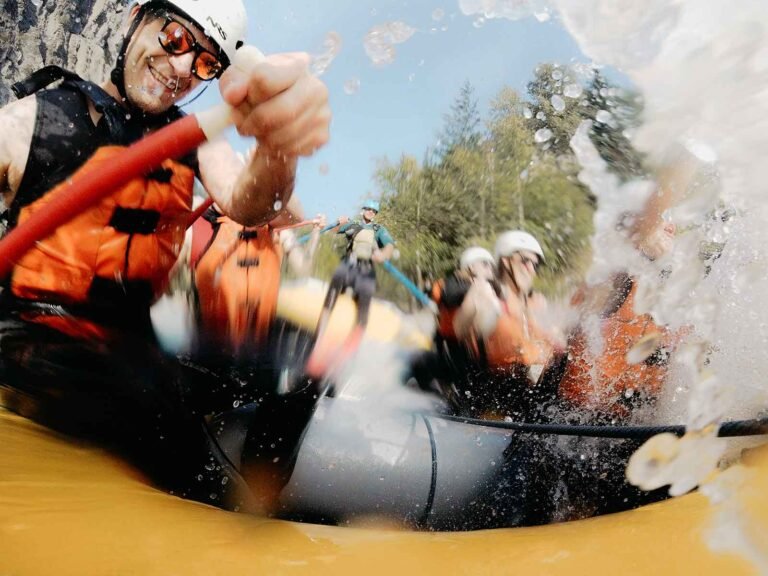
Visitors come to Port Alberni year round to sport fish Alberni Inlet and Barkley Sound for chinook, coho, and sockeye salmon. Salmon school in the inlet before ascending to the spawning grounds. Timing is crucial if you wish to take advantage of their presence. One day they’re here; the next, they’re gone, so plan ahead. In general, the Alberni Inlet and Barkley Sound offer year-round fishing. Salmon is the prize catch in these waters, but so too are halibut.
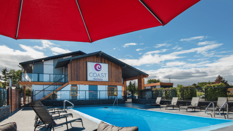
The City of Port Alberni offers a deep sea port, beautiful waterfront quays, an airport, a new hospital, shopping malls, a casino, and a well-developed array of recreational facilities. The Alberni Harbour Quay has recently been revitalized by the construction of Spirit Square and a new waterfront boardwalk. The area is a people’s place, with stores and restaurants, and art galleries.
On Saturdays throughout the year there is a lovely Farmer’s Market where you can find a variety of handicrafts, as well as groceries for your camping or kayaking trip. Also in the area are the Maritime Museum and a regularly scheduled cargo and passenger ship that cruises Alberni Inlet and the communities of Barkley Sound.
Port Alberni is the Start of the Pacific Rim Experience. Be sure and stop at the spectacular new Visitor Centre as you enter the town. To the west of Port Alberni are the communities of Ucluelet and Tofino, and the spectacular Long Beach. Port Alberni is also the starting point of a 102-km unpaved road to the village of Bamfield, and the start of the famous West Coast Trail.
Population: 18,790
Location: Port Alberni is located in the Alberni Valley on Vancouver Island, at the head of Alberni Inlet, 29 miles (47km) west of Parksville on Pacific Rim Highway 4.
View map of the area
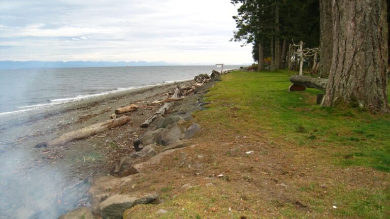
Alberni Inlet: Port Alberni sits at the head of Alberni Inlet, Vancouver Island’s longest inlet. The town is actually a saltwater port, situated 40 kilometres from the Pacific Ocean on the west coast of Vancouver Island! The Alberni Inlet is a long indentation that reaches so far inland from the Pacific Ocean that it comes to within just 30 miles (48 km) of Parksville on the east coast of Vancouver Island.
Alberni Valley Museum collections tell the story of Alberni Valley community history, Nuu Chah Nulth art and culture and the region’s industrial roots, from logging to fishing and farming. Displays include an exceptional display of local artifacts and original native crafts, such as the intricately woven cedar bark baskets of the Nuu Chah Nulth people.
Murals: Eighteen colourful murals adorn the buildings of downtown Port Alberni, celebrating the life and heritage of the Alberni Valley. A self-guided tour map of the Port Alberni murals is available at the Visitor Centre.
Alberni Harbour Quay at the foot of Argyle Street in downtown Port Alberni is a friendly conglomeration of restaurants, galleries, tour operators, and shops where visitors can find an island souvenir for friends back home. In summer, the steam locomotive Two Spot departs from the station at the head of the quay for a tourist tour along the waterfront.
Whaling Sculpture: On display on the boardwalk at Victoria Quay is a Nuu-Chah-Nulth Whaling Canoe sculpture, carved from yellow and red cedar. The elaborate carving is a replica of an historical First Nation whaler’s canoe pursuing a grey whale, considered as a great gift from the Creators.
McLean Mill National Historic Site: Step back in time and experience the heritage of British Columbia’s forest industry at the restored McLean Steam Sawmill. A troupe of professional actors breathes life into the very people who built this province. Through daily interpretive drama, songs, stories, and dance, the period characters show how it was for the pioneers of the logging industry. The site is accessible to the public year round, with mill demonstrations, theatre presentations, and tours operating from May to September. Located on Smith Road off Beaver Creek Road, north of Port Alberni.
1964 Tsunami: Port Alberni was devastated by a tsunami on Good Friday, March 27, 1964. The tidal wave reached three metres above the high water mark and destroyed everything in its path – without loss of life! Anchorage in Alaska was rocked by one of the strongest earthquakes of the century, measuring 8.5 on the Richter scale and raising a section of the ocean floor by 15 metres. The resulting waves travelled from the Gulf of Alaska, reaching speeds in open water of up to 720 km/h, At midnight, 4-1/2 hours after the earthquake, the first of these waves entered the mouth of Alberni Inlet. As the waves entered the funnel-shaped inlet, the narrowing shoreline forced the waves to pile up. In 10 minutes the wave advanced 60 kilometres (360 km/h) toward Port Alberni. The second wave was the most damaging, cresting three metres above the high tide mark when it raced inland and into the homes of sleeping residents. Four less forceful waves stormed in between 3am and 6.45am, reaching levels about two metres above the high tide mark. When the sun broke through the mist the next morning, 58 properties had been destroyed, 350 buildings damaged, and 300 cars written off, but nobody was drowned or even seriously injured.
Robertson Creek Hatchery officially opened in 1960, when it was the largest artificial spawning channel in North America. It is now the most successful hatchery on Vancouver Island, producing nearly 10 million smolts annually; chinook salmon, coho salmon and steelhead trout. The hatchery is open from 08:30 to 15:30 Monday to Friday, with an open house on the third Sunday of October every year. Drive through Port Alberni on Highway 4 and turn right on Great Central Lake Road. Follow the signs to the hatchery.
Somass Estuary Project: Almost 160 species of birds have been found on the land that is part of the Somass Estuary Project. Comprised of intertidal marshes, mudflats, forested islands and lowland meadows, the estuary lies at the head of the narrow 40-km-long Alberni Inlet, creating one of the most protected winter feeding sites for waterfowl migrating and wintering along the west coast of Vancouver Island. Some of the winter residents include the once endangered Trumpeter Swan, Canada Geese, and many species of ducks. The Estuary teems with black bears, bald eagles, black-tailed deer, beavers, mink, harbour seals, as well as five species of salmon. This property was purchased by Ducks Unlimited, and a variety of other government and local organizations, to protect it from development and to protect the fish and bird habitat. The Somass River is the second largest river on Vancouver Island, draining the land around Sproat Lake, Great Central Lake and reaching into Strathcona Provincial Park.
Flying Water Tankers: During the forest fire season, the gigantic Martin Mars water bombers use Sproat Lake for their runway as they thunder off to extinguish forest fires. The largest water bombers in the world, these aircraft can scoop up to 27 tons of water off the lake surface. One or more of the enormous red and white water bombers are moored on Sproat Lake at the Coulson Flying Tankers visitor centre on Cherry Creek Road, which is open to the public daily during July and August.
Spawning Salmon: Upwards of half a million salmon make their way to their spawning grounds via the Stamp River in the fall. Follow Beaver Creek Road about 7.5 miles (12 km) north from Hwy 4 to Stamp River Provincial Park. Watch for pullouts beside the river along the way. A spectacular waterfall at the park is perhaps the best place on Vancouver island to see salmon migrating. Below the falls is a canyon where you can view hundreds of fish awaiting their turn at the falls and the fish ladder beside it. Robertson Creek Fish Hatchery place video cameras at the top of the fish ladder for public viewing and to count the numbers of fish using it.
Fishing: Port Alberni hums with visitor activity during fishing season. The town has a freshwater fishing side that would be the envy of any fishing town anywhere. Freshwater streams and lakes near Port Alberni are filled with steelhead, rainbow, and cutthroat trout. Actively feeding spring salmon begin appearing in March as they follow the bountiful herring and anchovy spawning runs. Springs linger into May, when they are replaced by early-run tyee (also called chinook) salmon migrating in the Alberni Inlet. Sockeye salmon succeed the early-run tyee in late June and are joined by late-run tyee, the largest of all salmon, in July and August. The Somas River runs through the heart of town. Bank casting is possible from a number of locations beside Highway 4 and along Hector Road off Hwy 4 west of Port Alberni. Just north of Port Alberni, the Stamp River would probably make every chinook and steelhead angler’s top ten list. A winter run of steelhead occurs in the Stamp River, beginning in January and lasting through March.
Sproat Lake also has a good reputation for rainbow trout angling, particularly June through September. Use the boat launch here to head out for some trolling or casting. April and May are good months for steelhead in Sproat Lake.
China Creek is one of the chief staging areas for fishing the Alberni Inlet, located 9 miles (14 km) south of Port Alberni on the road to Bamfield. You’ll find a marina, a private campground, a boat launch, and quite possibly a salmon or two. Primary fish runs in China Creek include cutthroat trout from January to March, and steelhead from October to December. China Creek offers a privately operated marina and campground.
Golf: The Alberni Golf Club is nestled amongst the evergreens under the ever watchful presence of Mount Arrowsmith. Alberni Golf Club is a fully-serviced, 18-hole par 70 golf course with a pro shop, 18-stall driving range, cart rentals, practice greens, and a restaurant, located at 6449 Cherry Creek Road.
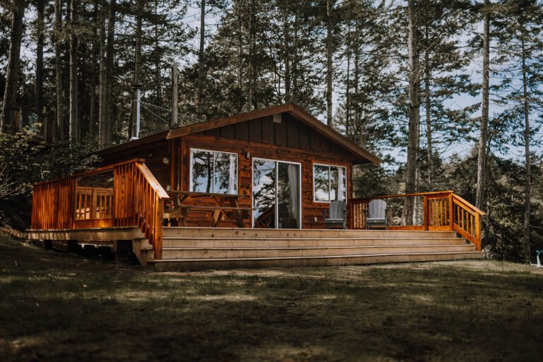
Camping: The private Arrowvale Campground offers 40 open and wooded sites on Hector Road, and the Ark Resort at the east end of Great Central Lake has a campground with RV and tent sites.
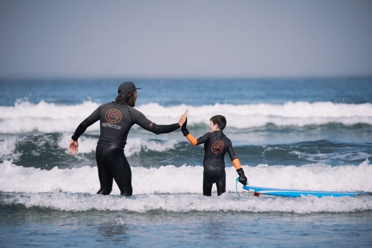
Houseboating: Enjoy a vacation with a difference, with all the comforts of home. Houseboating is popular on Sproat Lake, located west of Port Alberni. The warm water is great for swimming, and the boat provides a great base for freshwater fishing, waterskiing and windsurfing, and for scenic cruises to view the many beautiful homes on the lake.
Sightseeing Tours: Embark on guided day hikes, nature tours, wildlife safaris and birding excursions on Central Vancouver Island and the Pacific Rim, or sign up for a whale watching excursion down Alberni Inlet. Anglers can rise above the trees on a helicopter ride to a remote mountain lake for a day of fishing. Vancouver Island Soaring Centre gets visitors soaring effortlessly like an eagle in the sky. Gliders are towed high above the Port Alberni Airport and released for dramatic scenic flights over the Alberni Valley, soaring above magnificent mountains, forests, lakes, waterfalls and ocean inlets.
Hiking: Port Alberni has some of the best hiking on Vancouver Island. There are over 100 trails for hiking, mountain biking and horseback riding in and around the Alberni Valley. Three of the popular Port Alberni Hiking Trails are detailed below.
Log Train Trail in Log Train Regional Park in Port Alberni offers 25 km of trail for hikers, cyclists and horse riders through the beautiful Alberni Valley. The trail stretches along the foot of the Beaufort Range, leading to the McLean Mill Historic Site. The Log Train Trail was originally part of the Bainbridge Mill rail-logging operation. The trail is accessible from many points in the Alberni Valley, but the easiest start is from the trailhead sign on Highway 4.
Stamp Long River Trail provides access to 7.5 km of beautiful old growth riparian on the east bank of the Stamp River, running mostly parallel to the river. Several short switchbacks provide contrasting views of the river from above. Ancient firs and cedars can be found along the length of the trail, and there is a particularly fine stand of old growth near the north end. Eagles, hawks, mergansers, dippers and other water birds are frequently seen. In fall, bears are frequently encountered feeding on salmon. Care should be taken to avoid encountering a feeding bear. Caution should also be exercised during winter when water levels are high. The trail can be accessed from either the south or north ends, but there are no intermediate access points.
Della Falls is Canada’s highest waterfall, at 1,444 feet (440 metres). Along with Mount Waddington, British Columbia’s highest mountain, Della Falls is one of the most awesome and least visited natural attractions in BC. Della Falls lies within Strathcona Provincial Park, northwest of Port Alberni, and requires a hike of 3 to 5 days via the historic Drinkwater Trail (moderate; 20 miles/32 km return). The trailhead is at the west end of the 18-mile (29-km) long Great Central Lake.
Stamp River Provincial Park lies about 9 miles (14 km) north of Port Alberni. This park is often used by anglers who come to fish for salmon in the Stamp River, an excellent place to catch the fall salmon runs. The park features a riverside campsite and hiking trails to the scenic Stamp Falls, a beautiful waterfall that is sure to soothe even the most jangled of nerves. Take an easy drive on Beaver Creek Road north of Hwy 4 from the centre of Port Alberni.
Sproat Lake Provincial Park is a popular family camping destination 8 miles (13 km) west of Port Alberni on Hwy 4. The park overlooks an expansive body of freshwater, with Mount Anderson rising to the south. The park sits beside a sheltered bay at the northeast corner of Sproat Lake. Many of those who camp here come to take advantage of the triple boat launch and large public marina. In fact, there are twice as many boat slips as campsites. Sproat Lake Park has a fine beach and much warmer water than the ocean farther west. A distinctive historical feature in the park is the Native Indian rock carvings, known as petroglyphs.
Taylor Arm Provincial Park is a forested site on the north shore of Sproat Lake, about 15 kms west of Port Alberni on Hwy 4. The park features an astounding number of undeveloped campsites, hiking trails lead beside the lake and onto the mountain ridges above the park.
Mount Arrowsmith Regional Park offers good hiking and rock climbing, with superb views of Vancouver Island. Winter activities include cross-country skiing, snowmobiling, and ice-climbing. The trailhead for the Arrowsmith Trail is at the Cameron Lake picnic site. The trail ascends the lower slopes of the mountain to the site of the old ski resort, and winds up to the summit of Mt. Arrowsmith. The hike is strenuous, and do not set off without a trail map. Arrowsmith Trail is the oldest intact trail on Vancouver Island. Other trails include the Rousseau Trail, and the Lower Ski Area Trail.
Mount Arrowsmith Massif Regional Park encompasses the peaks of Mt Arrowsmith and Mt Cokely. Ecological significance includes the parks two key salmon producing rivers, the Englishman River and Little Qualicum River, as well as providing habitat for endangered wildlife species such as the white-tailed ptarmigan and Vancouver Island Marmot. Rising to a majestic height of 5,968 feet (1,819 metres), the Mount Arrowsmith massif dominates the skyline from both sides of Vancouver Island. Previously Crown Forest Reserve, the park was declared a regional park in November 2008 and officially opened in September 2009. Access to the mountain is located near the summit of Highway 4, 9 km east of Port Alberni.
Port Alberni Farmers’ Market is held in downtown Port Alberni in the centre of Harbour Quay every Saturday morning till noon throughout the year. The traditional farmers’ market promotes local produce and products, providing a wide assortment of meats, fruit and vegetables, free-range eggs, breads, soaps, arts and crafts.
Port Alberni Salmon Festival is the pinnacle of the salmon fishing culture. The popular world-class fishing derby is held in Port Alberni every year on Labour Day weekend, when anglers come from all over North America to test their fishing skills. You never know, you might just win a cash price for reeling in the biggest salmon!
Alberni District Fall Fair in September features a variety of homespun products, a midway, an art show, a 4-H competition, country fair baking, livestock competitions, and the famous Logger Sports Day. Bring the whole family to the 4-day event. Unserviced camping is available on either side of the horse rings.
Thunder in the Valley is an annual drag racing event and carshow held at the Alberni Valley Airport in August.
MV Frances Barkley: Set sail for spectacular West Coast scenery aboard the MV Frances Barkley, based in Port Alberni, travelling down Alberni Inlet to Barkley Sound and the coastal villages of Bamfield (year round) and Ucluelet (June to September). Sprinkled throughout Barkley Sound are the Broken Group Islands, a series of islands and shallow reefs that support a profusion of marine life. Kayaking and diving are excellent in the area. The Broken Group Islands provide kayakers and divers with a true West Coast experience in sheltered water.
East of Port Alberni is Parksville, an enchanting seaside village on the east coast of Vancouver Island. With its long sandy beaches and eastern exposure, Parksville is an ideal spot to spend a few days, or the whole summer, basking in the sun and swimming in warm waters.
West of Port Alberni is the Pacific Rim on the West Coast of Vancouver Island, incorporating magnificent Long Beach, the communities of Tofino and Ucluelet, and Pacific Rim National Park.
Southwest of the Alberni Valley is Bamfield, nestled quietly in a protected inlet on the south shore of Barkley Sound. This tiny fishing and harbour village, heavily populated by marine biologists, is a quiet, unassuming village where the love of the land and sea prevails.