There are some places, fortunately, that are still inaccessible by road. British Columbia’s Central Coast is one of them. Until BC Ferries launched its Discovery Coast Passage run, the Central Coast was also largely inaccessible by water as well.
Now, to the delight of adventurers and locals alike, from June to September, the Queen of Chilliwack connects the community of Port Hardy, at the northern tip of Vancouver Island, with Bella Coola on the mainland. For kayakers and campers, RVers and backpackers, the Discovery Coast Passage service opens up a brand-new circle tour through some of the province’s most beautiful and largely undiscovered terrain.
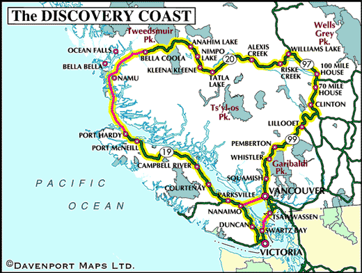
From Vancouver, sail between Tsawwassen and Swartz Bay, through the beautiful southern Gulf Islands. From the Swartz Bay ferry terminal travel south to Victoria, the capital of British Columbia at the southern tip of the Island.
After visiting Victoria, travel north along the highway over the Malahat, stopping at roadside pullouts – sweeping vistas at the Malahat Summit are spectacular. Beyond the Malahat lies the Cowichan Valley. Often called “The Little Town That Did”, Chemainus is now world famous for the series of over 40 murals depicting the area’s history that can be found on buildings and walls throughout the downtown area. This outdoor art gallery grew from a very successful revitalization project implemented when the town’s sawmill shut down in the early 1980’s. Now, almost half a million visitors a year come to view the murals and enjoy the other services that have sprung up.
From Chemainus head towards Nanaimo, known as the Harbour City. Nanaimo is second only to Victoria as Vancouver Island’s largest and most vibrant city. Famous for its varied landscapes and more than two dozen parks, this city possesses one of the most beautiful waterfronts in Canada. Stop again, this time at Qualicum Beach, nestled on the eastern shore of Vancouver Island. Qualicum Beach is a favoured year-round destination, accessible by road, rail and air. It is known for its spectacular setting of safe, sandy beaches and old-growth forests against a majestic mountain backdrop.
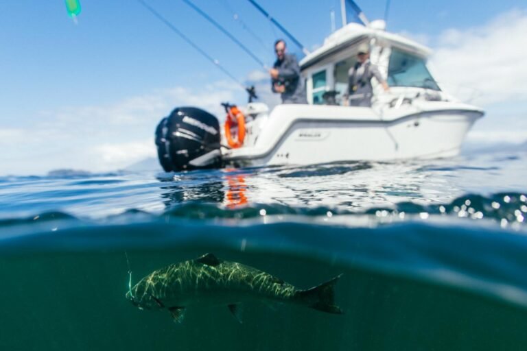
Your next stop should be the town of Courtenay, the urban centre of the Comox Valley. Join a studio or garden tour, or browse contemporary art galleries, craft shops and craft fairs that promote the talents of local artists, many of whom are known internationally. Continue towards Campbell River, historically renowned as the “Salmon Capital of the World.” Campbell River is beautifully set between Strathcona Provincial Park to the west and the Discovery Islands to the east. Strathcona not only has the highest mountain on the Island, but also boasts the highest waterfall in Canada.
From Campbell River continue to the sheltered harbour of Port McNeill, home to many that work in the surrounding forests and out on the channels between Vancouver Island and the mainland. Just north of this quiet seaside port lies the world’s largest burl. Taken from an ancient spruce tree, this burl weighs over 20 tonnes and measures more than 12 metres around.
Like many towns of northern Vancouver Island, Port Hardy remains a logging, mining and fishing centre, although it is recognized as the “Gateway to the North Island” – a popular departure point for outdoor enthusiasts heading out into the wilderness. From Port Hardy, board the Queen of Chilliwack and cruise past sheltered inlets, thunderous waterfalls, long deep fjords and narrow channels – the most stunning scenery is between Bella Bella and Bella Coola.
With the setting sun behind you, the monolithic rock formations looming over the narrow Burke Channel give the cruise a European flavour. Weather permitting, the ships’ two upper decks are an excellent vantage point from which to watch for the logging camps, barge houses, and abandoned settlements that indicate a human presence on this rugged coastline. Wildlife viewing is another bonus of this trip, as the ferry slows for orcas, so don’t forget your binoculars.
Scheduled stops at Oceans Falls and McLoughlin Bay (Bella Bella) prolong the day-long journey, but also lead to enjoyable scenery as the Queen of Chilliwack threads her way through the Inside Passage.
From Bella Coola, the Bella Coola Freedom Road (Highway 20), passes through diverse landscapes ranging from grassy plateaus and rolling meadows to picturesque canyons and high mountain peaks. Tweedsmuir Provincial Park, at over 2.2 million acres (895,000 hectares) and one of British Columbia’s biggest parks, is most easily accessed from Highway 20, which bisects the southern half of the park east of Bella Coola. Fly fish for trout and steelhead on Anahim and Nimpo Lakes, as well as on the Dean River.
At Tatla Lake, take the gravel road turnoff leading into spectacular Ts’yl-os Provincial Park – explore this incredible park on foot or horseback. You can fish for trophy-sized rainbow trout and dolly varden on renowned Chilko Lake. For outdoor enthusiasts, the Chilko River is rated amongst the best and most challenging in North American for kayaking and whitewater rafting. Lee’s Corner Rest Area, west of Williams Lake in Hanceville, offers the panorama of the Chilcotin Plateau, with the Coast Mountains in the distance, off to the west. At Riske Creek, take a side trip south to Farwell Canyon for a look at ancient hoodoo rock formations and Native rock pictographs. This road will also take you through a California bighorn sheep reserve.
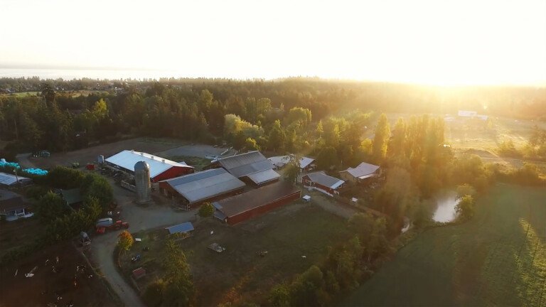
Head south from Williams Lake on the old Cariboo Wagon Road, Highway 97, to 100 Mile House and beyond to Clinton. The Cariboo offers a tip of the battered cowboy hat to the ways of cowboys, gold panners, and rustlers – those whose lives created such a rich and vibrant history. One of the best ways to experience the fun and flavour of life on the range is to stay at a working guest ranch. A crash course in lassoing, and a chance to practice some fancy rope work on an unsuspecting fencepost, may be included in the fun.
Like many of the towns in the Cariboo, Lillooet was born of the gold rush, and within twenty years of its founding, the town had swelled to almost 15,000 residents. Rockhounds and history buffs will find Lillooet to be a real treasure. Lillooet is also a contender for the most unusual gold course in B.C. – a local sheep farmer has converted his scenic farm into a golf course. Watch where you step!
As the Pemberton Valley opens up, so too does the number of roads leading off from Highway 99 that provide those seeking backcountry adventure with quick access to hiking, climbing, mountain biking and backcountry ski-touring routes. Complete your trip with a stop at Whistler, a charming alpine village and the home of Whistler and Blackcomb Mountains. Whistler Resort is a year-round destination consistently rated the number one ski resort in North America.
Next stop is Squamish, situated at the head of Howe Sound, and surrounded by the sheer faces of the Coast Mountains. Squamish is cradled in natural beauty, as only a west coast town can be. Squamish is well known for two features that outdoors people will appreciate: winds peculiar to the area provide some of the best windsurfing anywhere on the Pacific Coast; and there’s spectacular hiking and rock climbing at the Stawamus Chief Mountain, the largest free-standing granite monoliths in the world.
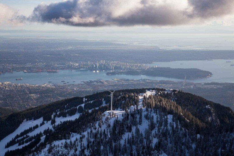
To list even a portion of the attractions of Vancouver is impossible to do here. Suffice to say, the real charm and advantage of this city is the range of entertaining options open to visitors. Urbanites can eat at world class restaurants, attend the symphony, shop at exclusive boutiques along Robonstrasse and never cast so much as a glance at the surrounding sea and skyscape. Those with an appreciation of the outdoors can windsurf in the morning, golf before lunch, ski in the afternoon, and take in the city lights atop a North Shore mountain. The city itself is clean, colourful and friendly, with a cosmopolitan vibrancy that Pacific West Coast cities are known for.
Approximate Distance: 2,000 Km
Approximate Duration: 7 to 14 days
Towns on or near this Route


