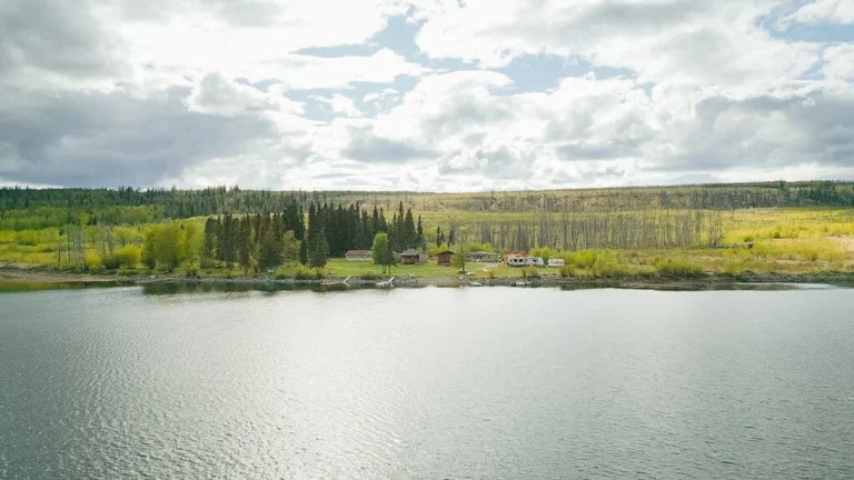
Shuswap Lake Marine Provincial Park is one of the most popular boating and canoeing locations in the Southern Interior. Shuswap Marine is comprised of 26 sites located around the perimeter of Shuswap Lake. All locations are popular for fishing and water sports, and hiking and nature study are popular at some sites. Some sites are road accessible, but most are water-access only. Facilities at the sites vary from nothing to 3 or 4 wilderness tenting sites with a pit toilet.
Shuswap Lake is shaped like an addled H, and is made up of four large arms: the Shuswap Lake Main Arm, Seymour Arm, Anstey Arm, and Salmon Arm. The product of the glacial scouring that also rounded the surrounding Shuswap Highlands, all four arms converge at Cinnemousun Narrows, northeast of Sicamous.
Shuswap Lake Main Arm
Cinnemousun Narrows Provincial Park is located where the four arms of Shuswap meet, and is one of the most popular destinations in the North Shuswap. At the northwest end of Shuswap Lake Main Arm, near Anglemont, Horseshoe Bay offers a safe anchorage to boaters.
Seymour Arm
On the northwest end of Seymour Arm, Albas Park has a small 5-site campground south of Blueberry Creek. An undeveloped camping area is found near the mouth of Celesta Creek. A trail begins near Steamboat Bay, follows Celesta Creek upstream for approximately 1.5 km, then crosses the creek and returns to the lake. Noted for a series of beautiful waterfalls and some interesting features from early logging days. Bears are frequent visitors in Albas Park.
Other attractions on Seymour Arm include Wright Creek, the wide sandy beach at Beach Bay and the small Cottonwood Beach, all on the east side of Seymour Arm, and Encounter Point, Two Mile Creek, and Woods Landing on the west side.
Silver Beach Provincial Park is located at the end of a long, gravel road at the head of Seymour Arm. This part of the lake is blessed with sandy beaches, and houseboaters come here to get away from it all. The park’s forest setting is lovely – Douglas fir interwoven with aspen. Paddle around the mouth of the Seymour River to watch the salmon spawn from mid-August to mid-September.
Anstey Arm
Located at north end of Anstey Arm, Anstey Beach has five rustic campsites, and a large cedar and cottonwood forest at the mouth of Anstey River. The pleasantly forested site at Anstey Arm offers five campsites and an excellent view up Anstey Arm. Other destinations on Anstey Arm include the sparkling creek, tiny bay and seven wilderness campsites at Four Mile Creek, Rendezvous Picnic Site, Roberts Bay, and Twin Bays.
The Anstey Arm/Hunakwa Protected Area includes approximately 20,000 hectares of old growth forests, wetlands and key wildlife habitat. A nature lover’s paradise at the north end of Anstey Arm, Hunakwa Lake is the only remaining low elevation, unroaded, mid-sized lake in southern B.C. This wilderness area connects the Anstey Arm with the Seymour Arm of the Shuswap Lake and includes the diminutive Wright Lake, where naturalists have identified a great diversity of ferns, flowers, shrubs and trees.
Salmon Arm
Attractions on the northern end of Salmon Arm include Hermit Bay, Tillis Beach, Sicamous Beach, Hungry Cove, Marble Point and Alpine Hill. A gravel beach is located at Paradise Point on the west side of Salmon Arm.
Herald Provincial Park is situated along the north shore of Salmon Arm. The park is very popular and fills up quickly during July and August. Campsites are located both at lakeside and a short distance uphill in the cool forest.
Mara Provincial Park is a small park situated on the eastern shores of Mara Lake, just off Salmon Arm. The park is strictly a day-use area, but offers a variety of recreational activities, and Mara Lake also provides important habitat for salmon.
Camping: This park offers vehicle accessible campsites on a first-come, first-served basis – campsite reservations are not accepted. Most campsites are very rustic with only pit toilets being provided. There are no public telephones available. Good vehicle-access sites on Shuswap Lake include Shuswap Lake Provincial Park, about 12 miles (19 km) northeast of Highway 1 at Squilax, and Silver Beach Provincial Park.
Fees are in effect for all overnight use including camping, beaching, docking, mooring and anchoring within 100 m, May 1 to September 30. Boaters overnighting in marine parks must purchase camping permits in advance (except Cinnemousun Narrows and Silver Beach). Permits are sold at most marinas and Visitor Centres and at Cinnemousun Narrows and Silver Beach.
Wilderness campsites with basic facilities include Two Mile Creek, Albas, and Fowler Point on the northeast shore of Seymour Arm; Anstey View on the northwest shore and Four Mile Creek and Anstey Beach on the south shore of Anstey Arm; and Marble Point on the south shore and Hermit Bay on the north shore of Salmon Arm.
Houseboating is extremely popular on Shuswap Lake. The shoreline of Shuswap is not complicated, and does not require refined navigational skills, although boaters should be able to use a chart and compass in the event of reduced visibility due to fog. Some sites in the park do not have protected beaches. In stormy weather, it is advisable to beach your boat stern-first, and secure it with long ropes from the bow to pegs on the shore. Houseboats should be beached according to instructions received from the rental companies. The lake can drop 5 to 10 cm daily during the summer, so check your beached boat regularly to avoid becoming stranded when camping for extended periods at parks with shallow beaches.
Boat launch facilities are located throughout the Shuswap area including Herald and Mara Provincial Parks, Scotch Creek, Magna Bay, Anglemont, Sorrento, Blind Bay, Sicamous, and the community of Seymour Arm. Kayakers can launch at the public wharf in Canoe on Salmon Arm, about 4 miles (6 km) east of Salmon Arm on Hwy 1, or in Sicamous, 13 miles (21 km) farther east on Hwy 1.
An important mode of transport on Shuswap Lake is the MV Phoebe Ann, which can hold 40 passengers (and canoes or kayaks) and acts as a vehicle barge. This vessel is based out of Sicamous and stops at numerous lakeside locations year-round, except when ice makes travel impossible.
Protected waterways, secluded beaches, and more than 1,000 km of shoreline make enormous Shuswap Lake a busy water-sports haven during summer. Anglers also head for Shuswap Lake as it contains 19 species of fish. One of the best places to begin exploring Shuswap Lake is at Sicamous, the ‘houseboat capital of Canada” and the service centre of Shuswap marine park. Mariners and watercraft rentals are located here. On the western edge of the famed Shuswap, Chase offers a beach, campsites, a dock and boat launch facilities.
The area is named after the Shuswap Secwepemc First Nations people, the most northern of the Salishan speaking people. This group was the first to inhabit the region, as evidenced by kekulis (semi-underground pit houses), which have been found at Scotch Creek and nearby Herald Provincial Park. Pictographs or rock paintings have also been discovered around Shuswap Lake. During the nineteenth and early twentieth century, European explorers, fur traders and surveyors came to the area. Then in the late 1800s, gold was discovered, and the population in the area soared. Today, little remains of these historic tales.
For sites accessible by water only, launch facilities are located throughout the Shuswap including at Shuswap Lake, Herald, and Mara Provincial Parks. As well, privately-owned marinas and the towns of Sicamous, Chase, Salmon Arm and Canoe all have boat launches. Shuswap Lake Marine Provincial Park comprises 904 hectares in total, located north of the Okanagan Valley, in the Thompson Okanagan region of British Columbia.
Nearby Regions & Towns
Park Notices


