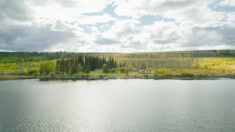
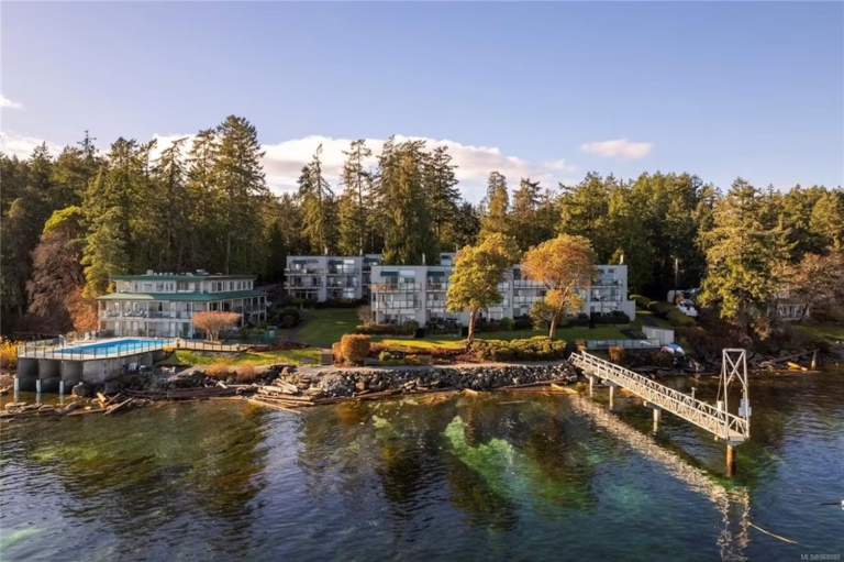
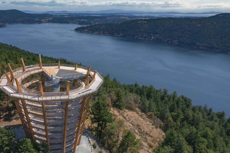
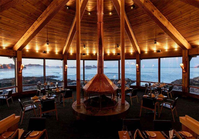
Gulf Islands National Park Reserve is one of Canada’s newest national parks. The park protects a portion of British Columbia’s beautiful southern Gulf Islands – a landscape of rocky headlands, forested hills and shorelines studded with colourful tidepools. The park resembles a patchwork quilt of protected lands scattered over 15 larger islands, and numerous islet, reefs and approximately twenty-six square kilometres of marine areas.
The new national park reserve offers a variety of opportunities for Canadians to learn about and experience an exceptional coastal island landscape and the cultures of the people who live there. Be sure to visit the Gulf Islands National Parks Reserve Operations Centre in Sidney – it’s certified as the most environmentally friendly in the country. Ocean water provides the heat, low-flush toilets use rainwater and even the temperature rises and falls depending on the number of people inside.
Whether visiting the larger populated islands or exploring the more remote areas of the park, many local tour companies offer opportunities to explore the islands – whether your interest lies in hiking, cycling, kayaking, diving or whalewatching.
The park shares the larger populated islands of Mayne, Saturna and the Penders with vibrant island communities that offer a full range of tourist amenities.
Facilities and services inside the national park are limited. Most campsites and trails are located in the following former provincial parks now included in the national park:
- Beaumont/Mt. Norman, South Pender Island
- Cabbage Island Marine Park, Strait of Georgia (off Saturna Island)
- D’Arcy Island Marine Park, Haro Strait (Sidney/Victoria)
- East Point Park, Saturna Island
- Isle-De-Lis Marine Park, Rum Island, Haro Strait (Sidney)
- Mchttps://britishcolumbia.com/wp-content/uploads/2020/07/discovery-islands-lodge-1-accommodation-quadra-island-british-columbia-1.jpg Park, Sidney, Victoria
- Mount Norman Park, South Pender Island
- Princess Margaret Marine Park, Portland Island
- Prior Centennial Park, North Pender Island
- Roesland / Roe Lake, North Pender Island
- Sidney Spit Marine Park, Sidney, Victoria
- Winter Cove Park), Saturna Island
Other protected areas in the Gulf Islands National Park Reserve are:
Benner Bay
The Bennett Bay component of Gulf Islands National Park Reserve is located on the Strait of Georgia shore area of Mayne Island. Its natural environment and undisturbed waterfront are combined with one of the finest sand beaches in the Gulf Islands. The beautiful peninsula (Campbell Point) features remnant old growth forest, a walking trail and superb views from the point across to Georgeson Island. Bennett Bay is a popular launch point for kayakers paddling along the North Eastern shores of the outer Gulf Islands.
Blunden Islet
Safeguarded by its inaccessibility, Blunden Islet off Teece Point on South Pender Island is a relatively undisturbed islet, with typical coastal bluff vegetation including arbutus, Garry oak and old growth Douglas fir, and no evidence of invasion by exotic species. The sensitive ecosystem on this islet is being afforded the highest level of protection within the national park: authorized access only.
Brackman Island
Brackman Island had been an ecological reserve since 1989. The island is unique in that it has never been affected by livestock grazing, logging or settlement. There are pockets of old growth forest, some as old as 250 years. Thirteen rare plant species have been identified. This island is being afforded the highest level of protection within the national park: authorized access only.
Channel Island and nearby Islets
The Channel Islands in Captain Passage, located between Prevost Island and Saltspring Island, are important as seal and sealion haulouts and are also used for nesting by various bird species. The Channel Islands were used by First Nations as landmarks when navigating between islands, and for harvesting of marine mammals, shellfish, barnacles, chitons and sea urchins. The Red Islets, Bright Islet and Hawkins Islet located adjacent to Prevost Island feature relatively undisturbed coastal bluff and Garry oak/arbutus woodland. The sensitive ecosystems on these islands and islets are being afforded the highest level of protection within the national park: authorized access only.
Georgeson Island
Located off Campbell Point at the southern end of Mayne Island, Georgeson Island is a beautiful sandstone ridge, clad in old-growth Douglas fir, arbutus and Garry oak forest. Because of sensitive ecosystems, access is not permitted.
Georgina Point
Georgina Point on Mayne Island sits at the entrance to Active Pass, the marine passage between Mayne and Galiano Islands. This popular day-use area, long managed by the Mayne Island Parks and Recreation Commission, provides spectacular views across the Strait of Georgia. It is one of Mayne Island’s most treasured heritage places.
Greenburn Lake
Freshwater lakes are rare in the Gulf Islands. Greenburn Lake and its wetlands are vital to the recharge of South Pender Island’s scarce water supply. The 118-hectare property also has high wildlife values and contains pockets of endangered Garry oak ecosystem. Studies are currently under way on the lake and wetlands. Visitors can hike up along the old access road to this picturesque lake surrounded by high bluffs. There are no visitor facilities at the lake. Bring your own drinking water. Fishing is not permitted.
The Islets
Sprinkled throughout this area are a number of smaller islands and islets. The ecosystems of these islands are fragile and easily impacted. Some are important haulouts for marine mammals, others are key nesting sites for seabirds, including species whose populations are threatened or at risk. Visitors should exercise discretion when approaching these islets, and abide by the wildlife viewing guidelines. The islets in this area that are included in Gulf Islands National Park Reserve are the Dock Islet, the Isabella Islets, Imrie Island, Grieg Island and Reay Island, the Little Group, Sallas Rocks and Unit Rocks. The sensitive ecosystems on these islands and islets are being afforded the highest level of protection within the national park.
Special Preservation Area: authorized access only, except for Little Samuel, an islet in the Belle Chain islets and Dock Inlet which is available for day-use along its shoreline as a place for kayakers to take a break on longer paddling routes. There are no services provided, however, and camping is prohibited. Plan your paddling itinerary to include those islands in the area where designated camping is allowed: D’Arcy, Portland Island, Rum Island, Sidney Spit, and nearby Ruckle Provincial Park on Saltspring Island.
James Bay and Selby Cove
James Bay and Selby Cove are located at the northern tip of Prevost Island on Trincomali Channel, and are only accessible by water. The park lands form a narrow point adjacent to a deep cove with a shoreline that varies from steep rock faces on the Trincomali Channel waterfront to gently rising, shelved rock near Peile Point, to a gravel beach in James Bay. This open field campsite is popular with kayakers, and there is good anchorage in Selby Cove.
Loretta’s Wood
The 38.7-hectare Loretta’s Wood property on North Pender Island has high ecological values. Four provincially rare or endangered plant communities, one vulnerable plant community, and the red-legged frog – a COSEWIC-listed Species of Concern – occur here. The property also contains wetland and terrestrial herbaceous ecosystems, both of which have been identified in the joint federal-provincial Sensitive Ecosystem Inventory initiative. Although no services and facilities are currently provided, a trail system is under consideration for the future.
Lyall Creek
A trail descends from the Narvaez Bay Road to the mouth of Lyall Creek, passing through the forested heart of Saturna Island, and featuring a beautiful waterfall. Lyall Creek is one of the few remaining salmon-bearing streams in the Gulf Islands. When a small group of volunteers began to restore a salmon stream on Saturna Island more than 10 years ago, no one could predict the future of the private land along the stream, or the success of the group’s conservation efforts.
Pacific salmon are remarkable for their ability to return to spawn in the streams where they hatched. A washed out bridge and the culvert that replaced it kept the chum salmon from returning to Lyall Creek. Chum salmon – poor jumpers compared with the coho salmon and cutthroat trout with which they share the stream – simply couldn’t make it to their spawning grounds. The chum salmon might have never had a chance to return without the efforts of Saturna Islanders. With support from Fisheries and Oceans Canada, in the early 1990s they began to incubate chum eggs in Lyall Creek and release the young salmon into the ocean each spring. A decade later more than 400 salmon were returning to the stream. The volunteers helped by moving the adult salmon by hand across the still impassable culvert.
The inclusion of the majority of the stream’s watershed within Gulf Islands National Park Reserve brought additional technical and financial support for the restoration. The culvert was replaced and a damaged part of the streambed restored to a more natural state. More restoration work is planned for the future.
Mount Warburton Pike
The summit of Mount Warburton Pike on Saturna Island provides breath-taking panoramic views of the southern Gulf Islands and the neighbouring San Juan Islands in the United States. At 397 metres (1,303 ft.), Warburton Pike is the second highest point of land in the Gulf Islands. The open, grassy slopes of the ridge are unique in the Gulf Islands, and the slopes and ridge itself are significant habitat for falcons and eagles. First Nations used this mountaintop for spiritual and sacred purposes. It was here spirit quest feathers (from eagles, owls and falcons) were gathered and people came for spiritual ceremonies and to camp. The road to the summit is unpaved, winding and narrow. The summit area is currently being rehabilitated. All vehicles, including bicycles must remain within the marked parking area.
Narvaez Bay
Narvaez Bay at the southern tip of Saturna Island is one of the most beautiful and undisturbed bays in the southern Gulf Islands. This area of regenerating Douglas fir forest and Garry oak-arbutus ecosystems includes a prominent point that historically was the first non-aboriginal settlement on Saturna Island. Park at the gate at the end of Narvaez Bay Road, and walk past the gate and down the road to the bay. Be careful walking out on the rocky promontory, and stay well back from cliff edges: rocks may be slippery and the drop-off is significant. Stay on the main path to avoid trampling sensitive vegetation. Seven walk-in backcountry campsites are available 1.7 kilometres from the trailhead.
The Outer Islands
Fronting on the open waters of the Strait of Georgia, the Outer Islands are the last bastion against the urban metropolis of mainland British Columbia across the waters to the north. Facing the silhouettes of skyscrapers by day, and the sparkling lights of a big city by night, the Outer Islands are a serene contrast – so near to and yet so far from the frenzy of modern life.
These islands have always been important to those who travel the waters of the inland Salish Sea. They were used by First Nations as a launching area before they travelled into open water heading to the Fraser River. Similarly, miners headed for the goldfields of British Columbia’s interior made Mayne Island their last stop, giving rise to the name Miners Bay.
The numerous small islets paralleling Mayne and Saturna Islands support an abundance of marine life and waterfowl. In days past, First Nations people made stinging nettle nets to hang across narrow gaps between islets to intercept migrating waterfowl. Codfish and their eggs were harvested in shallow areas. The herring fishery has also played an important role in the culture of First Nations. The method of fishing was a ritual undertaken with grace and skill. Paddling a canoe, the fisher would lower a rake which had pins of bones and in a gentle swooping motion would prick the herring and catch it on the sharp ends.
Saturna Island was and still remains an important and special place for First Nations. The island had affluent permanent village sites particularly on the east and west shores of the inlets. People lived in large cedar bighouses built using corner cedar posts. In some places, these posts still stand.
Portlock Point
Portlock Point/Richardson Bay surrounds the 1895 Portlock Point lighthouse on three sides, protecting the most visible part of Prevost Island seen by ferry passengers as they exit Active Pass on the way to Victoria. The shoreline of Richardson Bay on Prevost Island provides a good alternative to the nearby islets for a break for kayakers on longer paddling routes. No Services.
Prevost Island
National park reserve lands are located on both the north and south shores of Prevost Island. The majority of the island, however, remains in the hands of the descendants of Digby de Burgh—the man who bought the island in the 1920s. They continue to farm and raise sheep on the island. The island is largely unchanged from what would have existed a century ago, and contains large cedar and arbutus groves.
Russell Island
Settled by Hawaiians as early as 1886, this small island at the mouth of Saltspring Island’s Fulford Harbour is blessed with many of the natural features typical of the southern Gulf Islands. Douglas fir, arbutus and Garry oak trees dominate the forest cover, and stands of shore pine rim the island’s outer edges. Open meadows of native grasses host yearly bursts of camas lilies and a variety of other wildflowers. The original house dates back over a century. The island has a small salt marsh. Marine access only. Facilities include pit toilets and a loop trail, but no drinking water. The historic Kanaka house can be found via a side trail that leaves the northeast portion of the loop.
Taylor Point
This strip of virtually undisturbed old growth forest of Douglas fir, arbutus and Garry oak on Saturna Island, running north from Taylor Point to the vineyard, is one of the longest uninterrupted stretches of protected shoreline in the southern Gulf Islands. The cliffs are part of the rare coastal bluffs ecosystem in the Gulf Islands. At Taylor Point, the remnants of a farm with its old stone house and nearby sandstone quarry are reminders of one of the island’s past commercial enterprises. There are currently no services at Taylor Point. The adjacent lands are actively farmed and grazed. Please respect private property and keep dogs on a leash to avoid harm to livestock. Note that a trail has not yet been developed to Taylor Point, although hikers occasionally flag their own routes along the cliff edge. These are not designated trails, and being close to the cliff edge, their routes may pose dangers to hikers.
Tumbo Island
Tumbo Island has recovered well from the fur farming, timber harvesting and coal mining activities that highlighted its rich and varied past. Today, the island, located off the southern tip of Saturna Island, is largely forested with old growth Douglas fir and Garry oak meadows. Tumbo Island derives its name from the landform that gives it its distinctive shape – a tombolo. A tombolo is a sandbar extending outward from shore connecting with an island – or from island to island as it does here. First Nations found a safe harbour on Tumbo Island when hand trolling for fish offshore in their canoes or on their journeys across the Strait. The island remains an important spiritual place to this day.
Tumbo Island can be visited by kayak or by dinghy from larger boats. A short trail system provides opportunities to explore the island. Discover the diverse creatures who live in shoreline tidepools and the freshwater marsh. Birding, photography and picnicking are other great activities to pursue on Tumbo. Note that a life tenancy agreement for the house on the island means that there may occasionally be someone in residence on the island. Please respect their privacy.
Scenic Touring
The added bonus of scenic ferry rides makes car touring of Mayne Island, Saturna Island and the Pender Islands a great way to experience the Gulf Islands. Roads are narrow and winding – watch for cyclists and pedestrians.
Boating
The Gulf Islands area is one of the most popular marine recreation areas in Canada. Sailing, powerboating and kayaking are all great ways to visit the national park reserve. Mooring buoys are located at Sidney Spit (Sidney Island), Beaumont Marine Park (South Pender Island) and Cabbage Island. Limited dock space is also available at Sidney Spit, and dinghy docks are located at Tortoise Bay on Portland Island during peak season, and at Royal Cove year round. Only one boat is permitted per buoy and vessel size restrictions are printed on the buoys. Fees for mooring buoys are collected from May 15 to September 30 and the maximum total stay is 14 days per calendar year.
There are numerous marinas and boat charter companies in the area. Water taxis also operate in several locations. Several excellent marina guidebooks detail locations where potable water and holding tank pump-out facilities are available. Holding tanks should be discharged at pump-out stations and not in park waters.
Marine charts produced by the Canadian Hydrographic Survey are available from many marinas, marine supply stores and speciality bookshops. Check the Canadian Hydrographic Service website for the location of a chart dealer near you. The following charts cover portions of this region: 3473, 3476, 3477, 3478, 3441, 3442, 3462, also refer to their Sailing Directions (Pacific Coast).
Marine weather and sea conditions can vary dramatically throughout the Gulf Islands. Always check marine weather forecasts throughout the day to keep abreast of conditions and check the tide table before beginning your voyage.
Kayaking
Kayaking is a fun and challenging way to explore the Gulf Islands. Whether kayaking with friends or a tour operator, be sure to check the weather and tide tables in advance. Kayakers will need to bring adequate water and pack out all their garbage.
Walking and Hiking
Lace on your hiking boots and pack along some water if you plan to tackle the up-and-down topography inland on the larger islands. The terrain in the Gulf Islands is hilly and rocky, and there are often steep cliffs dropping precipitously to the ocean. While this is great terrain for goats, it isn’t the best footing for visitors. The challenge of hiking to a summit is rewarded with spectacular views of the Gulf Islands, San Juan Islands and, on exceptionally clear days, the snow-capped mountains of the BC Mainland and the Olympic Peninsula in Washington state. Locally developed trails outside of the national park reserve offer good hiking opportunities as well. Beachcombing is also a favourite pass-time in the Gulf Islands.
Cycling
The narrow winding and hilly roads of Mayne Island, Saturna Island and the Pender Islands attract many cyclists, providing challenging but enjoyable cycling and offering a slower paced introduction to the Gulf Islands.
There are no bike lanes or paved shoulders, so cyclists must be particularly vigilant when travelling these roads. There are no mountain biking trails in Gulf Islands National Park Reserve and cycling on park trails is not permitted. Bikes can be taken on the ferries, and there are numerous bed and breakfasts and other accommodations available to make “inn-to-inn” exploration a great way to experience the islands.
Camping
Drive-in campsites are available at Prior Centennial Park campground on North Pender Island and Mchttps://britishcolumbia.com/wp-content/uploads/2020/07/discovery-islands-lodge-1-accommodation-quadra-island-british-columbia-1.jpg Park campground located on Vancouver Island, a short distance from the Swartz Bay ferry terminal. Campsites that are easily accessible by boat or kayak are located on Cabbage, Portland, D’Arcy, Rum, Sidney, and Prevost Islands, and Beaumont Marine Park on South Pender Island. Beaumont can also be accessed by hiking in from Ainslie Point Road. Camping is in designated areas only, and is not permitted on park islets.
Picnicking
For a great place to picnic, try Winter Cove on Saturna Island, Sidney Spit on Sidney Island, or Roesland on North Pender Island.
Fishing
Owing to the strength of the tidal currents coursing through Active Pass between Mayne Island and Galiano Island, there are plenty of nutrients in the water to attract marine life. Salmon feed in these waters, although in recent years the large chinook have all but disappeared. It’s not as easy to purchase fresh seafood on the islands as you might imagine. Most islanders do their own crabbing and shrimping, but at Horton Bay on Mayne Island, you may find such delicacies for sale. Although the availability is seasonal, stop by the federal dock between 4 and 6pm and look for a truck with the personalized licence plates CRAB 4U, which says it all.
For more information on fishing in the waters of Active Pass around Mayne and Galiano Islands there are two marine services in Miners Bay on Mayne Island; and you can chat to the folks at the Corner Store, in Sturdies Bay on Galiano Island. East Point Regional Park on Saturna Island is a good place to spin-cast for salmon that feed in back eddies created by the swirling currents. You can tell where the fish are biting by looking to see where boats are congregating.
Gulf Islands National Park Reserve is located in the Southern Gulf Islands of British Columbia, between Vancouver Island and the mainland of BC. The populated larger islands – Saturna Island, Mayne Island and North and South Pender Islands – are accessible by vehicle, bicycle and walk-on by BC Ferries from Victoria and Vancouver.
Gulf Island Ferry Routes
BC Ferry: Village Bay, Mayne Island
BC Ferry: Lyall Harbour, Saturna Island
BC Ferry: Otter Bay, Pender Island
Nearby Regions & Towns
Park Notices
More Information
Parks Canada – British Columbia
Website: www.pc.gc.ca
Gulf Islands National Park Reserve
2220 Harbour Road
Sidney, BC, V8L 2P6
Phone: 250-654-4000


