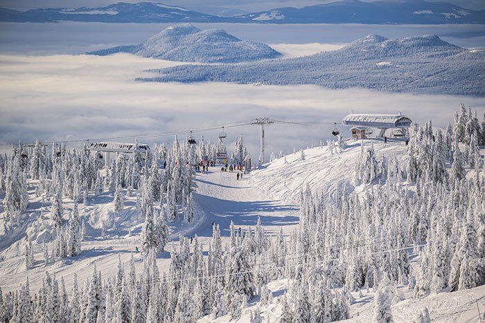
Premier Listings: Canoeing & Kayaking: Greater Vancouver
Deep Cove in North Vancouver is one of two jumping-off points for exploring Indian Arm, a steep-sided, 18-mile (30-km) fjord that branches north from Burrard Inlet just east of the Ironworkers Memorial Second Narrows Bridge. Kayakers (and the occasional canoeist) also launch from Belcarra Regional Park on the east side of Indian Arm. You can explore the south end of Indian Arm, including the islands that comprise Indian Arm Provincial Park, in the course of a day, or set out on an extended two- to four-day circumnavigation of the coastal inlet. The best time to paddle here is between April and October. During monsoon season, Indian Arm (and the North Shore generally) often receives twice as much rain as nearby Vancouver.
In addition to the convenience of having such a wilderness paddling environment so close to the city, Indian Arm is also a fairly sheltered environment in which to try ocean kayaking. However, don’t let its proximity to the city fool you into thinking all is peaches and cream. Strong winds funnel down the inlet from Garibaldi Provincial Park and can quickly turn a relaxing paddle into a fight to stay afloat. On busy summer days, powerboats also kick up a mishmash of waves that toss smaller craft around. The farther north you go, the steeper the walls of the inlet become, providing few places to beach in a hurry. Always exercise caution, and respect the speed with which conditions may change during a paddle trip here.
Some of the places where you’ll want to pause and stretch your legs along the way include Racoon Island and Twin Islands, which make up Indian Arm Marine Provincial Park (not to be confused with recently created Indian Arm Provincial Park, a large tract of undeveloped land along the west side of the inlet). These are among the very few islands that dot Indian Arm; from Deep Cove you’ll have to cross over to the inlet’s east side to reach them. If you’d like to spend the night, there are wilderness campsites on Big Twin Island. Water is scarce, so pack along whatever you think you’ll need. The best beaches on the inlet are located north of Deep Cove on the inlet’s west shore. As you make your way into the more remote, northern half of Indian Arm, stop to explore Granite Falls Regional Park on the east shore. Although there is no development in the park, there are plenty of signs of past logging activity around the falls. Indian River enters the extreme north end of the inlet and creates a marshy delta that attracts wildlife. Active logging carries on nearby; a Forest Service road leads from here to Squamish.
What’s amazing about paddling the Capilano River is how distant the well-ordered world nearby suddenly feels as you enter its 3.5-mile (5.6-km) drop-and-pool course. This is an enchanted canyon and should only be attempted by those who can handle its powerful spell. Opinion is divided as to whether this should be attempted in an open canoe. Opinion is united on one necessity: have a guide with you when you put in for the first time. By July, water levels begin to drop and the river becomes more technical. Even in summer this is most definitely a wet suit-and-helmet river. There’s only one put-in, at the top of the canyon beside the fish hatchery. The Cleveland Dam’s presence is a reminder that water levels on the river can fluctuate daily, depending on the amount of water released from the dam (and the sky above). A water gauge at the west end of the weir near the salmon pools indicates the difficulty of the water: 2-3 feet (0.6-0.9 m) equals easy; 4-6 feet (1.2-1.8 m) equals difficult; above 6 feet (1.8 m) equals expert only. On rainy days this river calls to local intermediate and expert paddlers, who treasure its proximity to home.
The other river on the North Shore is the Seymour River, a river of a whole different hue. About the only thing the two have in common is that they’re both dammed. The Capilano stole the Seymour’s thunder when challenges were being handed out (but don’t tell that to someone learning to paddle here). There’s not a canyon in sight, just a shallow boulder-and-rock garden riverbed, with a small patch of fast water just before the river passes under the Seymour Creek Bridge near its confluence with Burrard Inlet. An old weir creates a sudden drop at this point. Hang onto your paddles. Best places to put in on the Seymour are either at Riverside Park at the intersection of Riverside Drive (East) and Chapman Way or at the west end of Swinburne Avenue off Riverside. The take out is downstream from the BC Rail bridge over the Seymour at the west end of Spicer Road off Riverside Drive (West).
Paddlers began journeying to Horseshoe Bay long before the arrival of the first Europeans. For Native people, Horseshoe Bay was a traditional meeting place, used both as a seasonal fishing encampment and a place to spend a night when travelling between villages on the Squamish River and Burrard Inlet. The sheltered bay was called ch’xay or Chai-hai, after the swishing sound made by schools of little fish stirring up the waters of Horseshoe Bay. (In 1991, it was discovered that Horseshoe Bay Park stands atop an ancient shell midden.) Boaters launch from the federal dock next to the park. If you want to join the throng, you can rent one from the nearby marina. Also explore the nest of islands at the mouth of Howe Sound, as well as Bowen Island‘s extensive shoreline and nearby Gambier Island and Keats Island.