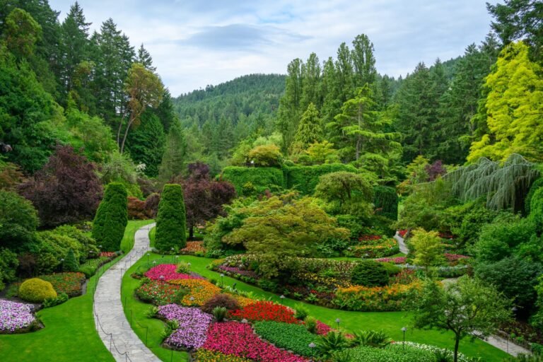
Premier Listings: Mountain Biking on Vancouver Island & BC Islands
Welcome to mountain biking bliss! Nature has been exceedingly kind to British Columbia, resulting in thousands of scenic narrow trails and crazy single tracks through rugged mountainous terrain. One of the more exhilarating fitness sports, mountain biking on Vancouver Island caters to newcomers experiencing their first-time high, as well as hard-core muddy madmen pushing the envelope of extreme competition.
Mountain Biking on Vancouver Island
Campbell River Area
There’s some good biking around Campbell River. Nestled in a nook between Iron River Road and Campbell River itself is an area known as the Pump House Trails. To reach this easygoing network of well-marked single-track trails, turn west off Highway 19 in Campbell River onto Highway 28. Follow Hwy 28, then turn north onto Duncan Bay Main and cross the Campbell River. A trailhead is located just south of the intersection of Duncan Bay and Iron River Road. Another trailhead is located west of Duncan Bay Road on Iron Bay Road.
Farther to the north and west of Campbell River on Hwy 28, a trail leads from a parking lot on the right of Loveland Bay Road (on the way to the Loveland Bay Provincial Park Campground) and into mountain bike heaven, the Snowden Demonstration Forest. Trails here are suited to all levels of mountain bike riding skills and include the Frog Lake System‘s five major routes and the Lost Lake Trail System‘s four main routes. Trails run from 2 to 8 km in length and frequently feed from one into the other to create longer rides. Some of the easier-going routes follow the railbeds left from logging here in the 1920s. This is some of the finest intermediate mountain biking on Vancouver Island, and is a sign of things to come as Forest Renewal BC funds are channelled into rehabilitating old logging roads as recreational trails. Detailed maps of the trails in the Snowden Demonstration Forest are available from the BC Forest Service district office in Campbell River.
Comox Valley Area
The Comox Valley, which comprises the towns of Courtenay, Cumberland, and Comox, is blessed with a plethora of multi-use and mountain biking trails. Many of the trails revolve around the Puntledge River and Comox Lake. A network of nine moderate-to-difficult trails, known collectively as the Comox Lake-Puntledge River Trails near Courtenay, for instance, starts at the dam on Comox Lake. Most of the trails here are hard-core singletrack, so if you find yourself chewing dirt, you can’t say we didn’t warn you. About 15 minutes uphill is a trail that leads off to the right. This is called Puntledge Plunge, and you’ll figure out why in the first few seconds of a near-vertical descent. More moderate trails begin off both Lake Trail and Bevan Roads east of the dam. Watch for a stone pillar marked with the sign ‘Number Four Mine’ on Bevan Road. Ride along a fireroad that begins here. The first fork on the left leads to an old mine site where mounds of tailings define the terrain and provide the challenge (the fun) for riders.
For those who like their ascents easy, and their descents long and sweet, you can’t get any easier and sweeter than catching the chairlift up Mount Washington, and riding down. Check with the Mount Washington Ski Resort for hours of operation and costs. The mountain biking season here generally begins by July 1 and extends through August. Mount Washington is 1,590 metres above sea level. At the end of the day you can take a long time making your descent back into the Comox Valley. Follow the signs to Mount Washington from Hwy 19 at the north end of Courtenay, a distance of 25 kms.
North of Comox, Seal Bay Nature Park doesn’t have a lot of downhill, but then, it doesn’t have a lot of uphill either. This is a nature park, but if you’re trying to find some easy cranking and some peace of mind, you could do a whole lot worse than the multi-use trails here. All trails are well marked and begin from the park’s main trailhead on Bates Road.
The Dump is another area located next to a landfill. Unlike the relatively pleasant-smelling Hartland Surplus Lands near Victoria, these ones, quite frankly stink in places. But if you can put up with the occasional olfactory assault, the riding’s pretty sweet.
Cowichan Lake/Duncan Area
The Koksilah River/Burnt Bridge/Eagle Heights region offers some incredible mountain biking trails just west of Shawnigan Lake. This is the site of the annual Burnt Bridge Classic Race Loop in the Can-Am Trails. Lose yourself for hours or even days in this challenging, but not overly technical area.
Located in the Maple Bay area east of Duncan is one of the most naturally challenging trails on the island, Mount Tzouhalen – it’s a behemoth of a ride. After parking or meeting at the bottom of the mountain, riders must ascend fire roads and rutted creek beds for quite sometime to reach the initial plateau. From there on in, Tzouhalen is an adventure of epic proportions. Extensive singletrack leads the rider flying by the seat of their pants at high speed through natural wonders. The forests are tall and magnificent and the trails hewn from the same natural beauty. In the trails you will find downhill runs so steep they’ll make your eyes water – any moderately skilled mountain bikers should go and see for themselves.
Nanaimo/Parksville
Both Nanaimo and Parksville have well-organized mountain bike trail-building groups. In Nanaimo, The Abyss is perhaps the most beautiful mountain biking spot and best-known trail on Vancouver Island because of its notoriously technical challenge. The trails are very pastoral, with rocky plateaus covered in moss and bracken. The magnificent thing about The Abyss is the scenery. Travelling through a gargantuan forest surrounded in the scents and sounds of nature, riders are guaranteed to enjoy themselves. Numerous trails branch out and reconnect, making this a true woodland experience.
Much easier riding is found nearby in the Westwood Lake area, reached by following Jingle Pot Road onto Westwood Road. More demanding trails can be accessed at the northern tip of the lake, along Westwood Ridge.
Parksville is the site of one of the major mountain-bike competitions on Vancouver Island, the Hammerfest. In addition to the difficult race course, the Arrowsmith Mountain Bike Club has created the Top Bridge Mountain Bike Park, where more moderate adventuring awaits.
Port Alberni
Log Train Trail Regional Park: Once the railbed for a logging railroad abandoned since 1953, it is now a multi-use trail extending 25 km along the foot of the Beaufort Range near Port Alberni.
Sooke Area
One of the most interesting rural sections of the Galloping Goose Trail runs for about 20 kms from Roche Cove Regional Park to Sooke Potholes Provincial Park and Leechtown. You can pick up the trail south of Roche Point on Rocky Point Road, just east of a donkey farm. Watch for a parking area just west of Rocky Point’s intersection with Malloch Road. Trail markers indicate that this is the ‘Km 29’ point west of the Johnson Street Bridge. Such markers occur at regular intervals to acquaint you with your progress.
Trails to Matheson Lake lead down the steep hillside above the lake. (Note: No bikes are permitted on the Matheson Lake trails.) Although the trail is mostly a level grade, it covers bumpy but solid ground with the exception of stretches of gravel near several bridges. The parking area beside Roche Cove Regional Park occurs at ‘Km 35’ on the east side of Sooke Basin. From here views begin to open up to the west, and the temptation is to pause beside the clear blue-green ocean water to enjoy the view. Along this stretch, a number of rough picnic spots can be reached by a short scramble downhill. The forested environment features broadleaf maple that burn gold and red in autumn. Snowbrush scents the air and its white clusters of flowers provide a rich contrast to the evergreens. You’ll encounter light traffic wherever you go along this portion of the trail, where butterflies often outnumber bikers.
Victoria Area
Galloping Goose Trail: this was one of Canada’s first Rails-to-Trails conversions. Starting in Victoria, it runs for nearly 61 km through some of the island’s finest scenery. The official trailhead is in Victoria, and travels through Metchosin following backroads to Sooke and beyond. The Galloping Goose is very much a family ride, but definitely worth mentioning. A paved trail with abundant scenery makes for a smooth journey.
Hartland Surplus/Mount Work (Mount Work Regional Park): This is the best all-purpose mountain biking trail in Victoria. Trails are well marked and rated accordingly. Technically challenging trails extend out from powerlines through fire roads and singletrack. Hartland is undoubtedly the most populated trail in Victoria. Many fanatical Victoria riders swear by Hartland as the best overall course for training to race cross-country.
From Hartland you can ride to Goldstream Provincial Park or to Millstream Highlands. There are more runs on Hartland than you can shake a stick at, and trails are easy to find. Not to mention a bathroom, water, and a 70-car parking lot. Access is via Hartland Avenue off West Saanich Road in Saanich.
Millstream Highlands: Located fifteen minutes outside of Victoria, the Highlands area straddling the eastern edge of Goldstream Provincial Park offers excellent single tracks and challenging climbs for skilled riders. Highlands has some of the most intense downhill runs on Vancouver Island. Dirt bikers started carving the trails out in the 1970s – the whole Highlands area is massive and steep. There are trails here hard enough to make even the most wizened mountain biking veteran get accidentally airborne. Access is via Millstream Road – park at the powerlines.
Mountain Biking in the BC Gulf Islands
Of all the southern islands, Galiano Island has the most well-organized mountain biking trails system. When exploring the rugged, spiny island, visit Bluffs Park, the site of some spectacular views and the beginning of a network of trails and roads around Mount Galiano.
Exploring Lasqueti Island by mountain bike (or even on skinny tires) makes a delightful day trip. You can easily ride the 18 km from False Bay at the north end of the island to Squitty Bay Marine Provincial Park on the southern tip in less than two hours.
On the ferry ride from Denman Island over to Hornby Island, you can’t help but notice the spectacular cliffs that drop almost to the ferry landing. Imagine the exhilaration of travelling atop those cliffs on your mountain bike. Then ride the Bench Trail, which is atop the cliffs, and feel your knees go wobbly, and not just from the 305-metre ascent to get there. Trails crisscross the island in all directions, and though the Bench Trail offers the best views, they are all worth exploring, especially the No Horses Trail, a half-pipe-like trail that follows an old riverbed. The bike shop has the skinny on all the trails on Hornby. Keep an eye out for members of Team Orb while you’re there, either on the trail or in the shop. Team Orb is the best collection of trails riders in British Columbia, and they are easy to spot. They’re the ones doing things you thought couldn’t be done with mountain bikes!
- Be alert and yield to hikers, horse riders and other trail users – courtesy avoids conflict!
- Wear a helmet – mountain biking is potentially dangerous
- Develop or improve your skills at a mountain biking clinic