Maps of Prince George & Northern BC
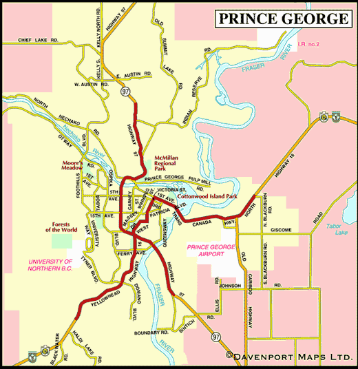 |
Here, where the Nechako and the mighty Fraser Rivers converge, and less than 100 km from the province’s geographical centre, sits Prince George, British Columbia’s “Northern Capital”. The area around Prince George is the traditional territory of the Carrier Sekani First Nations people, who made their livelihood off the bountiful rivers, lakes and forests of the region.
In 1793, the great explorer Alexander Mackenzie explored the area on his first crossing of the North American continent. However, it wasn’t until 1807 that European explorer Simon Fraser wintered over here, and before long, a trading post turned into a town. Originally called Fort George, after King George lll, the town flourished as a trading post, and was officially incorporated as a town in 1915.
For visitors today, Prince George is the fourth largest city in BC, and a gateway to the great North by Northwest. For the urban folks, there are all the cafés, art galleries, boutiques and museums that a modern city can offer.
Maps of the Prince George Area
- Northern British Columbia
- Inside Passage Circle Tour
- Native Heritage Circle Tour
- Northern BC Circle Tour


