Located where the green waters of the Thompson River meets with the brown, silt-laden flow of the Fraser River, Lytton is one of the oldest continuously settled communities in North America.
Built on the site of a First Nations village known as Camchin, the meeting place, Lytton was also a stopping place along the route taken by hardy prospectors as they made their way north to the gold fields.
Simon Fraser visited this site in 1808, travelling down the great river which now bears his name, seeking a route to the Pacific. He stopped here, at the mouth of its tributary, and named the Thompson River after his friend and fellow explorer, David Thompson.
The tremendous surge inland for gold and other precious metals saw the Indian trail through the Fraser Canyon expanded to a mule trail in 1860, followed by a wagon road in 1863. By this time, the community known as The Forks, had been renamed in honour of the British Colonial Secretary, Sir Edward Bulwer-Lytton.
Lytton’s appreciation of its Gold Rush history, as well as its thriving First Nations culture, are all visible through the preserved buildings and archives of a bygone era, and annual activities such as the Remembrance Day Pow Wow, which serve to celebrate Lytton’s rich heritage.
Lytton is perhaps best known as the Rafting Capital of Canada. Numerous first class commercial rafting companies guide adventurous visitors through the white waters of these challenging river routes. For those seeking tamer activities, excellent hiking, camping and river or lake fishing are all available within close proximity to the town.
Definitely a destination of unique and exciting adventures, the climate of the area makes Lytton a wonderful playground, abounding with magnificent scenery.
Population: 330
Location: Lytton is located at the junction of Highway 12 and the Trans-Canada Highway 1, at the confluence of the Thompson and Fraser Rivers, approximately 65 miles (104 km) north of Hope.
Adding to the unique air of Lytton is the famed Lytton Jellyroll an interestingly shaped geological anomaly. This unusual conglomeration of silt, sand and gravel, formed at the end of the last Ice Age, pays mute testimony to the incredible natural forces that shaped this area of the world many thousands of years ago.
View a unique collection of traditional and contemporary Native Art at the Siska Art Gallery and Band Museum, which represents a Siska Band elder’s dream of displaying First Nation’s artistic talent. Located in Nlaka’pamux Tribal territory near the top of the Fraser Canyon, the Gallery also showcases superb soapstone carvings by local artists in local stone.
Take a walking tour of the village, and continue your walk to the reaction ferry across the Fraser. At the corner of Fraser and 7th Streets, on the Anglican Church property, is a memorial to Chief Spintlum, who negotiated peace between the First Nations people and the new European settlers.
Follow the trains along the Fraser and Thompson Canyons as they wind their way through tunnels and across bridges to reach their destinations on the West Coast, or east to the prairies, Toronto and Montreal. Railway buffs will enjoyed the retired CN caboose in Caboose Park, and the famous photo opportunities of the Cisco Bridges crossing the Fraser just south of town.
Wildlife Viewing: A patient wildlife observer in the area surrounding Lytton may see elk, bighorn sheep, deer, coyote, black bears, cougar, bobcat, lynx, bald eagles, ospreys and many other wildlife species.
Watch the clear blue waters of the Thompson River mingle in an ancient dance with the muddy flow of the Fraser River. The Thompson’s addition to the Fraser River can be distinguished for nearly a kilometre downstream from the confluence of the two rivers in Lytton, before it mixes completely into the mighty Fraser River that flows powerfully into the Strait of Georgia south of the city of Vancouver.
Stein Valley Nlaka’pamux Heritage Park: The Stein Valley is one of the last untouched watersheds in the southwestern part of British Columbia. The enormous 107,191-hectare Stein Valley Nlaka’pamux Heritage Park encompasses a wilderness area known for its spectacular scenery and important historical, cultural and spiritual values. This is a user-maintained area, with 150 km of hiking trails and routes, four cable crossings, a suspension bridge and several wilderness campsites. Stein Valley Park offers limited opportunities for easy day hikes (primarily in the lower valley) but extensive opportunities for multi-night backpacking trips over moderate to difficult terrain.
Hiking: Take the free Reaction Ferry across the Fraser River to Stein Valley Nlaka’pamux Heritage Park. The Ferry is closed for periods in the spring due to high water. There is a short trail to Birthing Rock (1.5km/0.9 miles). Native women are said to have lined the rock hollows with fir boughs and given birth to their children here. It is also known as the Asking Rock, where Nlaka’pamux people asked permission from the spirits to enter the valley. The native lithographs encountered are echoes of a people and a way of life that thrived here for thousands of years.
Backpacking: Allow a week or more to cover the entire length of the extended 40-mile (60-km) Stein Heritage Trail that transects Stein Valley Nlaka’pamux Heritage Park. The challenging trail traverses the wilderness up to Stein Lake from the trailhead at the parking lot, accessed by a gravel road north of the ferry. This hike is suitable only for very fit, experienced hikers who are prepared to be totally self-sufficient.
Pan for Gold in the Fraser and Thompson Rivers, following in the footsteps of the Cariboo Gold Rush prospectors.
Whitewater Adventure: Located between two world-class whitewater rivers – the legendary Thompson and Fraser Rivers – the only decision to be made in Lytton is whether to power raft or paddle raft. The less strenuous but wetter power rafting requires that you cling to a wildly bucking powered raft while negotiating the big rapids, whereas paddle rafting offers the sense of accomplishment provided by teamwork and hard paddling. There are eighteen major rapids in the stretch of the Thompson River between Spences Bridge and Lytton, which is graded from 1 to 5.
The Nahatlatch, Fraser, and Thompson Rivers are all justifiably well known for their river-rafting experiences. Of the three, the Fraser and Thompson are more prominent, though not necessarily more challenging than the Nahatlatch River. In fact, the smaller and steeper Nahatlatch provides more excitement in its varied run than either of the others. The season begins in May, once water levels become manageable. The later in summer you try the Nahatlatch, the better your chances of being able to run the narrow Nahatlatch Canyon, a Class IV-V mind-altering experience. Although it’s entirely possible to run these rivers unaccompanied, the majority of paddlers opt for the services of a certified guide, at least the first time.
The scent of sagebrush fills the air in Skihist Provincial Park, yet another park with a historical flavour. Situated high above the junction of the Thompson and Fraser Rivers, the park encompasses a section of the old Cariboo Wagon Road, used by early settlers and travellers here in the heart of the Thompson First Nation. The best things about this park are the Saskatoon berries, which you can munch on when they’re in season, and the whitewater river rafting. A destination for naturalists or those simply seeking exciting outdoor adventures, Skihist Provincial Campsite and picnic area welcomes visitors with promises of inspiring natural beauty.
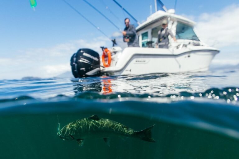
Right on the Thompson River, Goldpan Provincial Park is the park of choice for anglers. The Thompson Nation has fished here for centuries, and still does. It’s great for steelhead during the busiest time, mid-October to December. If you’re river rafting, you might overnight here, as Goldpan Provincial Park is used as a rest stop for many commercial river-rafting companies. Swimming is fun here, too.
The magnificent Fraser Canyon is readily visible and accessible just outside Hope travelling along the TransCanada Hwy (Hwy 1 east) on the banks of the Fraser River. The Fraser River cuts a swath through the Cascade Mountains creating a massive river valley of lush forests, deep gorges and mountain-side farmlands. A transportation link for generations from the original Cariboo Waggon Trail to the Gold Rush Trail, the Fraser Canyon roadway and railway systems continue to transport people and goods into the BC interior.
Circle Tours: See the best of the area on a driving Circle Tour. Head north out of Vancouver for the scenic Sunshine Coast and Vancouver Island Circle Tour, or stay on the intensely scenic Sea to Sky Highway, passing through the magical winter resort town of Whistler and Coast Mountains Circle Tour. To explore the rural farmlands and forests of the fertile Fraser Valley, take the Fraser Valley Circle Tour, travelling outbound on the scenic route north of the historic Fraser River, returning westwards along the Trans Canada Highway 1 to Vancouver. Circle Tours in British Columbia.


