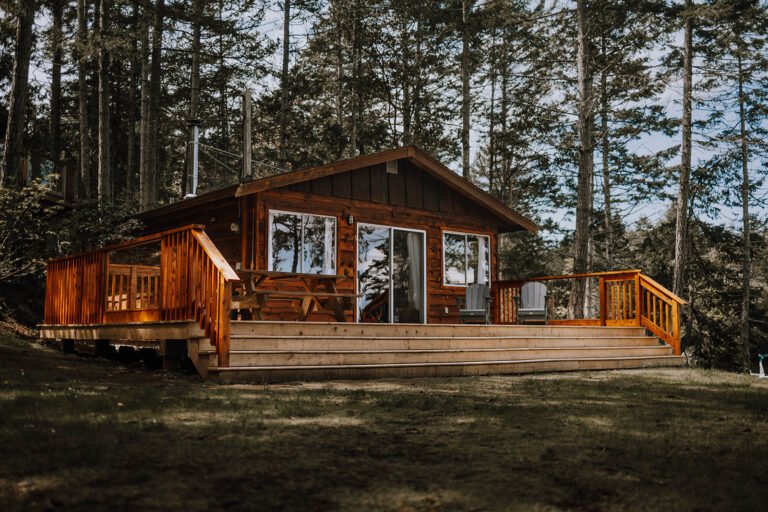
On the north shore of Jervis Inlet on the Sunshine Coast of British Columbia, Saltery Bay derives its name from the early 1900s when it was the base for a Japanese salmon saltery and fish packing plant. Salmon were purchased for the Coqueneet people of the Sechelt Band who have fished these traditional waters for many generations. Today, Saltery Bay is the terminal for ferries sailing to the northern Sunshine Coast from the Earl’s Cove ferry terminal on the southern Sunshine Coast. Saltery Bay offers a government marina and anchorage with limited space for small craft, fishing boats and sailboats.
Location: Saltery Bay is located on the north shore of Jervis Inlet on the Malaspina Peninsula of the Sunshine Coast of BC. Saltery Bay can be reached from Vancouver in the south by catching a ferry from Horseshoe Bay to Langdale, driving from Langdale to Earls Cove, and catching another ferry from Earls Cove to Saltery Bay. BC Ferries operates 10 scheduled daily sailings from Earls Cove on the Sechelt Peninsula across Jervis Inlet to Saltery Bay. The ferries carry both vehicles and passengers on the 50-minute trip. From Vancouver Island and the north, Saltery Bay can be reached by ferry from Comox on Vancouver Island to Powell River, with a drive south along Highway 101 to Saltery Bay.
- Vancouver/Horseshoe Bay Ferry Route
- Langdale Ferry Terminal
- Earls Cove/Saltery Bay Ferry Route
- Powell River/Comox Ferry Route
Trapper Descendants: Some of Saltery Bay’s residents are descendants of trappers who used to row dugout canoes up the coast, catching fish for canneries along the way.
Fishing: Some of the best ocean fishing is found in the Lang Creek Estuary, about 13.5 miles (22 km) west of Saltery Bay on the west side of Hwy 101. Beach casting is popular here for spring salmon from mid-September through late October. Owing to the shallow water of the creek’s outlet into Malaspina Strait, use lures that don’t sink quickly. If you use a spin rod, try spoons in a variety of colours to match the clarity of the water, with a light line. Salmon here are in the range of 20 to 50 pounds (9 to 23 kg).
Diving: A beautifully sculpted bronze mermaid sits in 60 feet (20 m) of water offshore from Saltery Bay Provincial Park in Mermaid Cove. The exquisite three-metre tall bronze mermaid known as the Emerald Princess is the first underwater statue in Canada. The park is not far from the ferry terminal, and has a convenient ramp for disabled swimmers and divers.
Beachcombing: When the park’s waters get too chilly for snorkelling, intertidal explorers can search the pebble, sand and rock beaches. Beachcombers never know what the sea will send their way.
Mountain Biking: The Upper Sunshine Coast area is well documented as having some of the best mountain biking trails in the province, most of which are clearly marked with a white mountain-bike symbol and double bands of various-coloured paints, making the routes a breeze to follow. The riding starts as soon as you get off the ferry at Saltery Bay, with the Elephant Bay Loop, a 30-mile (48-km) ride that will take you all day. Just follow the symbols. Except for a challenging ascent at the beginning, this is not a hard ride, but it is a long one.
Forest Service recreation sites: There are more Forest Service recreation sites concentrated around the Powell River area than in almost any other similar-sized area in British Columbia. Northwest of Saltery Bay there’s camping at Lois Lake (9 sites) at the start of the Powell Forest Canoe Route, at Khartoum Lake (16 sites), also on the canoe route, as well as at Nanton Lake (25 sites) and at Dodd Lake (12 sites), both located on the Welwood Mainline Forest Road.
Powell Forest Canoe Route: Since it was completed in 1983, the Powell Forest Canoe Route has come to be recognized as one of the more significant paddle routes in the province, right up there with the Bowron Lakes Canoe Route in the Cariboos. The Powell Forest route can be done in small or big bites – portages and streams connect 12 lakes over 80km. The full-on trip requires five to seven days to complete and includes almost 7 miles (11 km) of portages. A shorter 7.75-mile (12.5-km) route takes three days and includes about 3 miles (5 km) of portages. Each lake has its own characteristics: some are deep, others are exposed to strong winds. Altogether, there are 20 campsites sprinkled along the route, good places to hole up while waiting out a blow.
Hiking: The Sunshine Coast Trail stretches from the Saltery Bay ferry terminal in the south to Sarah Point in the world-famous Desolation Sound in the north. The 180-km trail rivals the West Coast Trail on Vancouver Island, offering panoramic views and wilderness campsites, while also providing access to developed campgrounds and two B&Bs for those who wish to spoil themselves after trekking through the forest.
More moderate hiking routes include the Lang Creek Trail (easy; 3 miles/5 km return) and Sweetwater Trail (moderate; 4.3 miles/7 km return). To reach the trailheads, turn north off Hwy 101 on the Duck Lake Forest Road, which is about 14 miles (23 km) north of Saltery Bay. The Lang Creek trailhead begins on the right side of the road in about 7 miles (11 km). To reach the Sweetwater Trail, carry on farther to Duck Lake, turn right over the bridge, and continue on for another 2 miles (3.2 km), then turn left and drive a short distance to the trailhead. The loop trail begins here and climbs through an enchanting stand of old-growth western hemlock past MacGregor Falls and returns along an old railbed.
Hardy Island Marine Provincial Park is a small Island in Blind Bay, located between the south shore of Hardy Island and the tiny Fox Island. The park is located directly south of Saltery Bay on the upper Sunshine Coast, and is only an island at high tide. Undeveloped Musket Island is the epitome of peace and tranquility, where wildlife like eagles and seals abound, the warm water encourages swimming, and wilderness campsites are provided for overnight campers. Musket Island is accessed by boat from Saltery Bay, Earls Cove and Egmont.
Saltery Bay Provincial Park, sits beside the BC Ferries’ Saltery Bay terminal on Jervis Inlet 8 km east of Lang Bay. A camping fee is charged between April and October. If you haven’t already enjoyed your picnic lunch while sitting out on deck of the BC Ferry that brought you across Jervis Inlet from Earls Cove, stop in at the Mermaid Cove picnic grounds in Saltery Bay Provincial Park. At both the campground and the Mermaid Cove site there are three dozen picnic tables, many of which sit atop mounds of sun-bleached mollusc shells left from precontact times when Native peoples picnicked and feasted here. You can see why they chose this spot: shellfish cling to the rocky shoreline, while in the deep, dark waters of the inlet, whales, seals, and sea lions cavort in pursuit of schooling fish.
Boat Launch: Public boat ramps on the northern Sunshine Coast are located at Saltery Bay Provincial Park, at Okeover Arm Provincial Park, and in Lund. Private ramps are located in Powell River.
Wildlife: Come fall, many of the streams that feed into Malaspina Strait and Jervis Inlet teem with spawning salmon. Depending on the year and the spawning cycle, Lang Creek Hatchery and Spawning Channels, north of Saltery Bay, will be thick with returning salmon. The best viewing is right next to the well-marked pullout on Hwy 101. As sure as salmon return to spawn in late summer, so too do raptors and bears follow. Although black bears in the Powell River region tend to frequent the backwoods logging roads, osprey and eagles, otters, and pine marten have no fear of approaching the coastline in search of carrion. Occasionally, even a black bear will put in an appearance. Killer whales, seals and sea lions also stop along the shores of Saltery Bay, heightening the experience of nature at its best.
Circle Tours: See the best of BC when you embark upon one of the many circle tours that take in Vancouver Island, the Discovery Coast, and the Sunshine Coast. The coastal tours involve exciting road and ferry trips on BC Ferries, and scenic highways flank the coast, taking you through charming beachside communities, rolling farmlands and majestic mountain ranges. Check out the Sunshine Coast and Vancouver Island Circle Tour, and other Circle Tours in British Columbia.
West of Saltery Bay is Lang Bay, a small community surrounded by small farms overlooking the Malaspina Strait, where miles of hiking trails lead to beautiful lookouts, waterfalls, peaceful lakes, and spectacular alpine hiking.