The West Coast Trail on Vancouver Island is an internationally acclaimed hiking trail that retraces an old telegraph route that once connected Victoria with Cape Beale near Bamfield.
The telegraph line was first carved through the virgin coastal wilderness in 1890, to serve as a communication link to aid in the rescue of vessels in distress off the southwest coast of Vancouver Island.
This treacherous, fog-prone coastline has a remarkable history of shipwrecks dating back to the earliest European records of the 1786 wreck of two British expedition vessels, and the loss of over 100 men. Winter storms continued to claim vessels throughout the nineteenth century, with many survivors perishing from starvation and exposure on the rugged coast of the island. After much deliberation and delay, a lighthouse was finally built at Carmanah Point in 1891.
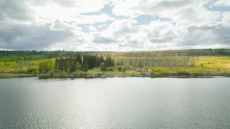
In January 1906, the Pacific Coast passenger ship Valencia sailed out of San https://britishcolumbia.com/wp-content/uploads/2025/07/Hidden-Cove-Lodge-1-1.jpg bound for Victoria. In thick fog and winter storm conditions, the Valencia missed the entrance to the Strait of Juan de Fuca and rammed the jagged coastline a few miles north of the lighthouse at Carmanah Point. The tragic loss of 126 souls under horrific conditions finally shocked the federal government of Canada into responding to the countless calls for an effective life saving trail.
Consequently, a second lighthouse was built at Pachena Point and the overgrown and poorly maintained telegraph line was completely upgraded to serve as a rescue route for unfortunate mariners shipwrecked on this treacherous, stormy coast. Shipwreck survivors could now follow the rough and arduous trail to civilization, finding shelter in wooden cabins constructed at intervals along the route. Almost 70 ships have met their demise along this stretch of the “Graveyard of the Pacific”.
With the development of modern navigation and communication equipment, and the subsequent decline in the number of marine casualties, the importance of the Life Saving Trail began to diminish. Inadequate maintenance and deterioration of the trail led to its eventual abandonment by the federal government in 1954.
The next decade saw a rekindled interest in the trail for recreational and historical purposes, as well as the start of a monumental battle against the incredible greed and ignorance of the island’s major logging companies who were intent on stripping the land bare right down to the shoreline. Intensive lobbying by The Sierra Club and environmental groups finally succeeded in securing park protection for the region in 1970. Improvements and rebuilding of the trail during the 1970s culminated in completion of the upgrade program in 1980.
The 75-km long West Coast Trail was formerly established as the West Coast Trail Unit of the Pacific Rim National Park in 1973. This 25,640 hectare strip of the Pacific Rim encompasses the section of coast southeast of Barkley Sound, between the villages of Bamfield and Port Renfrew.
More accurately though, the trail passes through the traditional territory of the Pacheedaht (Port Renfrew), the Ditidaht (Nitinat) and the Huu-ay-aht (Bamfield) people.
These three bands of the Nuu-chah-nulth First Nation have been custodians of the land for over 4000 years!
The land of the West Coast Trail unit is temperate coastal rainforest dominated by old-growth spruce, hemlock and cedar. Some of the tallest and largest trees in Canada grow along the West Coast Trail and in the adjacent Carmanah Walbran Provincial Park. The topography of the region features natural wonders like the Hole-in-the-Wall, a natural sandstone arch carved by relentless wave action over time, the Tsusiat Falls at the mouth of the Tsusiat River, the Nitinat Lakes and Narrows and countless caves, creeks, coves, tidal pools and rocky headlands.
The merit and hardship of hiking the magnificent West Coast Trail are known around the world. This challenging five to seven day trek is both difficult and physically demanding – accidents and injury are common and the potential for hypothermia exists if heavy fog and constant wind prevail. If that doesn’t scare you off, perhaps the reality that you may encounter black bears or cougar along the trail will do the trick. Described as the toughest trek in North America, the West Coast Trail is certainly not for the novice, casual or ill-prepared hiker.
The trail takes the hiker along the wild and remote west coast of Vancouver Island, through cedar, hemlock and spruce forests, along cliffs, beaches and sandstone ledges and over suspension bridges spanning rivers and flowing streams. Strength and stamina are required to power the cable trolleys across riverbeds, climb the hundreds of cliff face steps, hike through fog and mud and camp in torrential rain. Sound great? Eight thousand hikers per year think so!
The trail may be hiked in either direction. You can register either at Gordon River Info in Port Renfrew or Pachena Bay Info in Bamfield to get on the trail. The southern part of the trail is the most difficult, and many people prefer to get it over with whilst energy reserves are still high. On the other hand, being early on in the trip, hikers will have to endure this difficult stretch with fully laden backpacks. Attacking the trail from the easier northern end with a heavy load allows the backpacker to settle into the hike before encountering the more difficult stages.
The WCT is open from May 1st to September 30th. Prolonged periods of heavy rain, strong winds, high tides, large waves and short days necessitate closing the trail from October 1st to April 30th.
Orientation Session
All overnight users of the West Coast Trail participate in an orientation session. This purpose of the orientation it to reduce the number of hiker injuries, reduce environmental impacts, provide information about current issues and trail conditions, provide a history of the West Coast Trail and its place in Canada’s heritage and to issue the WCT Overnight Use Permits and collect fees.
There is a 9.30 am and at 1.00 pm orientation session for hikers starting the trail that same day, and a 3.30 pm orientation session for hikers who arrive a day early and are hiking the trail the following day. On average, orientation sessions last approximately 60 minutes.
Pachena Bay Trailhead
The northwestern trailhead, the Pachena Bay Trailhead and Registration Office is located 6 km south of Bamfield. Access by road from the east coast of Vancouver Island is on paved road. Other methods of transport are also available:
From Victoria: By car or bus (West Coast Trail Express)
From Duncan and Nanaimo: By car on gravel logging roads
From Port Alberni: By car, bus (Western Bus Lines) or passenger ferry (Alberni Marine Transport Ltd)
From Bamfield: Taxi
Gordon River Trailhead
The southeastern trailhead, the Gordon River Trailhead and Registration Office is located 4 km north of Port Renfrew.
From Victoria: By car on Highway 14 (2 hours) or bus (PBM Transport West Coast Trail Connector Bus).
From Duncan: By paved road via Lake Cowichan (turn south at the community of Mesachie Lake).
From Port Renfrew: By water taxi to the trailhead.
Nitinat Lake Visitor Centre
The Nitinat Lake Visitor Centre is situated on the northern end of Nitinat Lake, with the trail Registration Office located at the General Store. From the centre you will need a water taxi down Nitinat Lake to the trail at Nitinat Narrows. The ferry usually makes a trip at 5:00 pm from the Narrows to Nitinat Village.
From Victoria: A 2-1/2 hour drive via Duncan.
From Duncan: A 1-1/2 hour drive via Lake Cowichan (Highway 18, paved) and the Nitinat Main logging road (gravel).
From Port Alberni: A 1-1/2 hour drive on the Bamfield Road, Franklin Main and Nitinat Main logging roads (gravel).
Reservations are no longer necessary in the “shoulder season”.
Reservations are available in the peak season; June 15th to September 15th, and a quota system is in place. 30 people maximum can hike daily out of Pachena Bay and Gordon River. Out of the 30, 25 spots are usually taken up by hikers who have reserved in advance; and the remaining 5 are First Come First Serve spots available each day.
Before calling:
Know the regional layout of southern Vancouver Island. Plan how to get to your starting trailhead (Bamfield or Port Renfrew).
Your choice of starting dates and place must be determined in advance. Take the time to research the hike.
Prospective hikers must understand that hiking the West Coast Trail is not without personal risk: it is difficult and physically challenging. Accidents and injuries are common. This trail is for experienced hikers in good physical condition who are prepared to have a wilderness experience. The trail is not a training or practice area for novices.
Group Size: The maximum group size is ten.
Quota System: To maintain the ecological integrity of the area, there is a quota system in place.
Tide Tables
Canadian Tide and Current Tables are available from the Canadian Hydrographic Service, Box 6000, 9860 West Saanich Road, Sidney, BC V8L 4B2, or online at the Canadian Hydrographic Service website. Navigate until you find the tides for the Pacific Region, then select Bamfield or Port Renfrew.
Trail Use Fees:
Hikers will contribute directly to protecting and managing the West Coast Trail through a Mandatory Trail User Fee. For current Trail Use Fees please visit: www.pc.gc.ca/pacificrim
Accessing The Trail – there are three ways of accessing the trail:
– Obtain access via the reservation system
– Obtain access via the waitlist system
– Join a commercial or education group.
1) To obtain access via the reservation system:
Reservations are taken March 1 to September 30 and may be made 7 days a week between 7:00 a.m. and 6:00 p.m. (PST/PDT). Reservations are available only for the current year hiking season (May 1 to September 30) and can only be changed if spaces are available. Reservations are recommended but optional.
Hikers wanting to ensure a space within the quota system for the hiking season can now choose from a full month of possible starting dates for their hike. Now, beginning on the first day of each month, for three months out, they can request any start date. If someone calls in March, they now have the opportunity to book the start of their hike for any day during the month of May. Reservations for the entire month of June open on April 1st, for July on May 1st, and so on.
To make a reservation call the Super Natural British Columbia Reservation Service at:
Greater Vancouver: 1-604-435-5622
Within Canada & USA: 1-800-435-5622
Outside Canada & USA: 1-250-387-1642
The non-refundable reservation fee gives each hiker:
– a guaranteed start date for their hike
– a weather proof map of the trail
– a hiker preparation guide.
When you call, you must have the following information ready:
– intended start date and two alternate start dates
– which Trailhead you plan to start your hike from Pachena Bay or Gordon River
– number of hikers in your group (maximum 10)
– a mailing address (the information package will be sent to this address)
– valid credit card (VISA or MasterCard) to pay for your Reservations.
– Invalid or expired credit cards will result in cancelled reservations.
Changes to your reservation or your start date may only be made through the Super Natural British Columbia Reservation Service, and provided that space is available on your new intended start date.
2) To obtain access via the waitlist system:
From June 15th until September 15th a quota system is in place. 30 people maximum can hike daily out of Pachena Bay and Gordon River. Out of the 30, 25 spots are usually taken up by hikers who have reserved in advance; and the remaining 5 are First Come First Serve spots available each day.
3) Commerial and Educational Groups
Special provision is made to allow education and commercial groups to book access to the trail in advance. Only one group is allowed on the trail per day. Educational groups may have up to eighteen (18) members; all other groups are limited to ten (10) persons.
Booking for these groups begins in September and runs to December 31 of the year preceding the hiking season to be booked. Copies of the Commercial and School And Non-Profit Educational Groups Policies and Booking Sheets can be obtained by e-mailing Pacific Rim NPR at pacriminfo@pch.gc.ca.
Nearby Regions & Towns
More Information:
Parks Canada – British Columbia
Website: www.pc.gc.ca
Phone: 250-726-4600 (Pacific Rim NP Information Centre – Year Round)