The 10 Best Parks & Trails in British Columbia
British Columbia has the second largest parks system in Canada, after our National Parks, boasting nearly 1,000 Provincial Parks, National Parks, Marine Parks, Regional Parks, Protected Areas, Conservancy Areas, and Ecological Reserves, covering approximately 12% of the land area of BC. Highlights include nearly 50 campgrounds that accept reservations, over 6,000 kilometres of hiking trails, the largest intact coastal temperate rainforest in the world in Kitlope Heritage Conservancy, Canada’s only grizzly bear sanctuary in Khutzeymateen Park, and Tatshenshini-Alsek Park, a UNESCO World Heritage Site.
No matter where you travel and which way you turn in British Columbia there will always be a fabulous park or recreation area nearby: a welcoming wilderness for those seeking the solitude and tranquility of the great outdoors.
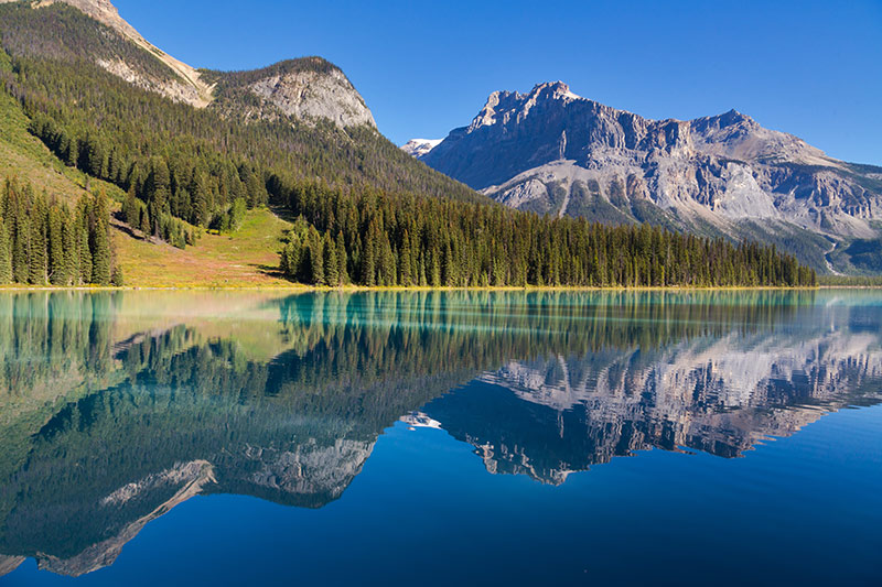
Emerald Lake, Yoho National Park, British Columbia, Canada.
Quick Links:
- All Parks in British Columbia
- Marine Parks in British Columbia
- National Parks in British Columbia
- Trails in British Columbia
- Top 10 Parks on Vancouver Island
- Campgrounds and RV Parks in BC
- Frequently Asked Questions
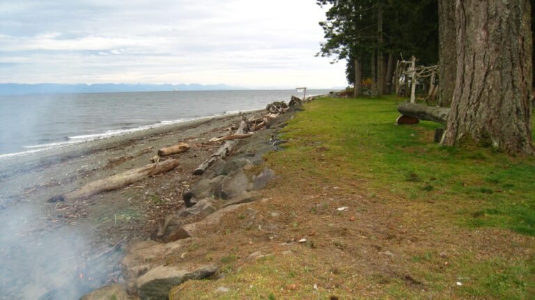
Parks on Vancouver Island & BC Islands
Born from volcanic rock and full of beauty and natural splendour, Vancouver Island and the Gulf and Discovery Islands offer magnificent rain forests, towering mountains, sparkling blue seas, remote shell beaches, and secluded bays.
Rugged Central and North Vancouver Island feature a largely uninhabited wilderness of forests, lakes and snow-capped peaks. The Pacific Rim on the West coast delivers wild landscapes, Old-growth forest, and never-ending sandy beaches. Victoria and South Vancouver Island present a remarkable diversity of landscape and recreational opportunities. Vancouver Island is a unique, natural paradise awaiting exploration.
Parks in Vancouver, Coast & Mountains
Greater Vancouver teems with parks, beaches, and cycling and walking destinations. On every corner, it seems, there is a pocket of green space, and the North Shore boasts no fewer than six magnificent mountain peaks to play in.
The evergreen Coast Mountains and the Sea to Sky Country offers quiet hikes through deep forests, wild trail rides, and the Mighty Fraser River to explore. Along these ancient pathways, generations of Coast Salish people traded with their relations in the Fraser Canyon. The Sunshine Coast offers a secluded world of beaches, bays, islands and fjords overlooked by the majestic Coast Mountains.
Parks in the Thompson Okanagan
The Thompson Okanagan is one of the world’s most beautiful and pristine places. Travellers to the North Thompson share this part of British Columbia with relatively few people.
Nothing is as arresting as the sight of snaggle-toothed Mount Robson, or the sinuous, green-hued surface of the North Thompson River. A series of gentle mountain ranges rolls between the Thompson Plateau in the west and the Shuswap Highlands to the east, then rises dramatically in the Selkirk and Monashee Mountains. The Shuswap offers over 1,000 kilometres of lake shoreline to explore, amidst spectacular scenery and a pristine environment.
Parks in the Kootenay Rockies
Dominated by mountains and water, the Kootenays region of British Columbia is cradled by the Monashee Mountains to the west, and the Selkirk and Purcell Mountains to the east.
Between these ranges are the enormous Arrow and Kootenay Lakes, and the major wilderness parks of Valhalla and Kokanee Glacier. The BC Rockies region is a motherlode of serious adventure, with the mountainous parks presenting some truly extraordinary landscapes to explore. The Columbia Valley is surmounted by the Rocky Mountains on the east and the Bugaboos on the west, with the Columbia River rolling through the southern part of the valley. one of the best Parks & Trails in British Columbia.
Parks in the Cariboo, Chilcotin, Coast
Cariboo gold prospectors have been replaced by adventurers in the wild canyons and thousands of pristine lakes, rivers and streams of the Cariboo, with rolling hills, deeply incised rivers, and many lakes providing an impressive landscape.
The Bella Coola Valley is of historical significance as a trade corridor between coastal and interior Native groups. The Chilcotin Plateau east of the Bella Coola Valley can rightfully claim to be the true bastion of the range rider in BC, with vast expanses of the Chilcotin being worked by large ranching outfits. The Central Coast offers some of the province’s most beautiful terrain.
Parks in Northern BC & Haida Gwaii
The mythical and elusive Haida Gwaii (Queen Charlotte Islands) and the vast wilderness area of Northern British Columbia are rich and unspoiled masterpieces of nature.
Haida Gwaii is made up of about 150 islands, offering arguably one of the most beautiful and diverse landscapes in the world. Nestled up under the Alaska Panhandle, the North West is filled with both unique wilderness experiences and the standard British Columbia fare of deep fjords, dramatic canyons, sheer mountains, rivers thick with salmon, old-growth forests, and an abundance of wildlife. The Rocky Mountains and their foothills dominate the Northeast of BC.
Neighbouring Parks in Alberta, Canada
Parks in neighbouring Alberta that border on British Columbia include Banff National park, the massive Jasper National park, and Willmore Wilderness Park.
Rugged mountains, ancient glaciers, icefields, alpine meadows, beautiful blue cold-water lakes, mineral hot springs, deep canyons and fascinating hoodoos compose the natural landscape and habitat for a great variety of birds and mammals. Jasper’s scenery is rugged, including deeply gouged Maligne Canyon and picturesque Maligne Lake, and Willmore Wilderness Park in the Rocky Mountains of central Alberta is a beautiful untouched wilderness area.
If you want to know more of the Parks & Trails in British Columbia
: