On the lower slopes of Hollyburn Mountain, between the Capilano River Valley and Horseshoe Bay, is one of Canada’s most picturesque residential communities, West Vancouver. Bordered by Burrard Inlet to the south and Howe Sound to the west, West Van incorporates the villages of Ambleside, Dundarave, Caulfield, and Horseshoe Bay.
There’s an old saying that if you can see the North Shore from Vancouver, it’s about to rain, and if you can’t, it’s raining. Rain is part of the price residents on the steep-sided slopes of West and North Vancouver pay for living on the wild side of Burrard Inlet. Clouds bump up against the forested mountainside, become ensnared in dense stands of Douglas fir and hemlock, and linger long after skies have opened over Vancouver.
This is a moody locale. On a clear day, few skylines can compete with the one composed of the Shores’ six peaks – Black, Strachan, Hollyburn, Grouse, Fromme, and Seymour Mountains. After a rainstorm, the brilliant black-green hue of the North Shore shines with freshness.
Before the construction of the original Second Narrows Bridge in 1925, the North Shore was a world apart. Ferries once linked Ambleside in West Vancouver with Vancouver. From Ambleside, hikers in summer and skiers in winter would make their way up the side of Hollyburn Mountain, at first on foot or by wagon, later by car and bus. Cabins were constructed, trails brushed out. Mountain tops were the perfect places to get away from dirty old Vancouver, especially in cool weather. Before the Second World War, sawdust was the fuel of choice in many Vancouver homes, darkening the air with its soot.
No matter how far up the mountainside neighbourhoods have crept, the wilderness still influences the North Shore. Black bears and cougars prowl backyards on the perimeter of habitation. Hapless hikers, skiers, and snowboarders routinely lose their way and wait (and pray) to be saved by the North Shore Rescue Team, a volunteer group who selflessly put their own lives at risk to track down missing adventurers.
Despite the outward appearance of urbanity, the North Shore contains some of the most rugged terrain in the province. The mountainous topography represents the forward perimeter of land pushed out to the coast by the mile-thick glacial ice pan that held sway 12,000 years ago. The Coast Mountains, which begin on the North Shore and sweep north along the British Columbia coast and through Alaska, are the tallest range in North America and among the most heavily glaciated.
Due to the North Shore’s steep incline, much of the outdoors activity that takes place here will get your heart rate up within minutes of starting out, whether you adventure on foot, by bike, or on skis or snowboard. Pothole lakes are the refreshing reward for those who explore the higher reaches in summer.
Along picturesque Marine Drive, on the way to Horseshoe Bay, you’ll find Lighthouse Park and its 75 hectares (185 acres) of majestic forest including towering Douglas Fir. The park’s extensive network of trails can take you out to the 1874 lighthouse – Canada’s oldest manned lighthouse – and along the rugged coastline where seals can be found basking on the rocks below. An equally impressive road will take you up to Cypress Mountain. Horseshoe Bay is the western most community in West Vancouver and it’s also the departure point for ferries to Bowen Island, Vancouver Island and the Sunshine Coast.
Population: 44,272
Location: West Vancouver is located between Marine Drive and the Trans-Canada Highway 1, on the North Shore of the city of Vancouver.
Ambleside By The Sea, originally created as a seaside retreat for city dwellers across the inlet, is one of West Vancouver’s oldest neighbourhoods. Today Ambleside is the social heart of West Vancouver, offering a wonderful combination of business, shopping and recreation.
Dundarave Village: If you’re hunting for antiques or exclusive boutiques, the picturesque seaside Dundarave Village is the place to go. Don’t miss the Dundarave Pier and beach. A waterside favourite only metres away from Dundarave Beach is the heritage Beach House at Dundarave Pier, first opened as a teahouse in 1912. From its early days as a logging camp, Dundarave Village has grown into a charming block of sidewalk or oceanview cafes, with an interesting array of unique shops.
The delightful seaside village of Horseshoe Bay at the entrance to Howe Sound was a traditional meeting place for Native people, used both as a seasonal fishing encampment and a place to spend a night when travelling between villages on the Squamish River and Burrard Inlet. The sheltered bay was called ch’xay or Chai-hai, after the swishing sound made by schools of little fish stirring up the waters of Horseshoe Bay. In 1991, it was discovered that Horseshoe Bay Park stands atop an ancient shell midden. You can rent a boat and join the throng of boats launching from the federal dock, a popular activity since the 1920s. Powerboats are popular with salmon fishermen. The waters around the mouth of Howe Sound are usually dotted with these boats.
The Lions Gate Bridge, built by the Guiness Family, opened Vancouver’s North Shore to vehicle traffic in 1938. Its lights were turned on in 1986, celebrating 50 years from the start of its construction, and the 100th birthday of Vancouver. Watch for Cruise Ships entering Burrard Inlet as the you cross the bridge, named after the two mountain peaks that look like sleeping lions.
The magnificent front doors of the Boathouse Restaurant, a large wooden-sided building on the far side of Sewell’s Marina on Nelson Avenue in Horseshoe Bay, are well worth a look. Carved by Nisga’a artist Norman Tait in traditional West Coast style, the two large panels rival those at the entrance of the University of British Columbia’s Museum of Anthropology.
Beaches: Going to the beach is a far different experience on the North Shore of Vancouver (which, interestingly, is never referred to as the South Shore). Over here it’s rugged from tideline to skyline. Cobble beaches and rocky outcroppings make beaches on English Bay look positively cushy by comparison. That being said, a few soft pockets do exist in places such as Caulfeild Park and Ambleside Park in West Vancouver. Both are extremely popular with families on weekends, yet they can be almost deserted on weekdays. Ambleside and Caulfeild are open, windswept expanses with terrific views of English Bay and Burrard Inlet. Caulfeild Park offers the most variety of sandy beach and shoreline trail, and is located on Pilot House Road. Ambleside Park is located south of Marine Drive between the Capilano River and Keith Road.
Diving: As you make your way along the beach at Whytecliff Marine Park, you’ll probably see wet-suited figures emerge from the embankment and make their way towards the ocean. After a day at the office, scuba divers come to experience a little weightlessness as they float off into the nether world just offshore, where temperatures matter little year-round, provided you dress appropriately. Although the majority of park visitors prefer gum boots over wet suits, Whytecliff has become a magnet for local divers.
Cycling: The 5-mile (8-km) Cypress Parkway has wide paved shoulders for those cyclists who enjoy the challenge of a lengthy ascent. Cypress Parkway climbs through four switchbacks from the Upper Levels Hwy (Hwy 1) to the parking lot at the foot of Cypress Bowl’s downhill ski runs. Hard-core cyclists lash skis and poles to their frames in winter when making their way here. Riders are rewarded with viewpoints midway up each mountain, and the scream of wind in the vents of their helmets on the way down. Check your brakes!
Fishing: During late August and September, fishing is at its peak, with coho and chinook salmon in the waters between Howe Sound and Capilano River. Anglers can drop their line in at any one of West Vancouver’s waterfront parks.
Cross-country Skiing: Hollyburn Ridge in Cypress Provincial Park is the domain of cross-country skiers. Hollyburn’s 10 miles (16 km) of groomed and track-set trails, as well as skating lanes, are cut through some of the most challenging terrain in Western Canada. The tradition of skiing is an old one here, dating well back into the 1920s. Evidence of this can be seen in the many rustic cabins that dot the woods. There are trails here to suit all skill levels.
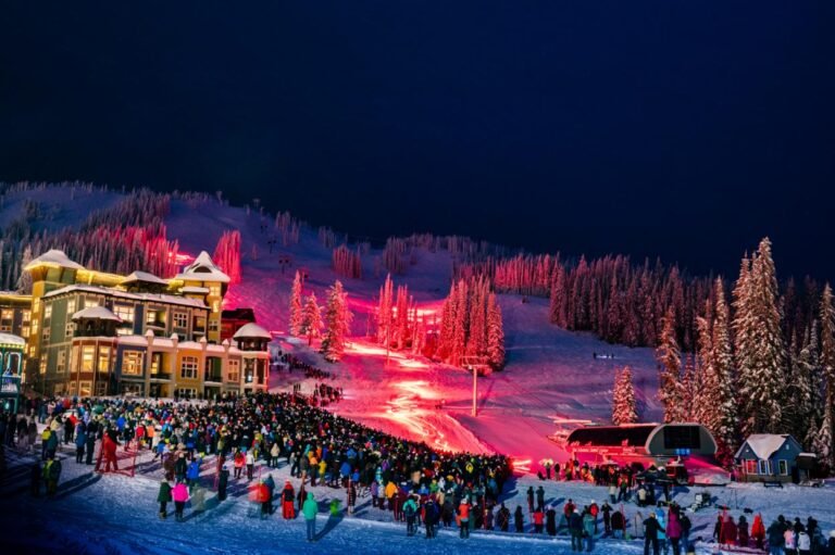
Skiing and Snowboarding: Downhill skiers and snowboarders have their pick of Cypress Mountain in West Vancouver’s Cypress Provincial Park and Grouse Mountain and Mount Seymour in North Vancouver. Intermediate and advanced skiers and snowboarders gravitate to Cypress and Grouse, while Seymour has the distinction of being the place where three-quarters of Lower Mainlanders learn to ski, and it’s got 5,000 pairs of rental skis and snowboards to prove it. Skiing & Winter Activities on the North Shore of Vancouver.
Imagine a wilderness sanctuary where endangered animals can play, protected and secure. You will find all this and more at The Refuge for Endangered Wildlife, a research, education, and conservation centre at the top of Grouse Mountain, dedicated to becoming a world leader in preserving both wildlife and flora at risk.
Lighthouse Park: By a twist of fate, the dark background provided by a stand of old-growth rain forest on Point Atkinson’s shore in West Vancouver turns out to be its saving grace. If it weren’t for the contrast that it provides for a powerful lighthouse beacon built here in 1888, this primarily Douglas fir forest would have been logged ages ago. As it stands, Lighthouse Park contains the largest uncut, coastal-elevation trees in the Lower Mainland. And what a beautiful environment in which to view them. Waves crash against an outcropping of granite as the ocean breeze whistles through the boughs above. All this within a 10-minute walk of the parking lot. The trees are so large and, in places, poised at such precarious angles to each other that one walks past them with bated breath. The sight of an occasional bench hewn from the trunk of a downed predecessor helps to steady one’s nerve. Pause here under the shelter of their moisture-trapping limbs (some cloaked with an estimated billion or more needles) and marvel at the lushness of the understorey. Follow along the seaside trail, part of a 3-mile (5-km) network of pathways, from the lighthouse to Jackpine Point, where you’re sure to find a smooth rock on which to pause again. Visit here on an autumn day to experience the Zen-like peace that pervades this oceanside scene. Lighthouse Park is tucked away off Marine Drive at the south end of Beacon Lane.
Whytecliff Marine Park: The rugged shoreline and cobble beach of Whytecliff Marine Park lie in West Vancouver’s Horseshoe Bay neighbourhood. The entrance to the park is at the western end of Marine Drive. Beside the beach, interpretive signs explain the variety of marine life to be found beneath the waves. Although you have to take most of it on faith, occasional life forms do bob to the surface, such as the head of a curious seal or a school of divers. The setting here at the mouth of Howe Sound is dramatic, with the vastness of the Strait of Georgia spread out to the west. Ferries serving Vancouver and Bowen Islands and the Sunshine Coast glide in and out of nearby Horseshoe Bay. On all but the busiest summer weekends, visitors can usually find a secluded spot with a driftwood log for a backrest. Follow one of the rough but well-trodden trails that run along the top of the cliffs. Small sets of rock stairways lead here and there. A rocky breakwater leads out to nearby Whyte Islet. At low tide you can clamber up its steep slopes and find a sheltered spot beneath a lone shore pine. Keep one eye on the progress of the tide. It’s a cold swim back to shore! In 1993, Whytecliff became Canada’s first Marine Protected Area. Harvesting or collecting any marine life beneath the waters of this sanctuary is prohibited. Upwards of 200 marine animal species, with exotic names such as the speckled sanddab or the sunflower seastar, call these waters home yet pay no property taxes, despite living in Canada’s most affluent community.
Cypress Provincial Park, a 7,400-acre (3000-hectare) provincial park in West Vancouver, was born out of controversy in the 1960s and 1970s after clandestine logging, carried out under the guise of cutting ski trails, devastated much of the landscape. The clear-cut can still be seen from Vancouver. Today, commercial development in Cypress is still a hot issue. To see why groups such as Friends of Cypress Park and the Sierra Club of Canada oppose any further logging in the park, take a hike on one of the park’s more moderate trails, such as the Hollyburn Mountain Trail. At 4,350 feet (1326 m), Hollyburn Mountain is one of the three peaks easily reached from the Cypress Parkway. The others are Black Mountain and Mount Strachan (pronounced strawn). Much of the unique old-growth forest on both Black and Strachan was thinned, if not wiped out completely, by logging. The subsequent cutting of trails for downhill skiing eliminated even more.
Ambleside Park is easily reached from numerous entrances along Marine Drive, including the south end of Taylor Way. (Taylor is the first major intersection west of the Lions Gate Bridge.) There’s usually a buzz of marine activity offshore from Ambleside beneath the Lions Gate Bridge. On Saturday evenings in summer this is a picture-perfect place to watch gaily lit cruise ships power their way out of port. When salmon are running in the Capilano River in September, you can count on seeing dozens of small pleasure craft drift-fishing just offshore. Upstream at such times, residents of the Capilano Indian Reserve, on whose land Ambleside Park and the north end of the Lions Gate Bridge are located, will also be fishing along the riverbank. Tidal currents ripple the surface of First Narrows, but the water at Ambleside’s sandy beach is predictably calm. Skip a stone, toss a stick, talk to your neighbour: it’s that kind of park.
Sea to Sky Highway: One of the world’s most breathtaking highways starts in West Vancouver taking the traveller along views of snowcapped mountains, tall stands of ancient timber and the gleaming Pacific Ocean…The Sea to Sky Highway leads to the recreation paradise of Britannia Beach, Squamish and Whistler, and north to Lillooet, gateway to the Cariboo.
Feel like taking a short sea cruise? The ferry ride from Horseshoe Bay in West Vancouver to the charming little village of Snug Cove on Bowen Island aboard BC Ferries’ Queen of Capilano takes only 20 minutes. You’ll be following a long-standing tradition if you do, as ferries once brought revellers from Vancouver for day and overnight outings to Bowen. One of the delights of visiting the island at the mouth of Howe Sound is that you’re in Crippen Regional Park as soon as you step onto the dock.
Circle Tours: See the best of the area on a driving Circle Tour. Head north out of Vancouver for the scenic Sunshine Coast and Vancouver Island Circle Tour, or stay on the intensely scenic Sea to Sky Highway, passing through the magical winter resort town of Whistler and Coast Mountains Circle Tour. To explore the rural farmlands and forests of the fertile Fraser Valley, take the Fraser Valley Circle Tour, travelling outbound on the scenic route north of the historic Fraser River, returning westwards along the Trans Canada Highway 1 to Vancouver. Circle Tours in British Columbia.