The term Lower Mainland came into currency among Vancouver Island settlers in the 19th century. Early immigration into the Crown Colony of British Columbia from Asia, Australia, Hawaii, Newfoundland, Europe, the United States, and Mexico spilled over from Vancouver Island into the lush farmland of the Fraser Estuary and Fraser Valley. Mainlanders became a term used by island residents to emphasize the separation, and perhaps the feeling of superiority, between the two.
The Strait of Georgia that divides Vancouver Island from the Lower Mainland of British Columbia represents a psychological schism as much as it does a physical split.
Just as Vancouver is blessed by its proximity to the North Shore mountains, so too is it graced by the Fraser River’s union with the Pacific Ocean. Riverside trails, intertidal wetlands, a delta of low-slung islands and a catalogue of wildlife accompany the mighty waterway. As you make your way through the Fraser River Estuary you are always aware of the silent weight of the Fraser, to which the landscape owes its existence. Much of the estuary has come into being only in recent times – geologically speaking – a fact attested to in the oral history of the Musqueam people, whose ancestors witnessed the islands at the mouth of the Fraser take shape. As the estuary silts in at a regular annual rate, it’s as easy to gauge the increase in its size as it is to measure the growth of a tree. In an age of diminishing expectations, it’s reassuring to know that in the Fraser Estuary, at least, there’s an expanding quantity of soft, rich soil and broad, muddy water to explore!
Location: The Fraser Estuary is the region around the delta of the Fraser River on the Lower Mainland of BC, between Vancouver and the Canada/United States border.
The following towns are located in the Fraser Estuary:
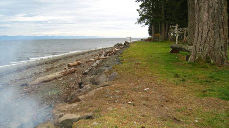
There are many things to experience on and around the Fraser River, but bathing isn’t high on the list. The river rarely warms up to a comfortable temperature, even in summer. Due to fast-flowing currents in spring, and the fact that industries still find the river a convenient place to dump waste, swimming in Big Muddy is not recommended. There are exceptions, such as at Deas Island or Iona Beach Regional Parks, where wading in the river is a refreshing way to cool off. Water-skiers in Deas Slough and Ladner Marsh, for example, are willing to brave the chill waters, though many of them wear wet suits.
One of the best ways to get a feeling for the Fraser Estuary is from a small boat such as a canoe or kayak. Although the Fraser River powers its way through the estuary in three main channels, there are numerous backwaters where the current is not as strong nor the wakes from passing tugboats and freighters as intimidating.
There aren’t many places in the world where you can swim between two countries with such ease as at Boundary Bay. A metal-scaffolded tower marks the place where the 49th parallel slices across the sandy beach. In summer, when the bay is a bathtub of sun-warmed seawater, you can make like a dolphin as you skip back and forth between Canada and the United States. When you’re ready to dry off, stroll the beach and experience the same thrill.
Almost all of the parks and beaches in the Fraser Estuary are ideally suited for picnicking. Some provide picnic tables while others have covered shelters, barbeques, and playing fields.
Camping is difficult to find close to Vancouver. There is a private campsite on Beach Road that offers quiet, family-oriented camping by the sea in summer. Group tent-camping is available at Deas Island Regional Park’s Muskrat Meadow in a setting in an open field in a forest.
The Gulf of Georgia Cannery National Historic Site in Steveston, is operated by a group of community members and representatives of the local fishing industry and contains relics from the past, when the canneries operated day and night. A model of a 1930s production line is set up along one long L-shaped counter. Murals of fish and trawlers cover the walls; showcases full of glass net floats from Japan, various shiny salmon tins, and model boats help convey a sense of Steveston’s heritage. Mountains of fishing gear and nets are arranged outside.
Also located in Steveston at the south foot of Railway Avenue is the Britannia Heritage Shipyard. Visitors can take a self-guided walking tour of this National Heritage Site. Britannia is one of the few surviving examples from Steveston’s rich past, when a mix of canneries, net lofts, boatyards, residences, and stores defined the neighbourhood. The Britannia Shipyard augments a walking or cycling tour of the Steveston harbour.
Cloverdale, one of Surrey’s five central hubs, lies just north of the 168th Street Bridge. If you’re out for a leisurely drive, this is an excellent area in which to buy fresh vegetables and fruit from roadside stands, particularly along 152nd and 168th Streets between Hwy 10 and 40th Ave. Also, on the west side of 168th Street between 50th Avenue and Colebrook Road, watch for a most unusual display of hubcaps affixed to the side of a large barn and on two tall poles at the entrance of a farm north of the bridge over the Nicomekl.
Many farms on Westham Island also feature fresh fruit, vegetables, and flowers from June to October. You can handpick berries, or purchase vegetables and fresh flowers from a number of roadside stands. Dried flowers, herbs, and vegetables are for sale from late May to early November.
Getting There:
Highway 99 links Richmond, Delta, and Surrey with Vancouver. Travelling in a north-south direction, Highway 99 crosses Lulu Island from the Oak Street Bridge through Richmond to the George Massey Tunnel, which conveys highway traffic under the South Arm of the Fraser River into Delta. Highway 99 gradually swings east around Boundary and Mud Bays and crosses into Surrey just east of the Highway 91 interchange. The Canada-US border is 10 miles (16.5 km) south of here.
Highway 91 is an alternate link between Delta and Richmond via the Alex Fraser Bridge that spans the South Arm of the Fraser River. In Richmond, Highway 91 leads east-west, with interchanges at Knight Street and Highway 99. The Knight Street Bridge spans the North Arm of the Fraser and links Richmond with Vancouver. Highway 91A leads east from the Alex Fraser Bridge and connects Richmond with New Westminster via the Queensborough Bridge.
Highway 99A (the King George Highway) runs north-south from the Canada-US border and links Surrey with New Westminster via the Pattullo Bridge, which spans the Fraser River. From its western junction with Highway 99A, Highway 1A (the Fraser Highway) links Surrey with Langley and the South Fraser Valley to the east.
Trans Canada Highway 1 links Surrey (and the South Fraser Valley) with Coquitlam, New Westminster, Burnaby, and Vancouver via the Port Mann Bridge, the most easterly bridge in the Fraser Estuary and Greater Vancouver.
Travellers arrive from Vancouver Island and the southern Gulf Islands at BC Ferries’ Tsawwassen terminal in Delta. Highway 17 links the terminal with Highway 99. This interchange lies just south of the George Massey Tunnel.
In order to avoid confusion, it’s important to note that reference is often made to former villages such as Whalley, Newton, Cloverdale, and South Surrey, which have all amalgamated into the city of Surrey. Other examples include Ladner and Tsawwassen, which are now part of Delta, and Steveston, which is part of Richmond. White Rock is an exception, a small, independent community surrounded by Surrey. Most adventure destinations listed in this chapter lie within an easy 30-minute drive of each other.


