Chilanko Forks
Chilanko Forks is a small settlement and First Nations community of the Tsilhqot’in people, located on the north bank of the Chilanko River, immediately south of Puntzi Lake in the Chilcotin region of British Columbia. Chilanko Forks is the location of the offices of the Alexis Creek First Nation. Chilanko means ‘many beaver river in the Tsilhqot’in language.
The Chilcotin region of BC is located between the Coast Mountains and the Central Interior of BC. Highway 20 links the Central Coast with the Central Interior as it crosses the Coast Mountains and the Chilcotin Plateau, passing through diverse landscapes ranging from grassy plateaus and rolling meadows to picturesque canyons and high mountain peaks. Roads off the highway provide access to excellent views of the Coast Mountain Range, as well as important backcountry lakes.
Location: Chilanko Forks is located on the Bella Coola Hwy 20 in the Central Interior of British Columbia, 176 km (110 miles) west of Williams Lake (about a 2-hour drive), between the communities of Redstone and Tatla Lake.
Puntzi Lake is a plateau lake surrounded by Lodgepole Pine forest and low rolling mountains. Fishing is good for Rainbow trout and Kokanee salmon at Puntzi Lake, which features a fishing derby on the last weekend in June. The ice fishing is also good, particularly for whitefish in January. Puntzi Lake Fishing Derby is hosted each year by one of the three resorts on Puntzi Lake, including Woodlands Fishin Resort. The fishing derby is held on the weekend following the Canada Day holiday (July 1st). There also Hiking trails at Puntzi Lake.
Puntzi Lake Recreation Site on the southwest shore of Puntzi Lake is a popular camping, fishing, and swimming destination offering 5 campsites, a boat launch, picnic tables and toilets.
Pyper Lake Recreation Site offers three camp sites in a clearing at the east end of the lake, a few minutes off Highway 20. Pyper Lake is a popular swimming hole with a cartop boat launch and a great view of the Coast Mountains.
Chilanko Forks Wildlife Management Area is a protected marshland for waterfowl, with good opportunities for bird watching and wildlife viewing in the summer months.
White Pelicans are an endangered species that has been breeding on Stum Lake on the Chilcotin plateau for many years after wintering in southwest California and the Pacific coast of Mexico. Many of the pelicans began nesting on the island on Puntzi lake around 2015, attracting wildlife viewers to Woodlands Fishin Resort, a prime location from which to observe these birds.
Wild Horses: The Chilcotin is also known for its large population of wild horses. There are a number of theories as to their origins, although it is widely believed that a large number may have come from stock brought in during gold rush times. The Brittany Triangle area between the Chilko River and Taseko River is home to approximately 200 wild and genetically distinct horses that are protected by a Xeni Gwet’in Wild Horse Ranger funded by the Friends of the Nemiah Valley organization.
Outdoor Recreation in the area includes boating, canoeing
and kayaking, hiking trails, mountain biking, 4×4 offroading, and wildlife viewing.
Eighty kilometres long and glacier-fed, Chilko Lake is the largest natural, high-elevation freshwater lake in North America, and plays host to the third-largest chinook/sockeye salmon run, from August through to October. The salmon eggs are a major food source for rainbow trout and dolly varden. There is true trophy fishing here, with rainbow trout as big as 22 pounds (10 kg) and dolly varden as large as 24 pounds (54 Kg). Whitefish also inhabit Chilko Lake. The lake is situated in the Ts’yl-os Provincial Park.
In Ts’yl-os Provincial Park (pronounced sigh-loss), experienced hikers can undertake a four-to six-day loop trek through the Yohetta Valley, Spectrum Pass, and Tchaikazan Valley. The easiest approach is from the Tchaikazan trailhead. To reach the trailhead, turn south at Elkin Creek, about 100 kilometres southwest of Hanceville on Highway 20. An alternative approach is via Chilko Lake and the Rainbow Creek Trail, a difficult 3-hour hike. A boat service to the Rainbow Creek Trailhead is available from the Xeni Gwet’in community in Nemaiah Valley. Also in the Park, at the north end of Chilko Lake, the well-marked Tullin Mountain Trail (12 km return) starts at the Gwa Da Ts’ih campground. This excellent day hike has an elevation gain of 2,400 feet. Since Ts’yl-os is a wilderness park with limited services, all hikers should be experienced in the backcountry and well equipped for route finding, first aid, and survival conditions.
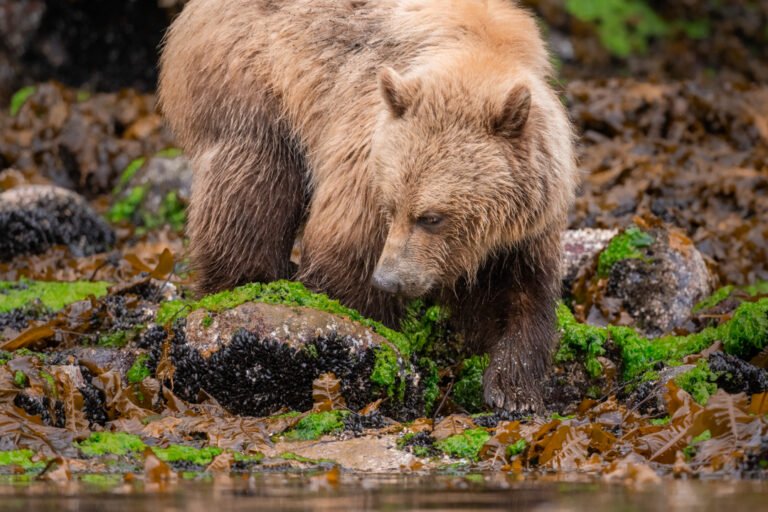
The chance of encountering bears is much higher in Ts’yl-os Park than elsewhere in this region. Be bear aware. The wilderness park has two small campgrounds that tend to fill up quickly in the summer months. There are two developed campgrounds located in the northern half of the park; Nu Chugh Beniz Campground at Chilko Lake’s midpoint, and Gwa Da Ts’ij Campground at the north end of the park on Chilko Lake, reached via Tatla Lake.
Itcha Ilgachuz Provincial Park is located in the Chilcotin Uplands east of the Rainbow Range of South Tweedsmuir Park. The park is extremely remote; the closest communities are Anahim Lake, Alexis Creek, Nimpo Lake, Redstone, and Nazko. No vehicle accessible camping facilities at this park, however wilderness, backcountry or walk-in camping is allowed. No facilities are provided.
The remote Nunsti Provincial Park is located on the Chilcotin Plateau, near the north end of Chilko Lake, south of the junction of the Taseko and Chilko Rivers. It is centred on Nunsti Creek and extends eastwards from the creek’s headwaters near Britanny Lake to the canyon of the Taseko River. Nunsti Provincial Park is located southeast of Chilanko Forks.
East of Chilanko Forks on Highway 20 is Redstone, a First Nations community of the Tsilhqot’in people, located at the confluence of the Chilanko and Chilcotin Rivers
West of Chilanko Forks is Tatla Lake, a small community near the western edge of the Chilcotin Plateau serving as a helicopter tour access point for several wilderness destinations, including the Homathko Ice Field and Mt. Waddington.
Circle Tour: See the best of BC when you embark upon one of the many circle tours that take in Vancouver Island, the Discovery Coast, the Sunshine Coast, the interior winelands or the remote Northern British Columbia. The coastal tours involve exciting rail, road and ferry trips, which is half the fun of travelling in British Columbia. Scenic highways flank the coast, taking you through charming beachside communities, rolling farmlands and majestic mountain ranges. Start your journey here and now, by selecting from one of the Circle Tours, designed to assist you in planning your journey by road through beautiful British Columbia.
Back to homepage: version2.britishcolumbia.com