Remote Muncho Lake is located within Muncho Lake Provincial Park on the Alaska Highway, west of Toad River and south of Liard River. Muncho Lake displays a perpetually blue hue, the result of copper oxides leached from the bedrock.
Flanked by mountains, the Terminal Range is on the west side of Muncho Lake, while the Sentinel Ranges, rising sharply above the campgrounds to the east, are near the northern limit of the Rockies.
One of the best ways to appreciate the mountains is to either get out on the lake in a boat or hike up into them from nearby trails. Highway 97 follows the east side of Muncho Lake and passes beside both Strawberry Flats and Machttps://britishcolumbia.com/wp-content/uploads/2020/07/discovery-islands-lodge-1-accommodation-quadra-island-british-columbia-1.jpg Campgrounds.
Back when the Alaska Highway was still a gravel road, the small roadside stations were the essence of life and travel along this long and lonely highway, and they still remain invaluable to the weary traveller today.
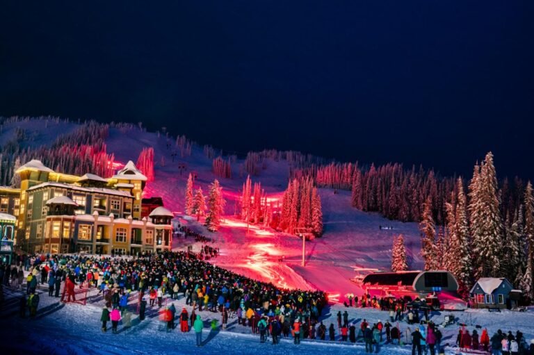
It is almost impossible not to observe wildlife as you travel through the Northeast, the so-called Serengeti of North America. The area’s spectacular wildlife fauna consists of eight species of ungulates, namely Stone Sheep, mountain goats, bison, moose, elk, caribou, and white-tailed and mule deer; plus at least seven species of medium-sized carnivores including wolves, coyotes, foxes, grizzly bears, black bears, lynx and wolverines.
Deer, moose, bears, and elk frequent clearings alongside roads, foraging for food. In some areas, salt licks have been placed near the road to attract ungulates. Be careful when driving these roads, especially at night; if you were to hit a moose, the chances are good that your vehicle would come out of the encounter in worse shape than the moose. Honest.
Population: 20
Location: Muncho Lake is located on the Alaska Highway 97, south of Liard River and 152 miles (245 km) west of Fort Nelson.
Hiking: There are no signed hiking trails, but much of the terrain is open. East of Muncho Lake, hiking routes up the numerous rocky draws and gullies will lead to rewarding vistas with wonderful examples of folded and faulted rock strata. West of Muncho Lake the backpacking is more difficult. Keen hikers can also hike part of the original Alaska Highway along Muncho Lake. There are two good spots to start from, at the Strawberry Flats campground and at the Muncho Lake Viewpoint.
A four-wheel drive road follows Nonda Creek at the park’s eastern boundary, offering spectacular views. Once at the viewpoint a number of hiking opportunities are available that run along open ridges and down into the valleys on horse routes.
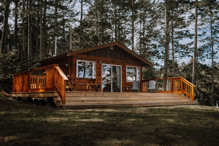
Muncho Lake Provincial Park has two separate campgrounds situated on the shores of one of the loveliest big lakes anywhere. Strawberry Flats Campground is located at the south end of the lake, while Machttps://britishcolumbia.com/wp-content/uploads/2020/07/discovery-islands-lodge-1-accommodation-quadra-island-british-columbia-1.jpg Campground sits roughly at the midpoint of the 7.5-mile-long (12-km) Muncho Lake. There are small beaches at each location. Car-top boats can be launched at Strawberry; Machttps://britishcolumbia.com/wp-content/uploads/2020/07/discovery-islands-lodge-1-accommodation-quadra-island-british-columbia-1.jpg has its own boat launch.
Wilderness campsites are located along the west shore of Muncho Lake for those willing to make the crossing by boat.
Winds: Beware the winds that rise on Muncho Lake and quickly whip up whitecaps. These same breezes will ensure that you wear a sweater on most days while camping here, even in the middle of summer.
Paddlers can challenge various stretches of the 1400-kilometre Liard River, which boasts rapids as difficult as those one the Colorado River. Rafting excursions on the Liard River are available. Whitewater Rafting excursions on the Liard River are also available. So, if you are looking for an unforgettable wilderness adventure with stunning scenery, moderate white water and a land teeming with wildlife look no further. Let your imagination be fulfilled on one of Canada’s most beautiful river expeditions.
Canoeing & Kayaking in Northern BC.
Liard Hot Springs, located in the Liard River Hot Springs Provincial Park , located about 12 miles (20 km) north of Muncho Lake on Hwy 97, is one of the few provincial campgrounds that remain open year-round along the Alaska Highway, and with good reason. Even in the depths of winter (which lasts eight months here) the hot springs are hot enough to provide relief to weary adventurers, whether they’ve been hiking on foot or on skis.
These springs are very popular with residents of the nearest town, Fort Nelson, 155 miles (250 km) south of the park, so be sure to reserve a space if you wish to overnight here. All sites are located in a heavily forested area of pine, trembling aspen, and cottonwood, a delightful environment at any time of year. Caution: Beware bears, even in areas where groups of campers are bathing.
Visit the Smith River Falls just north of Liard River. This pleasant picnic spot offers good fishing for dolly varden and grayling.
The Contract Creek Bridge at Mile 588 on the Alaska Highway marks the point where the construction crews met when building the section of the highway west from Fort Nelson and east from Whitehorse.
Stop at Toad River, south of Liard River at Mile 422 on the Alaska Highway, a town of 60 people with a collection of 4,580 hats – one for every mile between the Yukon and the continental United States, plus a few extras for every head in town.
At the Yukon border in Watson Lake, Signposts Forever is a must-photograph spot, with over 9,000 signs pointing the way home from the 60th parallel.
Circle Tours: See the best of Northern BC on one of the Circle Tours that capture the wonders of the north. The Circle Tour of Northern British Columbia incorporates the Alaska Highway through the Rocky Mountain foothills to Watson Lake in the Yukon, linking with the Stewart/Cassiar Highway and Yellowhead Highway 16 in the south. The Inside Passage Circle Tour and the Native Heritage Circle Tour follow the same route, from Port Hardy on Vancouver Island north by ferry to Prince Rupert. Catch another ferry to the Queen Charlotte Islands, or venture east on the Yellowhead Highway to Prince George, and south through the peaceful Cariboo to Vancouver along the historic Cariboo Wagon Road.
Circle Tours in British Columbia.