Braving freezing temperatures and risking arrest, an alliance of First Nations members and local landowners have camped out on the site of the first European settlement in British Columbia to protect the Peace River from destructive land clearing for the Site C dam.
While the camp has rightfully earned significant media attention, few outside the region are aware that it’s located in an area so high in ecological values that the B.C. government recognizes it as worthy of Provincial Park status, and designates it as an Old Growth Management Area.
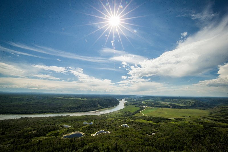
Travelling downstream along the Peace River from Hudson’s Hope to the site of the camp at historic Rocky Mountain Fort is a voyage through a rare landscape of natural heritage and wild beauty that needs to be protected for all British Columbians to enjoy.
While the northern bank rolls away in fertile plains and bountiful farmland, the southern bank rises from the life-giving waters of the Peace to encompass a richness of wildlife habitat and unique ecosystems.
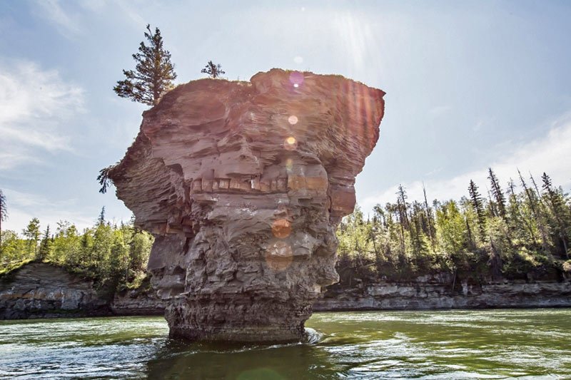
Streaming past columns of rock rising out of the turbulent waters of the upper Peace — dubbed “the teapots” by locals — the river flows past towering cottonwood stands and steep cliffs carpeted in spruce and aspen.
This is Peace-Boudreau, recommended for Provincial Park status in 1997, and appearing today on B.C. tourism maps as a star attraction. Yet it has not been formally protected despite decades of campaigning by local communities, First Nations, and scientists, and two recommendations from the region’s Land and Resource Management Plans.
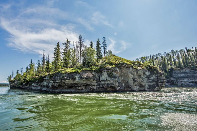
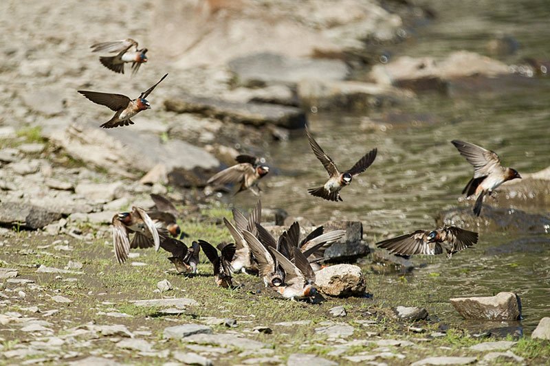
At more than 17,000 acres (7,000 hectares), the proposed protected area hugs the river shoreline, encompassing tributary creeks and aquatic features, such as the lower Moberly River and Boudreau Lake, and would protect high-quality habitat for a diversity of wildlife. The area provides high-value winter range as well as spring calving grounds on the islands for moose, deer and elk, and features a diverse range of wildlife, including grizzly bears, wolves, beaver and bull trout, and a plethora of bird species, such as osprey, eagles and trumpeter swans.
Peace-Boudreau was designed to protect the last remaining intact portion of the Peace River and conserve the Peace Lowlands, a critically underrepresented ecosystem in B.C. Only 0.4 per cent of these lowlands are currently protected, well below the provincial standard, while the proposed park would also provide representation of the moist warm Boreal White and Black Spruce Zone — another important ecosystem identified in this area.
Due to the heavy impact of oil and gas activity throughout Northeast B.C., protecting this region is vital from both a representative perspective as well as for ecological integrity. And yet the Site C reservoir would flood up to 30 per cent of these critical ecosystems, including all the islands.
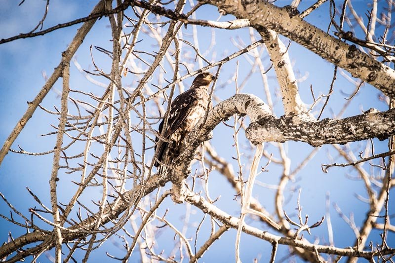
The B.C. government first identified Peace-Boudreau as a place of special significance in 1969 — a legally binding declaration to conserve it for the benefit of regionally and internationally significant fish and wildlife species. And much of the region, including the Rocky Mountain Fort site, falls within an Old Growth Management Area that recognizes the importance of its magnificent cottonwood groves and wildlife, such as nesting eagles, which depend on the forest for homes and food.
By allowing the clear-cutting of this land to proceed unchecked, the government has abandoned its responsibility to ensure Peace-Boudreau remains protected for the benefit of all. The stewards of the land camped out in the cold at Rocky Mountain Fort are stepping up to defend it.
Peace-Boudreau is a place of shared heritage, archaeological richness, First Nations cultural and economic importance and incredible wildlife habitat values combined together in a unique ecosystem that has been wisely reserved from destruction for almost 50 years. It’s time to protect Peace-Boudreau forever, starting with the rejection of the Site C dam.
By Tim Burkhart
Tim Burkhart is a Peace River Break Coordinator with the Yellowstone to Yukon Conservation Initiative, and a former researcher with the Cohen Commission.
Original Article
DeSmog Canada: Area to be Flooded By Site C Dam Was Once Recommended as Provincial Park
Photo Credit:
Feature Photo: One of the Peace River Islands, an important calving ground for ungulates in the Peace-Boudreau region. Photo: Tristan Brand.