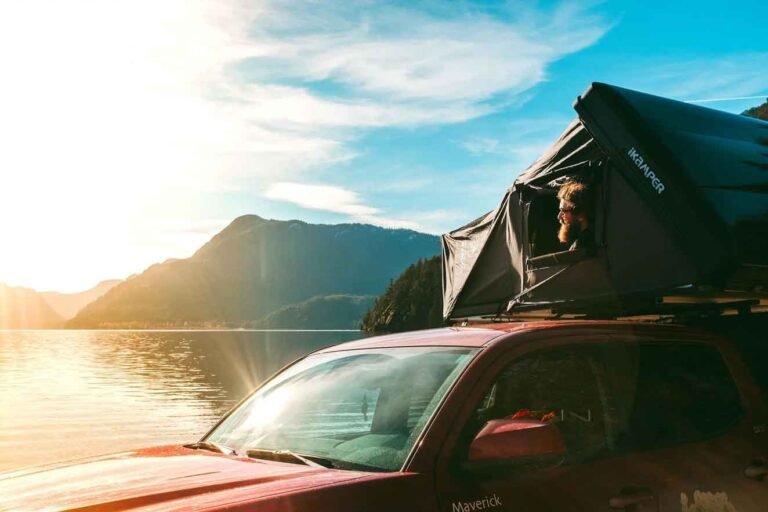
As you approach Vancouver, campsites become as rare as courtesy in rush-hour traffic. Out in the Fraser Valley, where folks have more breathing space, there are a number of stunningly beautiful public campgrounds.
Golden Ears is one of the largest provincial parks in British Columbia, encompassing an incredible 55,590 hectares of mostly undeveloped wilderness. It is also one of, and possibly the most popular park in the province. The park was named after the twin peaks of Mount Blanshard, which shine gold from the setting winter sun. Golden Ears lies in the Coast Mountains, north of the mighty Fraser River. It extends 55km north through untamed mountain wilderness to an impenetrable barrier of mountain peaks and steep-sided valleys that separate it from Garibaldi Provincial Park. Second-growth forests of western hemlock, western red cedar, and Douglas fir cover much of the landscape. At higher elevations, forests give way to alpine meadows and, at even higher elevations, permanent snowfields.
Golden Ears Provincial Park in Maple Ridge is a destination with may possiblities. Once there, you can fan out through the park to explore on foot, by boat, by bike, or on horseback.
Golden Ears Provincial Park contains one of the largest campgrounds in the province.There are 353 well-spaced vehicle/tent campsites at two locations inside the park, at Alouette Lake and Gold Creek Campgrounds, as well as wilderness, backcountry or walk-in camping at Alder Flats on the West Canyon Trail and Panorama Ridge on the Golden Ears trail, but no facilities are provided. All drive-in sites are nestled beneath tall stands of sheltering hemlock and fir. This canopy helps protect campers from the rain that is not uncommon here, even during summer heat waves. Hot showers are especially welcome after a day of ‘liquid sunshine.’ There are 55 campsites at sandy North Beach. The open beach in front of the forested sites is a great place to watch meteor showers in early August.
Campground Dates with Full Services and Fees:
Alouette campground is open from April 1 – October 9
Gold Creek campground is open from April 1 – October 9, Winter fee from October 10 to March 31; reduced services.
North Beach campground is open from June 16 – September 4
The closest store is in Maple Ridge approximately 14 kilometres away. There is a pay phone located at the park entrance.
There is swimming available at all campgrounds and day-use areas. Canoeing is very popular on Alouette Lake and rentals are available in the Alouette day-use area.
Freshwater fishing is available at Alouette Lake, Mike Lake and Gold Creek. Anyone fishing or angling in British Columbia must have an appropriate licence. There is one four-lane cement surface boat launch at the south end of Alouette Lake. There is overnight parking available for vehicles and trailers. There is no nearby marina to moor boats overnight. Waterskiing is permitted.
Cycling is permitted and there is an extensive network of horse trails. There are over 20 kilometres of gravel/dirt horse trails in the park. A permit is only required for commercial use of the horse trails. No camping or stopover in day-use allowed with horses except at the south beach corral area.
A large carving of a mountain goat greets visitors at the park gates. Stop at the visitor information kiosk located just inside the gate to pick up a map. Although it’s always a relief to reach this point, there is still another 7 miles (11 km) to drive into the park before you arrive at the entrance to Alouette and Gold Creek Campgrounds. Along the way you’ll pass the entrances to day-use areas at Alouette Lake and Mike Lake.
Golden Ears Provincial Park offers more walking and hiking close to Vancouver than any other single destination. Over a dozen trails lead to various destinations throughout the park, including a lengthy 8-mile (12-km) one-way journey to the Golden Ears themselves.
Adjacent to park headquarters, tiny Mike Lake is the starting point for the Alouette Mountain Hiking Trail (12 miles/20 km return) trek to the summit of Alouette Mountain. Although there aren’t many open views along the way, once on top you have a panoramic perspective south across the Fraser Valley into Washington and west across the Strait of Georgia to Vancouver Island. Shorter excursions in Golden Ears Provincial Park include the 2.6-mile (4.2-km) Mike Lake Trail. Search the understorey for signs of old logging equipment and wildflowers such as the delicate pink azalea, with petals shaped like five-pointed stars. By the beginning of summer, clusters of bright red elderberries hang from the branches that droop overhead. A month later, devil’s club, a relative of ginseng, with broad maple-shaped leaves, puts forth red berries from the ends of its pointed, and very prickly stems.
In addition, two more walking trails begin from the park’s Alouette Lake day-use area. The Lookout and Loop Trails each take walkers on a 1.5-mile (2.5-km) round trip from lakeside to an elevated viewpoint. Allow an easy hour to complete the loop, just time enough to dry off between swims. The Spirea Nature Trail is a short walk that winds through the woods adjacent to the park’s main road and introduces visitors to the fascinating variety of flora in the forest understorey. The trail begins from the parkway near the entrance to Alouette Lake.
Two trails begin from the Gold Creek day-use area parking lot, located at the north end of the park’s main road. Both lead to a set of waterfalls on Gold Creek. The Lower Falls Trail (easy; 3.5 miles/5.5 km return) is one of the most popular walks in Golden Ears Provincial Park. The East Canyon Trail (moderate; 17 miles/28 km return) is much rougher. One of the benefits of taking either route to the falls is the views of the Golden Ears and other peaks in this group that stand revealed on the skyline above Gold Creek.
Lower Falls Trail is a gentle, cedar-bark trail that winds through a mixed forest of mature vine maple and conifers. This is an especially pretty walk in autumn, when pancake-size bigleaf-maple foliage blazes red and reflects in the golden waters of the aptly named creek.
East Canyon Trail runs along the east side of Gold Creek and leads to the upper falls and far beyond. At first the trail follows a service road from the Gold Creek parking lot, past a metal gate, then left where it divides. (If you stay right, this road brings you to Alouette Lake’s North Beach in 15 minutes.) The road, signed with orange markers, climbs gradually uphill. Although you can’t see Gold Creek, its voice filters up through the surrounding forest. Moss-covered limbs of gracefully bowed vine maple frame the road. Large cedar stumps attest to the size of the ancient forest that once stood here. The rubble from runaway creekbeds, prone to flooding during heavy storms, cuts across the roadway in several places. At the ‘2.5 km’ sign lies the wreckage of an old log bridge that has been swept aside. A short distance beyond, watch for a rough trail, part of which is a broad, dry creekbed, that leads downhill to a dramatic view of the thundering falls. Mind your step here.
If you want to explore the far reaches of Golden Ears Provincial Park, hike the West Canyon Trail (easy; 6 miles/10 km return), which links with the Golden Ears Trail (moderate; 10 miles/20 km return) to eventually reach the summit of the north Ear, part of the two horn-shaped granite formations easily spotted from as far away as Washington and the southern Gulf Islands. An alpine cabin sits below the summit on Panorama Ridge and sleeps eight. In summer, many climbers use Panorama Ridge as their base to make an approach to the Golden Ears, which form the twin peaks of Mount Blanshard. A note of caution: Weather patterns in the region may change rapidly. Storm clouds smoke up the valleys so quickly that hikers on exposed sections of the trail may have little time to shelter. Hypothermia is always a threat, even on the hottest days. Plan (and dress) accordingly.
Golden Ears Provincial Park lies in the Coast Mountains 11 km north of Maple Ridge on the north side of the Fraser River. Access to the park is by vehicle via Highway 7 or Dewdney Trunk Road through the Municipality of Maple Ridge. If heading west, turn right onto 232nd and if heading east, turn left onto 232nd; then turn right onto Fern Crescent and follow road into park.
Nearby Regions & Towns
Park Notices