Cowichan River Provincial Park is a 750-hectare area stretching almost 20 kilometres, from the town of Lake Cowichan to Glenora, just south of Duncan. This spectacular provincial park protects significant stretches of the Cowichan River, a designated Canadian Heritage River that encompasses an impressive balance of nature, human heritage and recreational values.
This first-class recreational corridor allows for a myriad of recreational activities, from swift river kayaking to canoeing and tubing, from peaceful nature walks to exceptional hikes, all taking place on and around a river flowing through a glaciated valley in a stunning landscape. The park is internationally recognized for its wild salmon and steelhead trout, and for the historic Cowichan River Footpath that winds through dense Douglas-fir and Western Hemlock forest.
The Cowichan River originates at the easterly end of the community of Lake Cowichan. At its head is Cowichan Lake, the source of the river, twenty miles long and ringed by hills up to five thousand feet. The river is fed additionally by numerous small creeks from surrounding Vancouver Island Ranges as well as the smaller Somenos and Quamichan Lakes near the town of Duncan. Less than thirty miles away and five hundred feet lower, the river ends its journey at the sea, after rushing and fighting its way off the boulder-strewn floor of the valley, varying from swift rapids to waterfalls, to wide, slow channels through expansive valley flats.
Cowichan, derived from the Coast Salish word ‘Khowutzun’ meaning ‘land warmed by the sun’, is an area rich in First Nations history. The Cowichan Valley has been home to First Nations people from the earliest times. Cowichan is the collective name for a number of villages on eastern Vancouver Island. Today, the Cowichan Tribes make up the largest band in British Columbia and members of the band still own and reside on much of the land surrounding Duncan and along the Cowichan River.
The Cowichan River Footpath is an historic 20-km trail that winds its way along the scenic Cowichan River from Glenora to Skutz Falls. The Cowichan Fish and Game Association built the footpath during the 1960’s, and although the trail was primarily for anglers, it is now a popular spot for hikers and naturalists. The banks of the river support an interesting diversity of wildlife. This is an easy to moderate level of hiking, and you should allow about 6-1/2 hours to hike its length. If you plan to hike the complete trail, it’s advisable to arrange a pick-up at one end. The main trail is well marked, but several older secondary routes still exist, and these are not sign-posted or maintained.
Skutz Falls offers magnificent views of river rapids and a man-made fish ladder, and is a prime location from which to watch spawning salmon ascend the fish ladder in the fall, or for a picnic at the end of a day’s hike. The Cowichan River is home to seven species of game fish; coho, chinook and chum salmon, and steelhead, rainbow, brown and trout. The cowichan is one of only two rivers in British Columbia known to contain Brown Trout.
Marie Canyon day-use area overlooks the Cowichan River as it surges through a spectacular sheer rock canyon. This is also a prime location to watch spawning salmon in the fall, and an excellent area for kayaking and canoeing. Experienced whitewater kayakers may wish to navigate the river between Skutz Falls and Marie Canyon. Swimming and tubing are popular activities at the Stoltz Pool day-use area and below Skutz Falls.
There are 39 drive-in and 4 walk-in sites at the Stoltz Pool campsite. Campsite reservations are accepted. The Stoltz Pool Campground is open with full services year round. Campsites are available on a first-come, first-served basis, with some sites reservable through Discovercamping.ca. A reduced winter camping fee is in place. The old Skutz Falls Campground is now closed indefinitely.
The restored 66 Mile and Holt Creek railway trestles along the Trans-Canada Trail offer spectacular river views and the opportunity to imagine back to a time when log-laden traincars would thunder along these tracks high above the Cowichan River.
The 66 Mile trestle and the Skutz Falls forest service bridge provide access to the Skutz/66 Mile Loop Trail, which encorporates a section of the Cowichan River Footpath.
This 8-kilometre trail offers spectacular views along the Cowichan River as it travels through a steep canyon environment high above the Cowichan River. The trail loops on both sides of the river, with sections of the trail down at river level providing easy access to the river.
At Stoltz Pool, the picnic site overlooks the river from a grassy area nestled in a grove of old big leaf maple trees. The Stoltz Pool Loop is a relatively short, gentle trail that runs adjacent to the river for much of its length before gently climbing inland through second-growth forest above the campground.
The Burma Star Memorial Cairn, a replica of the Kohima Monument in Myamar (Burma) is located at the day-use area of Stoltz Pool. The cairn was erected by the Burma Star Association to commemorate and tell the story of Major Hoey and the Allied Second World War campaign in East Asia.
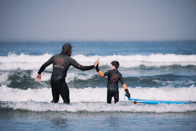
Cowichan River Provincial Park provides access points at various locations along the river, which allows canoeists and kayakers of all skill levels the opportunity to gain experience on the water. During the summer months tubing is extraordinarily popular on the Cowichan River. Thousands will bob and spin down the river, through peaceful bends and invigorating rapids.
Cowichan River Provincial Park stretches from the town of Lake Cowichan to Glenora, just south of Duncan, and can be reached from Highway 18 or from Highway 1, south of Duncan.
West Access: Skutz Falls Road provides access to Skutz Falls Day Use area, Horseshoe Bend Group Campsite, Marie Canyon Day Use area, and the Skutz Falls Trailhead of the Cowichan River Trail. Follow signs from Skutz Falls Road via Cowichan Lake Road and Mayo Road to Riverbottom Road.
Middle Access: Located off Highway 18, the Highway 18 Connector provides access to the Stoltz Pool Campground via Stoltz Road.
South East Access: Located on Robertson Road in the Glenora area south of Duncan. Proceed west on Glenora Road, turn right onto Vaux Road and continue down Vaux Road as it leads to Robertson Road. This provides access to the Holt Creek Trailhead of the Cowichan River Footpath.
Other provincial parks nearby are Gordon Bay Provincial Park and Koksilah River Provincial Park.
Cowichan River FootpathThe Cowichan River Footpath in the Cowichan Valley is an historic 20-km trail that winds its way along the north and south sides of the scenic Cowichan River, from Glenora to Skutz Falls. Although originally constructed and used by anglers, the Cowichan River Footpath connects all the river’s parks and makes for an excellent scenic hike along the meanders of the Cowichan River, providing a pleasant ramble through Cowichan River Provincial Park.
Hikers, naturalists and spectators of canoeing and kayaking also enjoy the use of the path. Highlights include salmon runs in fall and the large, open recreation site at Skutz Falls. The Swinging Bridge at Skutz Falls is quite a feature, linking the tow sections of the Footpath. The Cowichan River footpath was developed by the Cowichan Fish and Game Association between 1960 and 1969, with the co-operation of government, industry and private individuals. Their clubhouse is at the eastern trailhead of the Cowichan River Footpath.
The lower stretch of the footpath, from the clubhouse to Skutz Falls, is well-defined (blue and white markers) and brushed out seasonally. The bridges are in good repair, and there are some steep sections. This is the more frequented section of the footpath, beautiful at any time of the year, with many excellent picnicking spots.
The up-river section from Skutz Falls to Old Cowichan Lake Road receives less maintenance, but it is regularly used by anglers. In some places erosion of the river bank, winter flooding and obliteration by logging forces hikers to detour by road or along the old railway right-of-way. This section is on level ground and fairly close to the river, with several good swimming spots en route.
In summer the trail can be rather overgrown in places, and a little south of the Mile 71 CNR trestle the route becomes less distinct. Some spawning channels have been built close to the old railway bridge. Trail users should note that no emergency aid is readily available over much of the path.
Access to start of footpath at Clubhouse: To find the trailhead, head west of Highway 1 in Duncan on Allenby Road, then south on Indian Road, then make three successive right turns onto Glenora, Vaux, and Robertson Roads. The trail begins from the parking lot of the Cowichan Fish and Game Association, 250-746-1070. There is ample parking and camping space, toilet facilities, water and an emergency telephone.
Access to Skutz Falls: There aren’t many waterfalls as easily approached as Skutz Falls. To reach the falls, head west of Highway 1 on Highway 18 for almost 12 miles (19 km) to Skutz Falls Road. Drive south along this winding gravel road for almost 2 miles (3 km) to the Mile 12 section of the footpath, the fish ladders, parking and camping area. Another 500 metres will bring you to the bridge. Additional parking, minimal camping facilities, and toilets are nearby. From Skutz Falls many short hikes are possible; some hikers prefer to hike the whole footpath and camp along the way.
Access to the footpath at Cowichan Lake end: From the Skutz Falls turn-off on Highway 18, drive 4 km west on the Old Cowichan Lake Road. At the corner, close to the end of the houses in the 7400 block, look for the Ministry of the Environment fishing notice and a ribboned strut on a hydro pole next to a limited parking area on the road shoulder.
Hiking Distances:
- From Clubhouse to Holt Creek return on circle route: 1.5 miles/2.4 km
- From Clubhouse to Mile 2 return on circle route: 4 miles/6.4 km (good picnic spots)
- From Clubhouse to Skutz Falls one way: 12.5 miles/20 km (allow 6-1/2 hours)
- From Skutz Falls to Old Cowichan Lake Road trailhead one way: 9 miles/14 km (4.5 hrs)
Fishing along the Cowichan River Footpath
Vancouver Island waterways are characterized by relatively short watersheds. The Cowichan River is an exception to this general rule. Anglers can cover much of the Cowichan River Footpath’s 12 miles (19 km) of trails beside one of Vancouver Island’s most popular fly-fishing locales in one of British Columbia’s best fishing rivers and, according to knowledgeable sources, one of the world’s best salmon and trout rivers. Brown, rainbow, and steelhead trout, as well as vigorous salmon runs, make fishing here legendary. Brown trout were successfully introduced here about a century ago and coexist with the native stocks.
Altogether, the oxygen-rich water supports ten species of trout, salmon, and char. A controversial weir controls the outflow of water from Cowichan Lake into the river and guarantees stable streamflow conditions for most of the year. Big rainbow trout come down out of the lake to feed on salmon roe and overwinter in the river before returning to the lake by June. Chinook, coho, and steelhead that school in Cowichan Bay enter the river to spawn in November and December. There’s also a steelhead run in March.
Notes:
- The Cowichan River is treacherous. Swimmers, canoeists and kayakers should beware.
- No vehicles are allowed on the footpath. Observe all notices about private property, the lighting of fires and camp only on crown land.
- Do not litter the footpath. All maintenance is done by volunteers and there are no garbage cans or toilets along the way, except in the Skutz Falls area.
- The word “skutz” is from the Indian word “Skwetz” meaning “falls”
- The Cowichan River is one of BC’s top ten endangered rivers. Its wilderness character and wildlife are threatened by logging, water extraction, development and overuse.
- Maps for the Cowichan River Footpath can be obtained from the Visitor Centre in Duncan.
Nearby Regions & Towns
Park Notices