Premier Listings: Hiking & Backpacking: Cariboo, Chilcotin, Coast
The Cariboo region of BC offers hundreds of trails for hikers, cyclists and horseback riders.
The Blackwater Canyon Trail is a well marked 3-km round trip hike along the Blackwater River, following Blackwater Canyon through pines and flowers to the canyon rim – and several viewpoints and picnic sites. The trailhead is located at the Blackwater Crossing Recreation Site, 37 miles (60 km) west of Quesnel on Blackwater Road.
The Cameron Ridge Trail is a 14-km round trip hike winding through subalpine forest and meadows along windswept ridges. The Cariboo Mountains Lookout at the 3-km point of the trail sits atop a 1,000-metre cliff dropping straight down into the North Arm of Quesnel Lake. The Cameron Ridge Viewpoint provides spectacular views of Mitchell Lake, the Mitchell River estuary, and Penfold Valley. Three separate trails are all well marked. Hikers should note that black and grizzly bears inhabit the area. Access to the trailhead is located 70 km from Likely on the Cariboo Lake Road (8400 Road), 5 km past Maeford Lake.
The 33-km Collins Overland Trail follows part of the historic Collins Overland Telegraph Company survey route from Whittler Creek, northwest of Quesnel, to Pantage Creek. Work parties from the Collins Overland Telegraph Company pushed through the Telegraph Trail starting in 1866, part of a grand attempt to link Europe and America via telegraph lines extending through B.C., Alaska and overland through Siberia and Russia to Europe. The project was cancelled in the late 1860s when a cable was laid along the seabed. The trail follows Blackwater Road for most of the route.
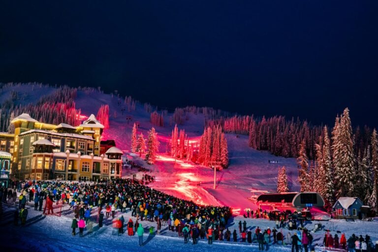
The Wells/Barkerville area is home to several exhilarating trails suitable for an afternoon ramble, including the Mount Agnes Trail that goes from Barkerville to Richfield following the route of the original Cariboo Wagon Trail to Summit Rock. An easy walking trail connects Lowhee Campground in Barkerville Park with Barkerville Cemetery and Barkerville Historic Town. You can also attempt a longer hike up the famous Yank’s Peak – 19 kms from Keithley Creek to Barkerville mining road over the Cariboo Mountains. The jaunt over the top of Yank’s Peak, perhaps more suitable for snowmobiles or 4×4 vehicles, is well worth the time and trouble. Breathtaking scenery, old mines, wildlife and rolling alpine are encountered on the route to Likely. Yank’s Peak was named after Bill Luce, a well-known American miner.
In Big Bar Lake Provincial Park, northwest of Clinton, a 2-km loop trail leads over the eskers and around the otter marsh providing beautiful views of the Marble Range and Fraser Plateau, as well as excellent bird-watching. Ducks Unlimited have built a water control structure at the end of the marsh to encourage waterfowl nesting.
Trails in Horsefly Lake Provincial Park, on the northern shore of Horsefly Lake northwest of Horsefly, lead from the campground to Viewland Mountain, and to alpine meadows at Eureka Peak. There are also historical features and fossil beds to explore.
At Ten Mile Lake Provincial Park, 11 km north of Quesnel on Highway 97, there are 10 km of hiking trails, including a self-guided nature trail leading to a beaver pond. In winter these trails are transformed into cross-country ski trails.
The Williams Lake River Trail is a 14-km (4-hour) one way hike through the Williams Lake River Valley and canyon that stretches from its origin at Williams Lake to the river’s confluence with the Fraser River. The river drops over 500 feet from Williams Lake to the Fraser River as it meanders past meadows, hoodoos, sagebrush, juniper, and grassy benches.
Dramatic cliffs line the valley, and BC Rail’s Cariboo Prospector line follows the north slope, over 600 feet above the river. The trail is well developed with 20 wooden foot bridges – mainly BC Rail boxcar floors – and is popular with hikers, riders and horseback riders. The signed multi-user trail section runs 4.7 kms from the BC Rail station. The valley corridor is accessed at several points along Mackenzie Avenue and Soda Creek Road (Weldwood).
Wells Gray Provincial Park, north of Clearwater, is laced with hiking trails, ranging in length from 1 to 15 miles (1.5 to 24 km) one way. The Helmcken Falls Rim Trail (easy; 5 miles/8 km return) leads from the Dawson Falls Campground on Clearwater Valley Road and follows the rim of the falls for much of the way. The thunder of the falls grows louder as you approach them, gradually drowning out all other sounds. In winter this trail is open for snowshoeing and cross-country skiing for those who wish to see the falls covered with a thick mantle of ice.
Much of the park’s topography is the result of glacial erosion and volcanic activity. One of the best hiking trails from which to observe this is the Pyramid Mountain Trail (moderate; 8 miles/13 km return), which leads to the summit of Pyramid Mountain, from where hikers enjoy spectacular views of the Premier Ranges across the north end of the park. The mountain itself exhibits fascinating volcanic characteristics. Geologists believe that Pyramid Mountain built up gradually beneath a thick glacial sheet as magma erupting beneath the ice was chilled and shattered into tiny fragments by cold water and ice. Over time, these fragments accumulated around the vent to form a mound-shaped structure.
Hikers looking for an opportunity to journey deeper into the park should follow the Horseshoe Falls Trail (strenuous; 21 miles/34 km return), which shares the Pyramid Mountain Trail and then continues beyond to Horseshoe Falls. Wilderness campsites are located at the 5-mile (8-km) point and at the top of Horseshoe Falls. The well-marked trailhead is located about 3.75 miles (6 km) north of the park entrance on the east side of Clearwater Valley Rd. Some of the best routes in the park feature lovely alpine hiking, with various huts to stop at along the way.
The following shorter hikes in Wells Gray Park can be accessed from the Cariboo side:
- Canim/Mahood Falls: The falls are situated on the waterway separating Mahood and Canim Lakes, a short hike off the Canim Lake South Road, northeast of 100 Mile House.
- Tommy Archie Trail: A short 1-km trail leads from the Pendleton FS Road (off Hendrix Road and Spanish Creek Road) to the small Tommy Archie Lake.
- Deception Falls Trail: The trailhead for the 30-minute hike to the popular Deception Falls is located just east of where Deception Creek flows into the northern side of Mahood Lake. Access is on Mahood Lake North Road.
Hikers with a historical bent would appreciate tackling some or all of the Nuxalk-Carrier Grease Route, known as the Alexander Mackenzie Heritage Trail, which stretches a full 264 miles (420 km) from the mouth of the West Road (Blackwater) River between Prince George and Quesnel to the Sir Alexander Mackenzie Provincial Park, a small coastal park located near Elcho Harbour on Dean Channel, approximately 65 km northwest of Bella Coola on the central coast of British Columbia.
Alexander Mackenzie is Canada’s Lewis and Clark, both wrapped up into one intrepid explorer. Mackenzie was the first European to cross the Rocky Mountains and view the western seas from the shores of northwestern North America, preceding the more widely known Lewis and Clark expedition by 12 years. Mackenzie and his party trekked overland and by canoe from Lake Athabaska in 1793 on behalf of the North West Company in search of a trade route to the Pacific. His journey took him 72 days and covered over 1,240 miles (2,000 km) of unmapped terrain. Near Prince George, he set out on foot across the Interior Plateau, through the Rainbow Mountains and down Burnt Bridge Creek.
Where the creek enters the Bella Coola River, they rested at a community that was named “Friendly Village” because of the hospitality of its Nuxalk inhabitants. These people guided Mackenzie and his men down the river into Dean Channel. A dispute between the Nuxalk and the coastal Heiltsuk people prevented them from reaching the open sea, but Mackenzie was satisfied that his mission was complete.
His journey followed pre-existing trading trails established by Native British Columbians. The trails were used by First Nations primarily for trading eulachon (a small, smelt-like fish) grease, perhaps the most valued commodity in the northwest. Long before Europeans discovered North America, First Nations peoples used a network of trails between the west coast and the interior of British Columbia for trade and travel. Because these trails were commonly used to transport eulachon grease, they are now referred to as “grease trails”.
At the westernmost point of his journey, Mackenzie wrote on a rock in reddish paint made of vermilion and bear grease: “Alex Mackenzie from Canada by land 22nd July 1793“. Now called Mackenzie’s Rock, the rock near the water’s edge still bears his words, which were later permanently inscribed in the rock by surveyors.
The major appeal of the extensive backcountry hiking or horseback riding trail is the opportunity for long-distance wilderness travel along an historic route that follows the footsteps of First Nations peoples, Alexander Mackenzie, and other explorers. The trail’s hiking terminus is at Burnt Bridge Creek, adjacent to the western boundary of Tweedsmuir Provincial Park, where it is intersected by Highway 20.
Designated as the first heritage trail in British Columbia in 1985, the Alexander Mackenzie Heritage Trail is gaining international recognition among hikers who wish to make a three-week trip along this historic route. The trail includes local wagon roads, provincial highways, forest access roads, rivers, and coastal waterways. Approximately 186 miles (300 km) of this corridor is recreational trail, and about 62 miles (100 km) is well-preserved aboriginal footpath. The 50-mile (80-km) stretch of the trail in Tweedsmuir Provincial Park, which takes five to seven days to travel, is perhaps the most scenic of the entire route. A short section of the trail that offers views of the Bella Coola Valley and south to Stupendous Mountain can be reached in a one- to two-hour loop from Burnt Bridge Creek.
The heritage trail spans an area traditionally occupied by three culturally distinct Native groups: the Nuxalk people of the Bella Coola Valley, an enclave of the Salishan linguistic group; the Heiltsuk people of Bella Bella and the Outer Coast, members of the Wakashan linguistic group; and the Southern Carrier people of the Interior Plateau, members of the Athapaskan linguistic group. There are a number of prehistoric cultural sites along the trail. Several are at Bella Coola and in Tweedsmuir Provincial Park, and about eight are located in the Upper and Lower Blackwater River areas. Portions of the trail itself have been in use for thousands of years.
It is not necessary to hike the 264-mile (420-km) route from Prince George to Bella Coola in one trek in order to get a feeling for what Mackenzie encountered. There are a number of access points to the trail, mostly in the first 60 miles (100 km) or so. The main trailhead begins next to a parking lot on Blackwater Road, southwest of Prince George, near a viewpoint that overlooks the Blackwater River Valley. To reach it, travel about 37 miles (60 km) south of Hwy 16 on Blackwater Road, which begins west of Prince George. You can also fly in via floatplane to points along the trail – or, rather, trails, as this is not so much a single trail wending over hill and dale as it is a network of interconnected trails, fragmenting into a dizzying array of routes in some places.
Sometimes, these are just different routes around a lake, while at other points the trails lead to different destinations entirely. Proper maps and a compass are indispensable. To obtain a detailed map, contact the Forest Service’s Prince George Regional Office, 250-565-6100. The main trail stretches from the primary trailhead, just south of Prince George where Blackwater Forest Service Road ends at the confluence of the Blackwater and Fraser Rivers, through Tweedsmuir Provincial Park and all the way to Bella Coola, though not to the actual site Alexander Mackenzie reached.
If you do attempt to hike the entire trail in one fell swoop, bear in mind that experienced hikers can expect to take three weeks, and most of the trail runs through remote wilderness areas, far from civilization. The trail is best done in late summer or early fall. Any earlier, and the black flies and mosquitoes in some of the lower, wetter areas can be unbearable.
In order to reach Sir Alexander Mackenzie Provincial Park, hikers must still travel the last segment of the journey by boat, as Sir Alexander Mackenzie did. Anchorage at the historical rock is poor and exposed to high winds. Temporary anchorage is possible in the cove immediately to the west of the point, but it is shallow and exposed, and suitable only in settled weather. Better protection is found at the head of Elcho Harbour, two miles farther west.
Since portions of this trail may be on or near private property (including Native reserves), trekkers should check with the BC Parks district office, 181 First Avenue N in Williams Lake regarding access. Staff there can also supply information on current maps, local conditions, and available guides. No matter how much or little of the trail you want to hike, you must plan ahead. An excellent 200-page guide to the entire trail is In the Steps of Alexander Mackenzie, published by the Alexander Mackenzie Trail Association, Box 425, Kelowna BC, V1Y 7P1.