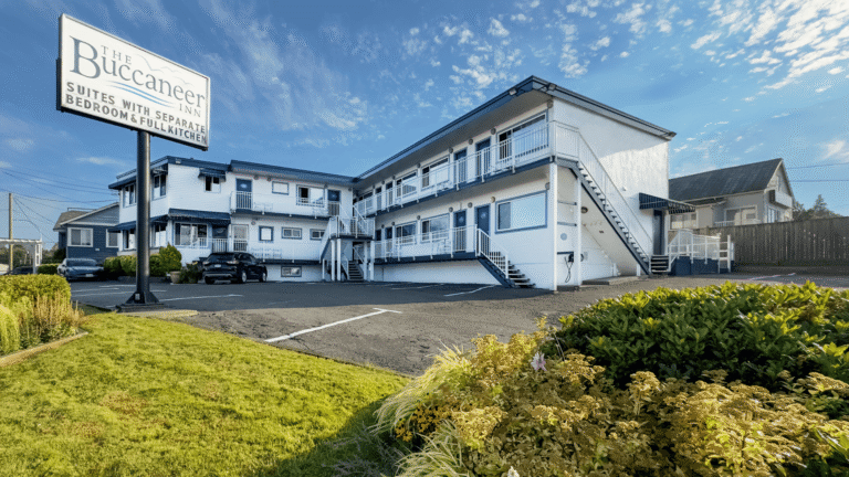
Premier Listings: Private Campgrounds & RV Parks: Kootenay Rockies
Crowsnest Highway 3: The East Kootenays
Yahk Provincial Park sits just north of the British Columbia – Idaho border on the banks of the Moyie River. Yahk is a pleasant little campground, on the south side of Hwy 3, 22 miles (35 km) east from Creston.
Moyie Lake Provincial Park occupies the north end of Moyie Lake, a large scenic lake on the eastern fringe of the Purcell Mountains. If you like cool, secluded picnics beside a welcoming lake on a hot summer day, this is the spot. When you want to explore after the tent is set up, there’s a marsh with a fascinating community of plants and animals, plus the forested Meadow Trail. Fly-casting and trolling for trout and other fish are also fun here; the lake has a boat launch. The park is beside Hwy 3, 12 miles (19 km) south of Cranbrook.
Jimsmith Lake Provincial Park, just south of Cranbrook, is a popular park for year-round outdoor recreation. It’s centred on small Jimsmith Lake, a good ice-fishing site in winter. Once the ice thaws, the boat launch swings into action, but only nonmotorized boats are allowed on the lake.
Mount Fernie Provincial Park is a small park with a big personality. Black bear, deer, and elk are commonly seen in these parts, and if they drop by for a visit, you better be on your best behaviour. To take your mind off that, follow the trail that leads beside Lizard Creek. Let the small waterfall that the creek forms as it near its confluence with the Elk River do your thinking for you. You find this well-signed, semiwilderness park just off Hwy 3, about 2 miles (3 km) west of Fernie.
If you’re travelling with an RV, Elkford Municipal Campground may be best for you – vehicle/tent sites are featured in the freshest air in the Rockies. The campground is located on Hwy 43, 22 miles (35.5 km) north of Sparwood.
Columbia River Valley
Off the beaten path, Norbury Lake Provincial Park is situated in the broad, rolling valley of the Rocky Mountain Trench, a remarkable feature extending north almost 750 miles (1210 km) from the US border through the Rockies and the Purcells. Not surprisingly, there’s a spectacular view here of the Steeples (in the Hughes Range of the Rockies). The campsites are well spaced beside Norbury Lake. Nearby, Peckham’s Lake offers good boating (self-propelled craft only) and swimming in summer. There aren’t any winter facilities here, but cross-country skiing, ice fishing, and skating are all worth trying. From Cranbrook, Norbury Lake Provincial Park is about 24 miles (38 km) east; from Fort Steele, about 11 miles (17 km) southeast, off Hwy 93. The entrance is from Wardner-Fort Steele Road.
Friendly Wasa Lake Provincial Park sits at the northern end of Wasa Lake, one of the best recreational lakes in the East Kootenays (and one of the warmest in the province). The beaches here are very good, with sandy shores from which to launch car-top boats, and excellent swimming conditions. Two separate picnic/day-use areas are complemented by an amphitheatre and a self-guided nature trail. In winter, the cross-country ski trails are well groomed, and there’s even a lit, maintained ice rink. Wasa is about a 13-mile (21-km) drive northeast from Kimberley via Hwys 95A/95 or north from Fort Steele on Hwy 93.
Thunder Hill Provincial Park is a small, tucked-away roadside campground with spectacular views of Columbia Lake and the undulating terrain of the Rocky Mountain Trench. In the past, Kootenay First Nations camped near this site and named it for the stormy natural phenomenon they experienced. Nearby are the remnants of the Thunder Hill mine tramway. Take Hwy 93/95 for 43 miles (69 km) north of Kimberley, just past Canal Flats.
Whiteswan Lake Provincial Park is a favourite destination for anglers. Campsites are spread out among four locations in the park, primarily at Alces Lake Campground, Packrat Point Campground, and Inlet Creek Campground, all easily accessed from the Whiteswan Forest Road. More sites are located at Homebasin Campground, reached via the Moscow Creek Forest Road, which branches away from Whiteswan Forest Road at the northwest corner of Whiteswan Lake. To reach the park, go south from Canal Flats on Hwy 93/95 to Whiteswan Forest Road, then take Whiteswan Forest Road about 12 miles (20 km) east.
Kootenay National Park blankets almost 350,000 acres (140600 hectares). Its lands were ceded to the federal government from British Columbia in 1919. In return, the federal government built the Banff-Windermere Rd (Hwy 93) – the first motor road through the Canadian Rockies. After severe construction difficulties, the road was completed in 1922; in 1952, it was rebuilt and repaved, and remains a favoured route for visitors.
Situated on the west side of the Continental Divide, Kootenay National Park extends across the valleys of the Vermilion and Kootenay Rivers, touches on the Rocky Mountain Trench at Radium Hot Springs, and straddles the Main and Western Ranges of the Rockies. Some of these peaks rise to 11,000 feet (3355 m). The 110 deg F (43 deg C) waters at Radium Hot Springs come out of the Redstreak breccia fault line, a unique area of red cliffs and shattered rocks, and, like most hot springs, these are well worth relaxing in. (You can also find mineral hot springs bubbling out of the canyon of Sinclair Creek.)
The park features three major campgrounds: the biggest one, Redstreak Campground, can only be approached from the south side of Radium Hot Springs, 2 miles (3 km) southeast of the park’s western entrance at the junction of Hwy 93/95. A 30-minute walking trail links the campground with Radium Hot Springs.
McLeod Meadows Campground occupies a quiet, wooded area on the banks of the Kootenay River. The wildlife is plentiful; in early summer, it’s a special treat to see the orchids bloom in the nearby meadows once the snow has melted. This campground is located 16 miles (26 km) north of Radium Hot Springs on Hwy 93. A dense subalpine forest is the setting for Marble Canyon Campground. It’s 27 miles (43 km) north of McLeod (9 miles/ 14.5 km west of the park’s east entrance).
Two major forest fires swept through the park last century, destroying more than 21,000 acres (8505 ha) and affecting the plant community. Glacial erosion has left fascinating patterns everywhere – cirques, moraines, hanging valleys, and more. Especially notable are deep cuts into the limestone at Rockwall Canyon and Marble Canyon. If you want the hottest and driest environment in the area, head south into the Columbia Valley and Lower Kootenay Valley and explore the forests. In the northern area around the Upper Kootenay Valley and Vermilion Valley, the summers are moderate and the winters severe. You’ll find the alpine zone above 6,561 feet (2001 m) with its own beautiful flora. Some wetland communities have developed around ponds, beaver dams, and small lakes.
Wildlife is much in evidence. A band of Rocky Mountain bighorn sheep have their summer range near Radium Hot Springs; mountain goats can be spotted in the Mount Wardle area. Two words of warning about elk and bears: the elk population has grown, and in winter they migrate down the valley and congregate along the highway. Drive carefully. Ask for information on bears from an information officer or a warden: black bears are present throughout the park, and grizzlies frequent the avalanche slopes in the spring, digging for tender lily bulbs.
Most of the park’s waters are glacier-fed and are too cold to provide sufficient nutrients for fish growth; however, some of the lakes have been stocked, and you might try for whitefish and native dolly varden, or for stocked trout in the rivers.
Finally, on your rambles, you might justifiably feel a part of history. Archaeological evidence shows that the mountain passes and river valleys have been major trading routes for thousands of years for Natives, and pictographs near the hot springs suggest its role as a gathering place. Hudson’s Bay Company traders also travelled through here.
Other facilities at the park include an aquacourt and fully developed pool area, picnic/rest stops along the highway, self-guided trails, warden stations and backcountry warden-patrol cabins, and more than 124 miles (200 km) of hiking and cross-country ski trails. Powerboats are not allowed anywhere in the park; other boating is permitted only on the Kootenay and Vermilion Rivers. (Note: Only experienced paddlers should attempt to canoe on the Kootenay.) For some activities, arrangements must be made in advance. Backcountry hikers, campers, and mountaineers require a park use permit from a park officer to make overnight trips. Registration is required at the park information office or with the warden for group camping at the Dolly Varden Picnic Area, for using the winter vehicle trails, and for winter camping and snowmobiling.
Kootenay National Park is open year-round. The western entrance to the park is located in British Columbia at the junction of Hwys 93 and 95 in the town of Radium Hot Springs. Radium Hot Springs is located 64.5 miles (104 km) south of Golden and 88.5 miles (143 km) north of Cranbrook. The park’s eastern entrance is located at Vermilion Pass in Alberta.
If you can’t get into Kootenay National Park, you might try Dry Gulch Provincial Parkk, just 5 miles (8 km) south of Radium Hot Springs on Hwy 93. Dry Gulch is frequently used as an overflow campground for the popular National Park nearby.
Campgrounds & RV Parks
Information on Provincial Park Campgrounds and Reservations, National Park Campgrounds and Reservations, Camping on Crown Land in BC Recreation Sites, Frequently Asked Questions on Parks and Campgrounds, and Provincial Park User Fees. Go to Campgrounds & RV Parks.