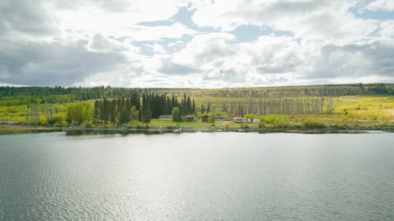
The Thompson Okanagan region of British Columbia border starts in the south, near the BC / US border. Spectacular backcountry surrounds the arid Osoyoos and Oliver regions as you head north through Kelowna and the Okanagan Valley, through orchards and vineyards, and some of the best fruit and vegetable-growing land in the world. Dozens of parks surround Okanagan Lake, and outdoor adventure awaits at Silver Star, Big White, and Apex Mountain. North of Kamloops, the Yellowhead Highway follows the green-hued North Thompson River through the Thompson Plateau until you have sight of the snaggle-toothed Mount Robson in the north.
Thompson Nicola
Travellers to the North Thompson soon realize that they’re sharing this part of British Columbia with relatively few people. Nothing is as arresting as the sight of snaggle-toothed Mount Robson or the sinuous, green-hued surface of the North Thompson River. It’s easy to go with the flow here.
- Ashcroft
- Barriere
- Blue River
- Cache Creek
- Clearwater
- Coquihalla Highway
- Gold Country
- Heffley Creek
- High Country
- Kamloops
- Little Fort
- Logan Lake
- Merritt
- Nicola Valley
- Savona
- Spences Bridge
- Sun Peaks
- Tete Jaune Cache
- Trans Canada Highway 1
- Valemount
- Walhachin
- Yellowhead Highway 5
Okanagan Similkameen
You can’t really say you know British Columbia until you’ve travelled this area, certainly one of the liveliest in the province. A series of gentle mountain ranges rolls between the Thompson Plateau in the west and the Shuswap Highlands to the east, then rises dramatically in the Selkirk and Monashee Mountains.
- Armstrong
- Boundary Country
- Cherryville
- Crowsnest Highway 3
- Enderby
- Grand Forks
- Greenwood
- Hedley
- Kelowna
- Keremeos
- Kettle Valley
- Lake Country
- Lumby
- Midway
- Naramata
- North Okanagan
- Okanagan Falls
- Okanagan Valley
- Oliver
- Osoyoos
- Oyama
- Peachland
- Penticton
- Princeton
- Rock Creek
- Silver Star Mountain
- Similkameen Country
- South Okanagan
- Summerland
- Trans Canada Highway 1
- Tulameen
- Vernon
- Westbank
- Winfield
Shuswap
The Shuswap boasts the largest houseboat fleet in Canada, offering over 1,000 kilometres of shoreline to explore, amidst spectacular scenery and a pristine environment – a fabulous place to vacation with family and friends, lazily drifting along the lakes gazing at blue skies and gorgeous mountains.
Thompson Okanagan
Starting in the south, near the US border, you’ll find spectacular backcountry, with the remains of old mining settlements dotting the highway. After you pass through the arid Osoyoos and Oliver regions and head north up the valley, you will encounter orchards and vineyards, evidence of some of the best fruit- and vegetable-growing land in the world. Dozens of parks surround Okanagan Lake, an outdoor adventure playground where the only difficulty is deciding what to do with your time. Ski at Silver Star, Big White, or Apex? Wilderness camp at Okanagan Mountain, or farther north at Monashee? Mountain bike at Kalamalka, or at Silver Star? Wait, wasn’t that where you were thinking of skiing? As you can see, the choice is dizzying: Many of the spots you love in one season offer a whole new set of opportunities in another. To put it simply, this is one area worth spending some serious time in.
North Thompson Okanagan
This southern stretch of Highway 5, the Yellowhead Highway, follows the green-hued North Thompson River as it flows south through the forested hillsides and grasslands of the Thompson Plateau. This is a quiet, lightly populated region, and travellers along this route soon realize that they’re sharing this part of British Columbia with relatively few people. Nothing is as arresting as the sight of snaggle-toothed Mount Robson or the sinuous, green-tinted surface of the North Thompson River. It’s easy to go with the flow here.
The Yellowhead Pass (elevation 3,730 feet/1138 m), is 77 km east of Tete Jaune Cache on the British Columbia-Alberta border, and marks the border between Mount Robson Provincial Park and Jasper National Park. Both Tete Jaune Cache and Yellowhead were the nicknames of an early 19th-century fur trader and trapper – either Francois Decoigne, or Pierre Hatsinaton. Which of these blond fellows was it? Only the mountains know for sure.
Okanagan Valley
The 7821-km Trans-Canada is Canada’s mythic highway, starting (technically) at Mile 0 in St. John’s, Newfoundland, and ending in Victoria, British Columbia. More than 800 km of the Trans-Canada run through the Southern Interior, Lower Mainland, and Vancouver Island regions. You can’t really say you know British Columbia until you’ve travelled this area, certainly one of the liveliest. Once you leave the Fraser Valley north of Hope, you’re suddenly into some great driving. When you pass delightfully named Spuzzum (don’t blink), you know that you’re on your way towards Golden, a distance of about 560 km. In the short space of 42 km a series of seven tunnels, interspaced by long sections of heavily forested roadway, leads through the rock walls of the Fraser Canyon at Yale, Saddle Rock, Sailor Bar, Alexandra, Hell’s Gate, Ferrabee, and China Bar (at 2,000 feet/610 m, one of the longest highway tunnels in North America).
In 1986, the opening of the Coquihalla Highway (Highway 5) sharply reduced traffic on the stretch of Highway 1 between Hope and Kamloops. Today this drive is much easier to explore without fear of holding up a convoy of 18-wheelers, although a high percentage of the traffic is commercial traffic, with frequent mishaps involving big rigs and smaller vehicles. Truckers surely don’t miss this winding road through the canyon. However, anyone interested in a real motoring experience (instead of putting the car on cruise control) should drive this section of Highway 1. You’ll be doing so in the spirit of many pioneers who’ve gone before you under much more trying circumstances.
Once east of the Fraser Canyon, the Trans-Canada climbs onto the open Thompson Plateau. The arid, eroded windswept countryside here is one of the most unusually beautiful landscapes in British Columbia, and that’s saying a great deal. Thanks to widespread irrigation you’ll find roadside fruit and vegetable stands between Lytton and Cache Creek.
A series of gentle mountain ranges rolls between the Thompson Plateau in the west and the Shuswap Highlands to the east, then rises dramatically in the Selkirk and Monashee Mountains between Revelstoke and Golden near the British Columbia-Alberta border. Travellers between the two towns must negotiate Rogers Pass (elevation 4,534 feet/1382 m), one of the great mountain crossings in the province and certainly the Trans-Canada Highway’s crowning glory. The lofty sensation of crossing Rogers Pass is one of the rewards for travelling here.
The Okanagan Valley is almost dry enough to warrant being called a desert. After even one visit to this spectacularly diverse area, you’ll understand why superlatives are constantly used to describe it. Beloved by thousands of visitors and inhabitants alike for the unparalleled variety of its climate and landscape, the Okanagan Valley has something for everyone: hoodoos, orchards, vineyards, mountains, valleys, lakes, highlands, ski slopes, and trails. This is truly one of the most desirable locales in the province for year-round outdoor fun.
South Okanagan
Sometimes called the Crowsnest Route or the Route of the Crow, Highway 3 is a memorial to a young engineer who came to Canada in 1859. An Englishman from Devonshire, 24-year-old Edgar Dewdney arrived in Victoria with little more than a letter of introduction to Governor James Douglas. To keep himself alive during his first few months in the west, he found work surveying for the Royal Engineers.
When the discovery of gold in the Similkameen River prompted Governor Douglas to build a trail to the Interior through British territory, Edgar Dewdney and Walter Moberly won the contract. They completed the section from Fort Hope to Vermilion Forks, now Princeton, in 1861. A few years later, gold was discovered in Wild Horse Creek, and Dewdney was given the job of continuing the trail into the Kootenays. Fighting towering mountain ranges, wild rivers, and bottomless bogs, Dewdney and his crew completed the 590-km trail in seven months at a cost of a mere $75,000. Dewdney’s hard work and ambition later served him well in provincial and federal politics. He became lieutenant-governor of British Columbia before he retired in 1897.
As you descend into the Okanagan Valley on Highway 3, a desert panorama broken by regular patterns of green spreads out before you. The area from the United States border north to Skaha Lake is known as Canada’s Pocket Desert, although it is slightly too cold and wet to qualify for official designation as such. Instead, climatologists classify it as a midlatitude steppe. However, outside the sweep of the irrigation sprinklers, greasewood, sagebrush, and prickly pear cactus are visible reminders of the desertlike environment, while western rattlesnakes and scorpions lurk out of sight.


