First settled as Port H’Kusam in the 1890s, at the mouth of the Salmon River which flows into Kelsey Bay and then into the Johnstone Strait. The settlement officially became Sayward in 1911, when the government of the day decided that William Parsons Sayward, a carpenter and very successful lumber merchant who moved from Boston to California and onto Victoria in 1858 deserved significant honour and recognition, so they named the Sayward region after him. However, he never had the privilege of visiting the area, never making farther north on Vancouver Island than Chemainus.
When the settlers first arrived, there was a small First Nations village on the Salmon River, but by 1917, the village was deserted and remains so today. You can access the ruins through a trail which takes several hours or by boat to the shoreline.
The wharf at Kelsey Bay was once the southern terminus for the B.C. Ferries Inside Passage route until 1978, when Highway 19 was extended north to Port Hardy, but is now a convenient stopping point for sport fishing and eco-tourism. The Sayward Harbour authority is responsible for the Small Craft Harbour (DFO) where boats can moor as needed.
As with all communities on northern Vancouver Island, Sayward was only easily accessible by water in the past. It was not until after World War II that a gravel road connected Sayward with Campbell River, and not until 1979 that a paved road connected the North Island.
Population: 325 in Sayward Village; 900 in Sayward Valley
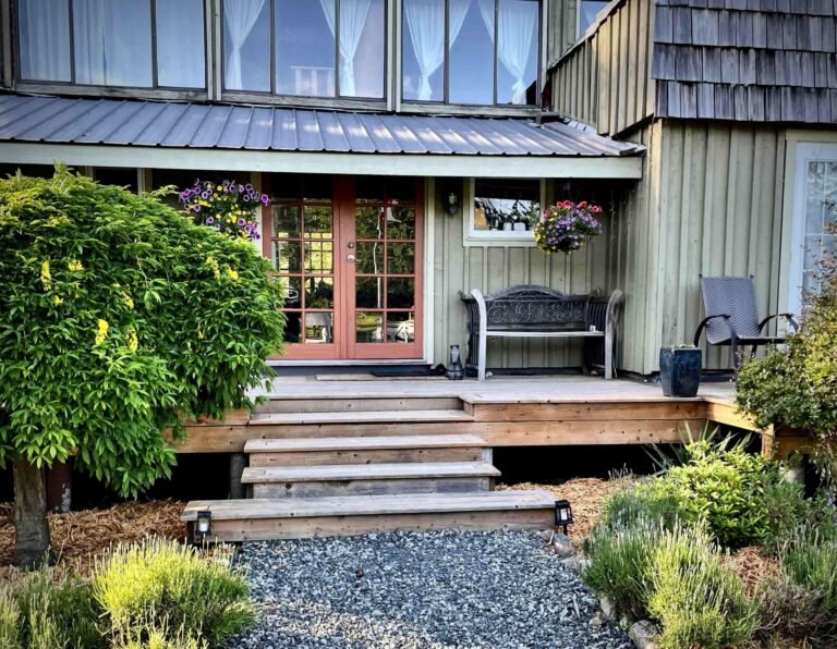
Location: The Village of Sayward is located on the east coast of north Vancouver Island, British Columbia, accessed by a 12km paved road — Sayward Road — from the Sayward Junction at Island Highway 19. At the junction you will find the Co-op gas station, convenience store, liquor store, and small grocery store. There is also a restaurant called The Crossroads. Travel time along the Island Highway 19 to Sayward is just under one hour from Campbell River to the south, and about 2 hours from Port Hardy to the north. Sayward can also be reached by boat at Kelsey Bay.
The World’s Largest Yellow Cedar stood tall for centuries, a giant among B.C.’s largest trees. Sergeant RandAlly after Randall Dayton and Ally Gibson, the two forestry engineers who discovered it in 1993, the world champion tree boasts impressive statistics; Height 61m (200 ft), Circumference 13.08m (42ft.11in), Diameter 4.16m (13.7ft), Crown Spread 16m (52.5ft), and Stem Volume 175 cubic meters (6,200 cu. ft). In 2004, shortly before the opening of the St. RandAlly recreational site, the Alaskan yellow cedar, succumbed to old age and blew down. The demise of the 2,000-year-old tree shocked supporters, who had worked to keep it safe and had viewing platforms constructed around it. But they are looking on the bright side, saying the sight of the massive tree laying across the forest floor provides an even better view of its size.
Champion trees in North America are determined using a point system that awards 1 point per inch of circumference at breast height, 1 point per foot in height, and 1 point for every 4 feet diameter of the live crown. Sgt. RandAlly’s score in British Columbia Big Tree Points is 728. The number 2 yellow cedar in the record book is Admiral Broeren (575 points), also located in the Memekay, with more volume (188 cubic meters) than Sgt. RandAlly, but smaller in height, crown and diameter.
H’Kusam Mountain: Watch for a mysterious cloud formation that consistently appears around the peak of H’Kusam Mountain – the Kwakwaka’wakw People called it Hiatsee Saklekum: “Where the breath of the sea lion gathers at the blow-hole”. The locals have nicknamed the cloud formation “Oscar”.
Fall and winter are good times to visit the Salmon River Estuary to view winter waterfowl. Spring is also a delightful time due to the prolific nesting around the estuary. At one time this 52-hectare reserve on the Salmon River estuary sheltered and sustained the island’s largest wintering population of Trumpeter Swans, which are still numerous here. The village maintains the path along the estuary to make your viewing experience even more special. Visitors are asked to be very careful not to disturb the wildlife at any time. The wildlife, in addition to the bird population includes a herd of Elk numbering close to 100 that meander through the Sayward Valley, as well as black bears, occasionally grizzly bears that swim over from the mainland in the spring, cougars, coyotes, racoons and of course squirrels.
Sayward Harbour Authority is responsible for the small craft harbour (DFO) in Kelsey Bay . It is the only small craft harbour located between Campbell River and Port McNeill on Johnstone Strait. They do not take reservations — boats can moor if there is a free space, or can tie up to another boat with permission. The Harbour Master makes rounds through the docks at 8:00am and 5:00pm.
Kelsey Bay Wharf which is owned and operated by Sayward Futures Society — you will find the Sayward Visitor Centre, which is open 24/7 with FREE WIFI, water, maps, brochures, colouring for kids, puzzles for all ages, and spectacular views of Mount H’Kusam, the Estuary, Kelsey Bay and Johnstone Straight. There is abundant marine life to be observed and cruise ships pass through April to September. The Oceanview Gallery & Cafe is open Daily — 8:00am to 6:00pm May through October and is Sayward Futures Society’s social enterprise raising funds for the maintenance of the wharf and community events. They offer Salts Spring Island coffee, tea varieties, cold beverages, snacks, a selection of ice cream, jewellery, art, decals, candles, t-shirts, hats and much more, all created by Vancouver Island artisans. You can also purchase fishing licences.
The Salmon River is one of the better known destinations for steelhead fishing on Vancouver Island, before it empties into Johnstone Strait at Kelsey Bay. Drive east of Hwy 19 towards Sayward and Kelsey Bay. En route, Sayward Road crosses the Salmon River at several points, offering access. Angling information is available where fishing licenses are sold.
Hiking: Hikers can spend the day on the trail up Mt. H’Kusam, called Bill’s Trail by the locals. The 8-hour return trip to the summit (peak at 5,261 feet) will reward you with sweeping views of the area, including the Village of Sayward, Sayward Valley, Kelsey Bay and the Salmon River estuary and wildlife reserve. The world-class hike called Kusam Klimb, has been an annual event in June since 2004 and is the 2nd largest run in BC that draws participants from around the world hoping to conquer the mountain. The wilderness course is a loop heading up and over the back of Mt. H’Kusam, then down the Stowe Creek watershed. Starting at sea level, participants pass through some of the most spectacular scenery on Vancouver Island, with views of mountain peaks and the Johnstone Strait as they negotiate their way over the well-developed trail known as Bill’s Trail. The Kusam Klimb is held annually in June — more information can be found at www.kusamklimb.com.
Another awesome hike is the Dalrymple Creek Trail located 8km south of the Sayward Junction on Hwy 19, where Dalrymple Creek crosses the highway. The self-guided forest interpretation trail leads you on a 500-metre peaceful walk through a changing forest. There is a myriad of other trails and hikes through the Sayward Valley — information can be found on the BC Recreation Sites and Trails website, and BC Parks website.
Alpine Hiking: Mount Cain also offers wonderful alpine hiking in a sea of bright flowers. Hiking trails also abound in the immediate vicinity of Sayward, including the White River Provincial Park, a BC Park with easy walking trails approx. 27 km south of Sayward.
Picnic Site: There is a spot for romantic picnicking just south of the Adam River Bridge on Hwy 19, 10 km north of the turnoff to Sayward. As you feast, enjoy the view of Mounts Romeo and Juliet, the snowmelt from which fills Adam and Eve Lakes, from which two rivers of the same names flow east into Johnstone Strait. Equally impressive is the sight of Jagged Mountain and Mount Cain, which dominate the skyline north of here.
Skiing: Spend the day skiing and snowboarding in unbelievable powder at Mt. Cain Ski Resort (5,400 ft). From the Sayward Junction travel on 19 Hwy North approx. 45 minutes to Davie Road, where you will turn left and travel approx. 35 minutes to Mt. Cain Ski Resort. It’s approx. 20-km drive on a gravel road from the highway to the day lodge (3,900 ft), with chains mandatory. Mount Cain offers a unique experience for skiers, snowboarders and backcountry explorers, with virtually no line-ups for lifts, and a friendly, welcoming atmosphere. The community-run Mt. Cain Alpine Resort is located in a regional park, and is ideal for families and snow enthusiasts of all skill levels. The Mt. Cain resort usually opens from November to April.
Wildlife: Visitors driving the scenic route from Sayward to Port McNeill are very likely to encounter at least one large mammal alongside the road or ambling into the forest. Black-tailed deer, Roosevelt elk and black bear are common year-round. Cougar, gray wolf and occasionally grizzly bears can also be present, but are less frequently spotted.
Paddling: The Salmon River is a popular river for exhilarating river rafting in the Sayward region, — the surrounding lakes and rivers offer a range of canoeing and kayaking routes.
The Sayward Forest Canoe Route covers 50km of lakes and rivers throughout the Sayward region. Allow three to four days to complete the circuit, which begins on Campbell Lake. Wisdom has it that the best approach to the route is to journey in a counterclockwise direction, putting in at the boat launch on Mohun Lake in Morton Lake Provincial Park. The well-marked route continues through 10 lakes before returning to the park. Road access to most of the lakes within the canoe route means that paddlers can pick and choose from a variety of put-in and take-out points.
North of Sayward, you’ll find good paddling on the Klaklakama Lakes. Travel 7km south of Hwy 19 along a rough logging road that initially leads towards Schoen Lake Provincial Park. The best place to launch is from the Forest Service recreation site on Upper Klaklakama Lake (5 vehicle/tent sites). You’ll also find a small Forest Service recreation campground at the south end of Upper Klaklakama Lake, as well as a good picnic spot on Lower Klaklakama Lake near Hwy 19, when you’re in need of a break from driving.
The nearest large provincial park to Sayward is Schoen Lake Provincial Park, considered by some to be the most beautiful areas and lake on Vancouver Island, offering wilderness hiking, canoeing, fishing and spectacular mountain scenery.
Camping: There are a number of campsites available off of Highway 19 from Campbell River north to Cape Scott, travellers must seek out a provincial park through BC Parks, a BC Recreation Site, or private campground. Elk Creek Recreation site is located on Hwy 19 about 500 meters north of the Sayward Junction on the west side of the highway (sign visible). The campground is a provincial recreation site maintained by the by Sayward Futures Society and is considered a wilderness camp, providing water, tables and outhouses. Pockets of Forest Service recreation sites occur around McCreight Lake as well as nearby Pye and Stella Lakes, all located east of Sayward and north of Hwy 19. To reach McCreighton Lake, take Rock Bay Road east of Hwy 19, about 23 miles (37 km) north of Campbell River. Both Pye and Stella Lakes are located short distances south of Rock Bay Road, and their respective turnoffs are well marked.
A public campsite is located at H’Kusam Park in the middle of the Village of Sayward, offering camping, washrooms and spectacular views. Information is available at the Village of Sayward Office. Additional information can be found at the Sayward Visitor Centre located on the Kelsey Bay Wharf.
Robson Bight (Michael Biggs) Ecological Reserve, north west of Sayward in Johnstone Strait, provides ocean adventurers with a sure thing when it comes to whale watching. In this case it is actually killer whale watching. Pods of orcas come to this part of Johnstone Strait each summer to rub on the barnacle-encrusted rocks at Robson Bight. As the top predator on the inland-water food chain, they are also attracted by the annual salmon runs that funnel through the strait beginning in late June through to September. One of the best ways to approach killer whales is quietly aboard a boat or kayak.
Golf: Golfers will have to head south on the Island highway to Campbell River for a game at one of the two courses: Storey Creek Golf Club or the Naturally Pacific Resort. Vancouver Island Golf Vacations.
Travel from Sayward to Zeballos – here is a community whose roads were once truly paved with gold! In fact, the owners of the nearby gold mine actually scraped the surface of the road at one time so the tailings could be run through new equipment and residual gold removed.
Premier Business Directory in Kelsey Bay, Vancouver Island – Small Business BC
[/fusion_builder_column][/fusion_builder_row][/fusion_builder_container]