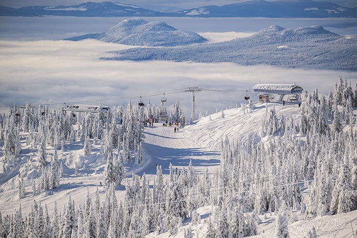
Sechelt Peninsula
The Soames Hill Trail (moderate) is Gibsons’ answer to North Vancouver’s Grouse Grind, a 40-minute stair-climb that seems to last forever, at the top of which you’re rewarded with a view that just won’t quit of Howe Sound and the Strait of Georgia. To reach the trailhead, take North or Reed Road to Chamberlain Road, then east on Bridgeman Road to its end.
Much lengthier hiking trails in Gibsons can be found on Mount Elphinstone, which dominates the northwestern entrance to Howe Sound. The Mount Elphinstone Heritage Trails have been developed only in the past decade and take advantage of numerous logging roads that had become overgrown when the timber supply was exhausted. All the trails are well marked with both colour-coded surveyor’s tape and metal disks. The K2 Trail (moderate) ascends the side of Mount Elphinstone (4,137 feet/1261 m) from the end of Wharf Road. To find the trailhead, follow the Port Mellon Hwy a short distance north of the ferry terminal at Langdale to Wharf Road.
As the pink-taped K2 Trail ascends, it meets with the blue-taped Waterfall Trail (easy), a much shorter, lower-elevation hike that leads to a waterfall viewpoint on Langdale Creek. The trailhead for the Waterfall Trail begins at the north end of Stewart Road. Take either North Road or the Gibsons Bypass to reach Stewart Road. Red-taped Tramway Trail (moderate) follows the path of two tramways that once ferried supplies to loggers at higher elevations. The trailhead is located only after following several marked and unmarked roads. Take North Road from either Gibsons or Langdale to Cemetery Road, then follow Cemetery, which leads past a – you guessed it – cemetery, to Keith Road. Watch for a road opposite the Boothill Ranch, which will deposit you in front of a yellow gate. Hike a short distance from here to the trailhead, which is marked with a red aluminum tag.
Three postage-stamp-size remnants of old-growth forest on Mount Elphinstone have recently been designated as provincial park. A prolific number of mushrooms, some of which have yet to be properly identified, grow here. Tread carefully and take only photographs.
Pender Harbour is a tough part of the Sunshine Coast to get a handle on. If you try to figure it out as you pass by on Hwy 101, you’ll have only a half-baked notion of where freshwater lakes end and saltwater coves begin. This place is a geographical mess. Even if you take the plunge and begin exploring the roads that connect the three oceanside communities that comprise Pender Harbour – Madeira Park, Garden Bay, and Irvines Landing – you’d be hard pressed to keep your bearings. You’d probably do just as well if you were blindfolded and spun around three times.
Fortunately, two hiking trails lead to viewpoints that will explain everything. Pender Hill (758 feet/231 m) rises sharply from the saltchuk (a Native term for water) above Irvines Landing, while Mount Daniel (1,375 feet/419 m) sits above Garden Bay. Both present moderately difficult, unrelentingly steep hiking. Packing a water bottle (or two) is a must. If time is of the essence, choose the Pender Hill Trail (moderate; 2 miles/3 km return) where a 30-minute cardiovascular workout will have you at the top. Plan on 90 minutes to reach the top of Mount Daniel (moderate; 5 miles/8 km return). Mount Daniel is too diminutive to be identified on most maps (tell that to someone who’s just made the ascent) but the surrounding lakes and bays are. Mount Daniel is west of Hwy 101 on Garden Bay Road. Drive some 2 miles (3.5 km), watching for a trail sign on the left side of the road. Park here and hike a short distance along a dirt road to the trailhead. To find the trail for Pender Hill, stay on Garden Bay Road to Irvines Landing Road, then along to Lee Road. Watch for a sign on the right side of Lee Road – and a turquoise-coloured telephone pole – that announces the trailhead.
The hiking trail between Ruby Lake and Klein Lake is also part of the Suncoaster Trail system. At 2.5 miles (4 km), the trail is not overly long but is quite steep as it climbs north between the two lakes. Park at Don Bosch Regional Park beside Hwy 101, just north of Ruby Lake Resort. The trailhead at Klein Lake begins near the south end of the lake opposite the Forest Service recreation site. If you have a four-wheel-drive vehicle you can drive to the Klein Lake trailhead; if you don’t you may have to add 0.6 mile (1 km) to the hike where the road around the lake grows impassable. To reach Klein Lake, follow Hwy 101 north to Egmont Road, then drive 1 mile (1.6 km) to the North Lake Forest Road. The rough road follows the shore of North Lake, then climbs towards Klein Lake. Use your discretion as to where to park and begin hiking. When you reach Klein Lake, take the left fork and follow the road as it leads around the lake, staying right at each subsequent fork until you reach the well-marked trailhead. Allow two to three hours to make the round trip.
One of the greatest natural shows in British Columbia occurs twice daily in Skookumchuck Narrows Provincial Park in Egmont at the north end of the Sechelt Peninsula. One of the largest saltwater rapids on Canada’s West Coast, Skookumchuk Rapids boils as huge volumes of water force their way through Skookumchuk Narrows at the north end of Sechelt Inlet (‘Skookum’ is a Native word for strong and ‘chuk’ means water). A 2.5-mile (4-km) walking trail leads from the outskirts of Egmont to viewing sites at North Point and Roland Point. This is an easygoing ramble without much diversion except where it skirts Brown Lake. Depending on the motion of the ocean, viewing is at North Point during a falling tide and at Roland Point during a flood tide. The two points are separated by only a short distance.
At low tide, the bays around both points display astonishingly colourful and varied forms of marine life. Giant barnacles, colonies of starfish, sea urchins, and sea anemones thrive in the nutrient-rich waters, whose strong tidal currents cause these creatures to grow to extravagant sizes. In order to fully appreciate the scene, plan your visit to coincide with the change in tides. The most dramatic motion, when billions of gallons of water are sucked into cavernous whirlpools and whipped up into standing waves, occurs an hour after slack tide when the ocean is rising. Consult tide tables to determine the timing of your visit. You’ll find these posted at Visitor Centres around the Sunshine Coast, on BC Ferries, and at the trailhead.
Malaspina Peninsula
The Sunshine Coast Trail is an ambitious program to create a route from the ferry terminal in Saltery Bay to Okeover Inlet and the western end of the peninsula at Desolation Sound. Trail building began in the early 1990s, and it will be a few more years before the entire 112 miles (180 km) is complete.
Other, more moderate hiking routes include the Lang Creek Trail (easy; 3 miles/5 km return) and Sweetwater Trail (moderate; 4.3 miles/7 km return). To reach the trailheads, turn north off Hwy 101 on the Duck Lake Forest Road, which is about 14 miles (23 km) north of Saltery Bay. The Lang Creek trailhead begins on the right side of the road in about 7 miles (11 km). To reach the Sweetwater Trail, carry on farther to Duck Lake, turn right over the bridge, and continue on for another 2 miles (3.2 km), then turn left and drive a short distance to the traihead. The loop trail begins here and climbs through an enchanting stand of old-growth western hemlock past MacGregor Falls and returns along an old railbed.
Several hiking trails originate in the lake country north of Powell River. You can walk through old-growth forest as you explore the landscape around Powell, Inland, and Confederation Lakes. Confederation Lake is part of the new provincial park that also includes the Haslam Lake watershed. The moderate, 7.4-mile (12-km) round-trip hike leads around Mount Mahoney to Confederation Lake and will take the better part of a day to complete. To reach the trailhead, follow directions to Inland Lake. Instead of turning in at Inland Lake, continue on, take the next road on the right, and drive another mile. Leave your vehicle at the pullout here and walk up a deteriorating road to the next fork. Take the right-hand route up a washed-out road, which soon narrows to a trail that is indicated by strategically placed metal markers. Make the rustic cabin on Confederation Lake your destination, although a rough trail does lead farther on from there to Powell Lake. With the exception of one steep section where a ramp and staircase assist hikers, most of the trail is easily negotiated.
A 2.5-mile (4-km) moderately difficult hiking trail connects Haywire Bay Regional Park on Powell Lake with the west side of Inland Lake. Along the way this up-and-down, forested route passes diminutive Lost Lake. Short lakeside hiking trails also run along the shores of Powell Lake from Mowat Bay Park and Haywire Bay Regional Park.
North of Powell River you’ll find a lengthy hiking route along the Marathon-Appleton Trail (moderate; 7.5 miles/12 km return). Some of the values of these routes include fine viewpoints at the Gibraltar and Gentle David lookouts, located off the Marathon Trail, as well as picnic sites at Rieveley’s Pond and Appleton Creek. To find the trailhead, head north of Powell River through Sliammon to Southview Road, which begins on the east side of Hwy 101. Travel almost 3 miles (5 km) on Southview to the well-marked trailhead. One of the beauties of this trail system is that you can choose to do all or part of it and still find significant rewards. An alternative approach to the Forest Service recreation site at Appleton Creek, where a stand of old-growth forest is located in Appleton Canyon, is via Wilde Road, which begins on the east side of Hwy 101 in Sliammon. Wilde connects with the Theodosia Forest Road, which climbs for more than 7 miles (12 km). The well-marked Appleton Creek Trail begins about halfway up the forest road on the left.
Powell River’s Inland Lake Trail is a lengthy walk, with plenty of places to rest along the way. There’s something so exhilarating about the 8-mile (13-km) loop around the lake that some folks we met here were on their second time around.
The Powell River Greenways Trail, part of the Sunshine Coast Trail, passes along the hillside above the Forest Service recreation site at Dinner Rock. A quiet 2-mile (3-km) walk here provides lovely views of Malaspina Strait and nearby Savary Island. You’ll find the trail partway down the Dinner Rock Road on the west side of Hwy 101. (Note: There are two roads named Dinner Rock. Take the one marked by a Forest Service sign.) The road is gated from mid-October to mid-April. Park and walk in if you arrive during these times.