Of the 1,884 magical islands that make up Haida Gwaii, formerly called the Queen Charlotte Islands, two islands comprise the majority of the land mass; Moresby Island to the south and Graham Island to the north.
Moresby Island and Moresby Camp were named after Rear Admiral (later Admiral of the Fleet) Sir Fairfax Moresby, Commander-in-Chief of the Pacific Station from 1850 to 1853.
The San Christoval Mountains form the backbone of Moresby Island, rising to 1,123 metres at Mount de la Touche. The higher elevations of this range are dominated by mountain hemlock and alpine tundra. The lower elevations are mainly cedar, pine and western hemlock. The southern portion of Moresby Island is low and densely wooded.
Moresby Island is penetrated by many significant inlets, bays and sounds, on both the Pacific Ocean and Hecate Strait shorelines; Englefield Bay, Tasu Sound, Gowgaia Bay, Flamingo Inlet, and Louscoone Inlet on the west coast, Houston Stewart Channel (between Moresby Island and Kunghit Island), and Carpenter bay, Skincuttle Inlet, Juan Perez Sound, Sedgewick Bay, Darwin Sound, Laskeek Bay, Selwyn Inlet, and Cumshewa Inlet on the east coast. South of Moresby Island, the southern tip of Haida Gwaii is formed by Anthony Island, Kunghit Island, and the tiny St. James Island and Kerouard Islands.
The distinct island flora and fauna have evolved over thousands of years. The species here often differ from those found on the BC mainland, and many common continental species are not found on the islands at all, or have evolved into unique subspecies. Because the islands are situated along the Pacific flyway, dozens of species of migrating birds stop here in spring and fall.
Moresby is the less accessible of the two main Haida Gwaii islands, with less than 18 miles (30 km) of public roads, the majority of which are in Sandspit or located along Skidegate Inlet, the passage between Graham and Moresby Islands that leads to Skidegate Channel. A logging road runs 25 miles (40 km) south from Alliford Bay to Moresby Camp, the first 9 miles (15 km) of which are paved.
Visitors making use of logging roads should call 250-637-5323 for information on the road conditions and logging truck schedules. When travelling on logging roads, drivers should drive with headlights on, observe the 50 km/h speed limit, stay alert for posted signs and indications of oncoming traffic, and grant right of way to the monster logging trucks. The roads are safest to travel between 6 pm and 7 am, or on weekends.
Many visitors come to the islands to see the ancient villages on Moresby Island, accessible only by boat. Check with the Visitor Centre before you visit any of the protected sites. Reservations are necessary, and permits are required for visits to the ancient Haida villages and Gwaii Haanas National Park.
There are countless beaches, streams, fishing holes, coves, and old First Nation villages to explore. Many unique subspecies of flora and fauna share these islands with the Haida, a nation legendary for its art. The Haida quarry and carve rare black argillite, found only on these islands, into miniature totem poles, jewelry, and boxes. A few artist’s studios may be open for you to visit (ask around upon your arrival), or purchase the art at one of several gift shops.
Population: 1,000
Location: Moresby Island is located south of Skidegate Inlet and Skidegate Channel that separate the two main islands of the Queen Charlotte Archipelago. The Haida Gwaii Islands are accessed by ferry from Prince Rupert to the Skidegate Landing Ferry Terminal on Graham Island, by air from Vancouver to Sandspit (770 km), and by air from Prince Rupert to Sandspit on Moresby Island. Commercial air services (including float planes and helicopters) are available at Sandspit, Queen Charlotte City and Masset. A 20-minute ferry ride connects Graham and Moresby Islands.
Sandspit
The hamlet of Sandspit, on the northeastern tip of Moresby Island, is the Gateway to Gwaii Haanas. The only settlement on Moresby Island, Sandpit is the location of the main airport for Haida Gwaii, formerly known as the Queen Charlotte Islands. Sandspit’s history goes back to at least one ancient Haida Village, Kil, which was situated east of Haans Creek. The first settlers at Sandspit established farms and ranches around the grassy flats.
Alliford Bay
On the north coast of Moresby Island is Alliford Bay, the southern terminus of the important inter-island ferry between Alliford Bay and Skidegate Landing on Graham Island. Alliford Bay is located a 15-minute drive from the airport at Sandspit.
Moresby Camp
The old logging site at Moresby Camp is the closest road access to Gwaii Haanas National Park. Moresby Camp serves as a floatplane and kayak departure point for those venturing into the park, 30 miles (50 km) to the south.
Louise Island
Louise Island is enveloped by Moresby Island, Hecate Strait and other islands on the east coast of Haida Gwaii. The mountainous Louise Island is home to the ancient Haida village of Skedans, and one of the largest displays of totem poles in these mystical islands.
Gwaii Haanas National Park Reserve, a remote collection of 138 islands in the southern part of Haida Gwaii (Queen Charlotte Islands), was established in 1988 amidst a tense confrontation that divided the island’s population, as well as public opinion across Canada and around the world. There are perhaps only 6,000 permanent residents in Haida Gwaii, but 3 million people pledged their support to see logging stopped in this area. At the height of the confrontation, 72 Haida were arrested and charged with criminal contempt of court, an act that shocked the international community. In a gesture of good faith, the Canadian government passed a resolution to support the Haida’s wishes, and Gwaii Haanas was formed. The park is managed by both Parks Canada and the Council of the Haida Nation.
Haida Villages: Moresby Island and the islands incorporated in the Moresby Archipelago have a number of ancient and uninhabited Haida Village sites: Kaisun (northwest coast), Cumshewa (Cumshewa Inlet), New Clew and Skedans (Louise Island), Tanu (Tanu Island), and Ninstints (Anthony Island). Cha’atl village is located on Chaatl Island in Skidegate Channel, between Graham and Moresby Islands.
Sightseeing day trips can be arranged out of Sandspit to ancient and uninhabited Haida villages; Skedans (formerly Koona) and New Clew on Louise Island, Cumshewa Village (Cumshewa Inlet), Tanu (Tanu Island), and a longer trip to the village of Ninstints on Anthony Island, near the southeast end of Moresby Island.
Anthony Island, home of the old Haida village of Ninstints (Nans Dins), is located within the boundaries of Gwaii Haanas National Park and designated as a UNESCO World Heritage Site. Remains of houses, together with carved mortuary and memorial poles, illustrate the Haida people’s art and way of life. The site commemorates the living culture of the Haida and their relationship to the land and sea, and offers a visual key to their oral traditions.
Boat tours to Anthony Island can be arranged in Sandspit and Queen Charlotte City. Visitors to Gwaii Haanas must attend mandatory orientation sessions.
Hotspring Island (Gandla’kin) is one of the more popular destinations in this kayaking playground, accessible only by boat or floatplane. Nothing is more idyllic than relaxing in a hot spring or hot pool on Hotspring Island and watching a pod of orcas swim passed. Note: Following the 7.7 magnitude earthquake that rocked Haida Gwaii on Saturday October 27, 2012, the three hotspring pools commonly accessed by visitors to Hot Spring Island, or Gandll K’in Gwaayaay, are now cold and empty. The shifting tectonic plates and reorganization of stress has evidently affected the pathways the water took to the surface.
The remains of the old mining town of Tasu can be viewed in Tasu Sound on the west coast. The reserves of iron, copper, silver and a small quantity of gold (1.3 tons) were mined at Tasu Mine from 1967 until the mine and town were abandoned in 1983. The mine closure caused a significant population decline for outlying settlements, mainly Tasu and Sewell Inlet. The secluded Tasu Sound is now a sport fishing destination where lodging is provided by a strategically located floating resort.
The earliest mining development on the islands occurred at Mitchell Inlet in 1852, which led directly to the establishment of the Queen Charlotte Islands as a Crown colony the following year. This venture, the first lode-mining in British Columbia, was variously reputed to have yielded $5,000 to $75,000 in gold, which was lost in transit in a wreck near Cape Flattery. The mining on Mitchell Inlet, then called Kuper or Gold Harbour, was under the direction of Captain Mitchell of the Hudson’s Bay Company. News of the discovery led to succeeding expeditions, but the vein was reportedly mined out and no further gold was discovered. Attention then turned to the gold frenzy in the Cariboo and the Fraser River.
Diesel generation was the only source of electricity supplied to Sandspit until the early 1980s. Since 1990, Queen Charlotte Power Corporation has supplied electricity from its Moresby Hydroelectric Project to BC Hydro, with diesel generation only supplementing the supply during summer months. This hydroelectric plant on Moresby Lake saves significant quantities of diesel fuel and reduces air pollution on the islands.
Camping: Four Forest Service campgrounds are located on Moresby Island. To find them, drive 9 miles (15 km) east from the ferry landing at Alliford Bay to Sandspit. Follow the main road south from there as it leads to two Forest Service campgrounds on the island’s more sheltered east coast. The Gray Bay Campground 13 miles (21 km) southeast of Sandspit has two locations and a smaller campground on Sheldens Bay is located about 7 miles (11 km) farther south. Southwest of Alliford Bay you’ll find a vehicle recreation site on Mosquito Lake, 27 miles (44 km) from Sandspit, and the site at Moresby Camp, 4.5 miles (7 km) beyond.
Elsewhere in Haida Gwaii, camping is not organized. There are no formal campgrounds in Gwaii Haanas National Park Reserve and Haida Heritage Site, because there is no road access to the park. Camping is not permitted at T’anuu Village, or on Gandla’kin (Hotspring), Ata Naa (House), Copper, Jeffrey, Rankine, or Skung Gwaii (Anthony) Islands, or Slug Islet. These areas are particularly sensitive cultural sites or important bird-nesting areas. If in doubt, ask at any of the Watchmen base camps. There is no camping at any Haida Gwaii Watchmen site in the park except for Windy Bay, or Hik’yaah, where the stand against logging was taken by the Haida Nation back in the 1980s.
Camping in Haida Gwaii (Queen Charlotte Islands).
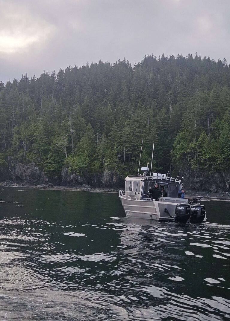
Fishing is the most common sport in Haida Gwaii, formerly the Queen Charlotte Islands, there being ready access to superb freshwater and saltwater fishing. There are a number of outfitters and guides Haida Gwaii, and if you are interested in renting a boat, the Visitor Centre can point you in the right direction. On Moresby Island, the best lake fishing is found in Mosquito Lake and Skidegate Lake. Both lakes are near Moresby Camp. Mosquito Lake is closer, about 3 miles (5 km) northwest, while Skidegate Lake is about 6 miles (10 km) beyond. Remote fishing lodges are located at Port Louis, offering excellent fishing for Salmon and Halibut, or fishing for Tuna 15 miles offshore.
Hiking: The Gray Bay-Cumshewa Head Trail leads 3 miles (4.5 km) from the end of the Forest Service road near Sheldens Bay along the shoreline to Cumshewa Head, one of the easternmost points on Moresby. Hiking in Haida Gwaii (Queen Charlotte Islands).
Hiking & Backpacking in Haida Gwaii (Queen Charlotte Islands).
Kayaking: The entire cluster of islands has been circumnavigated by kayak, and is open to the seafaring explorer. The southeastern side of the Haida Gwaii, rife with tiny islands, secluded coves, and lots of sheltered coastline, is the most popular kayaking destination. That said, Gwaii Haanas National Park Reserve is by far the most popular kayaking playground, with such destinations as Hotspring Island, Burnaby Narrows, Windy Bay, Anthony Island (Ninstints), Tanu, All Alone Stone, Rose Harbour, St. James Island, Flatrock Island, Echo Harbour…the list goes on and on. You could spend months, even years, exploring the coasts of Gwaii Haanas, stopping to investigate the many onshore and inland attractions, and still not feel that you knew the place. But that’s part of the magic and appeal of Haida Gwaii. Only experienced paddlers should attempt travelling along the exposed west coast of Haida Gwaii. Kayaking in Haida Gwaii (Queen Charlotte Islands).
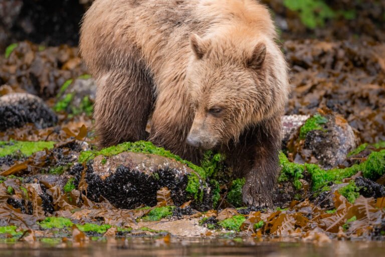
Wildlife: The Haida Gwaii islands are rich in wildlife in the sky and sea, and on the ground. Among the native species, expect to see black bears and river otters, birds such as bald eagles, Steller’s jays, and peregrine falcons, and all kinds of ocean creatures, from grey whales and killer whales to jellyfish and starfish.
One of the best places to see the latter is in Burnaby Narrows on the east side of Moresby Island, accessible only by boat from Moresby camp. Also known as Dolomite Narrows, the waterway connects Juan Perez Sound with Skincuttle Inlet. The narrows are about half a mile (1 km) long, about 160 feet (50 m) wide, and quite shallow, especially at low tide. The bottom is coloured with a cornucopia of sea life: starfish, sea urchins, moon snails, clams, needlefish, sea cucumbers, sea blubbers, red crab . . . the list goes on and on. Because of the high nutrient content in the water, the aquatic life is almost impossibly large and vibrant. From a kayak or other small boat the viewing is good; with a mask and snorkel, it’s even better. At low tide it is possible to walk along the shore, but as this can’t be done without treading on delicate life forms, it is discouraged.
Killer whales, or orcas, are often sighted in the Juan Perez Sound region. Best time for whale watching is late spring and early summer. Fully one third of the province’s sea lion population calls Haida Gwaii home. A water-access-only site for viewing sea lions is located at the southernmost tip of Haida Gwaii, at Cape St. James, and on a string of islands called the Kerouard Islands. All manner of seabirds, including the horned puffin, can also be seen. Puffins also breed on Puffin Rock in Puffin Cove, north of Gowgaia Bay on the west coast. Visitors in this area can never be sure what manner of creature will show up. A pod of orcas, a grey or a humpbacked whale, or perhaps a gang of Dall’s porpoises, numbering up to 300 strong, may escort you as you sail or paddle along in the southern section of Gwaii Haanas.
Circle Tours: See the best of Northern BC and Haida Gwaii on one of the Circle Tours that capture the wonders of the north. The Inside Passage Circle Tour and the Native Heritage Circle Tour include Haida Gwaii by catching a ferry from Prince Rupert to Haida Gwaii (formerly the Queen Charlotte Islands).
Circle Tours in British Columbia.


