With almost a half-million visitors annually, Shannon Falls Provincial Park is one of the most popular picnic spots along the entire Sea to Sky corridor. Located on the east side of Hwy 99 just south of Stawamus Chief Mountain, extensive picnic grounds surround the base of BC’s third-highest waterfall (1,105 feet/335 m). In summer months the parking lot is full by noon, with half of the visitors arriving by tour bus. Picnic tables are located beside Shannon Creek and in the Loggers Sports Field nearby.
A boardwalk leads to a viewing platform near the base of the roaring falls. From here you can gaze up the smooth sides of the granite walls over which the falls foam and tumble. At low flow, the falls does little more than veil the rockface. In feistier seasons, when the falls gives off an almighty roar, its spray will drench you if you get too close. Some people (the cold shower types) don’t mind and follow a rough trail that leads from the viewing platform to the base of the falls.
Often the best time to picnic here is on the first warm days of spring and the last ones of fall, when water levels in the falls are running strong and the number of visitors is lower than mid summer.
Stawamus Chief Mountain is a strenuous, 4- to 7-mile (7- to 11-km) return hike, depending on which of three summit routes you choose. There are several approaches to the base of this mass of granite. For the first, leave your car in the lot beside Shannon Falls Provincial Park’s Logger’s Sports Area. Look for the orange and red markers affixed to a large cedar tree by the Federation of BC Mountain Clubs at the north end of the sports area, which point the way. Travel time to the base of the Chief is 15 minutes on this 0.6-mile (1-km), well-maintained trail, which features several good viewpoints and close encounters with the cool, smooth rock face where the trail runs beside it.
An alternative approach allows you to drive to the base of the Chief itself at the interpretive viewing area on Hwy 99 just north of Shannon Falls. Take the dirt road that leads up the embankment in the middle of the viewpoint (it’s not as badly eroded as the others). It links up with a section of the old highway that runs north and south as it hugs the base of the Chief.
When you stand next to the Chief here, you look up and up at a wall of smooth granite. It’s awe-inspiring. You can see why this monolith has become internationally famous among climbers and has graced more than its share of magazine covers.
To reach the trailhead, turn south onto the old road above the viewpoint, continuing on to its end. Hiking from here to the Chief’s south summit is a 2-mile (3.5-km) ascent and takes about 90 minutes; add another hour if you choose the longer Centre and North summit route (3.5 miles/5.5 km one way). Both routes share a common beginning, then divide above Oleson Creek. (Note: The trail from Shannon Falls joins this approach at Oleson Creek, a short distance uphill.) Altogether there is a 1,980-foot (600-m) elevation gain on this hike; you will be climbing almost constantly until the top. This trail is the most popular with hikers (upwards of 50,000 a year), but it is only one of several possible routes on the Chief.
Even if you don’t plan to hike, be sure to stop at the Stawamus Chief Mountain viewpoint on Hwy 99 in Squamish, a short distance north of Shannon Falls Provincial Park. An interpretive display will acquaint you with the mountain and some of the history of the region. Get out your binoculars and scan for climbers high up on the sides of the Chief.
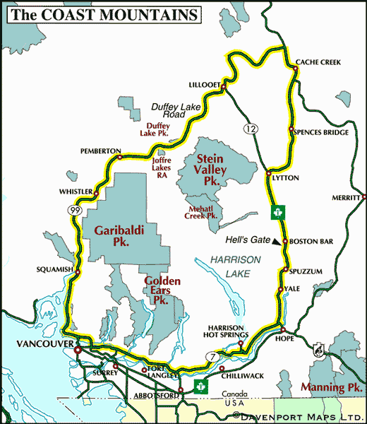
Shannon Falls Provincial Park is located 2 miles (3 km) south of Squamish and 16 miles (25 km) north of Horseshoe Bay on Vancouver’s North Shore.
Nearby Regions & Towns
Park Notices


